MyTopo
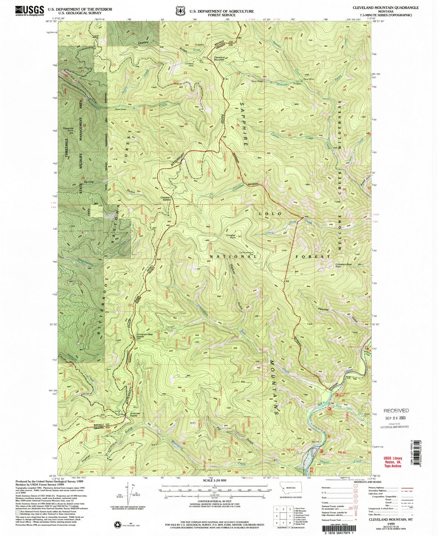
Classic USGS Cleveland Mountain Montana 7.5'x7.5' Topo Map
Couldn't load pickup availability
Historical USGS topographic quad map of Cleveland Mountain in the state of Montana. Map scale may vary for some years, but is generally around 1:24,000. Print size is approximately 24" x 27"
This quadrangle is in the following counties: Granite, Ravalli.
The map contains contour lines, roads, rivers, towns, and lakes. Printed on high-quality waterproof paper with UV fade-resistant inks, and shipped rolled.
Contains the following named places: Ambrose Saddle, Arasta Creek, Bidwell Gulch, Bitterroot Divide, Butte Cabin Creek, Carron Creek, Chino Creek, Cinnabar Point, Cinnabar Saddle, Cinnamon Bear Creek, Cinnamon Bear Point, Cinnamon Bear Saddle, Cleveland Mine, Cleveland Mountain, Cooney Ridge, Feather Gulch, Ferret Creek, Harrys Flat Campground, Harrys Gulch, Howell Creek, Laveck Creek, Pat Gulch, Pawnee Gulch, Spartan Creek, Threemile Point, Wahlquist Creek, Walkup Gulch, Welcome Sawmill Saddle