MyTopo
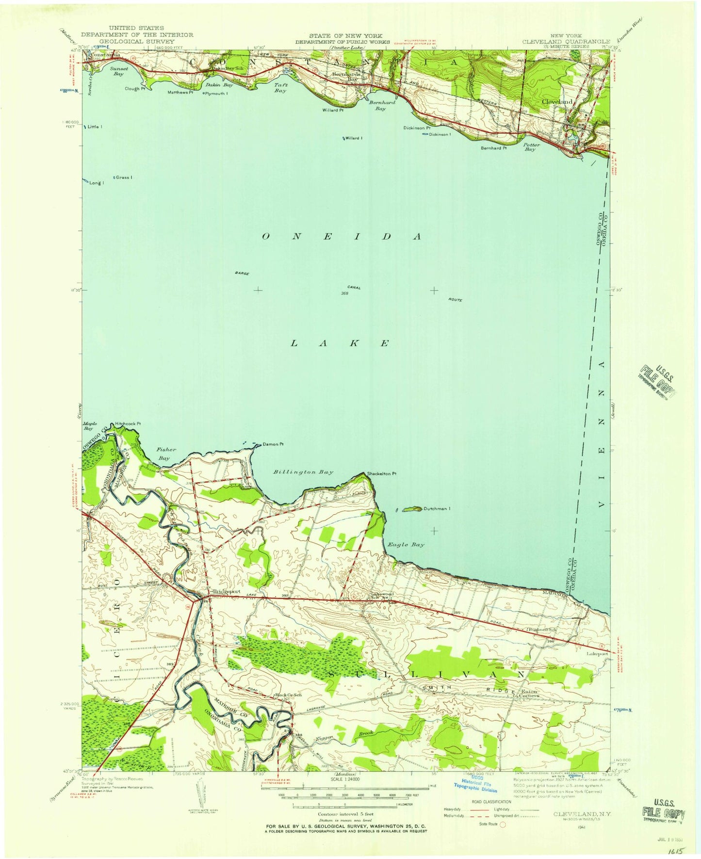
Classic USGS Cleveland New York 7.5'x7.5' Topo Map
Couldn't load pickup availability
Historical USGS topographic quad map of Cleveland in the state of New York. Map scale may vary for some years, but is generally around 1:24,000. Print size is approximately 24" x 27"
This quadrangle is in the following counties: Madison, Oneida, Onondaga, Oswego.
The map contains contour lines, roads, rivers, towns, and lakes. Printed on high-quality waterproof paper with UV fade-resistant inks, and shipped rolled.
Contains the following named places: Amazing Grace Christian Fellowship, Anchorage Marina, App's Landing Marina, Barry's Mobile Home Park, Bernhard Bay, Bernhard Point, Bernhards Bay, Bernhards Bay Methodist Church, Bernhards Bay Post Office, Billington Bay, Black Creek, Black Creek School, Boathouse Marina, Bridgeport, Bridgeport Cemetery, Bridgeport Census Designated Place, Bridgeport Elementary School, Bridgeport Fire Company, Bridgeport Post Office, Briggs Bay, Bushnell School, Chapman Park, Chittenango Creek, Cleveland, Cleveland Bible Chapel, Cleveland Elementary School, Cleveland Post Office, Cleveland Village Cemetery, Cleveland Village Wastewater Treatment Plant, Cleveland Volunteer Fire Department, Clough Point, Cold Spring Brook, Crandell Creek, Dakin Bay, Dakin Bay School, Dakin Creek, Dakin Shoal, Damon Point, Deyo Cemetery, Dickinson Island, Dickinson Point, Dutchman Island, Eaton Corners, Fisher Bay, Grass Island, Grassyshoal, Hitchcock Point, Lakeside Rural Cemetery, Lakewood School, Little Island, Lydiatt Creek, Matthews Point, Methodist Church of Cleveland, Negro Brook, North Shore Volunteer Emergency Squad, Oneida Lake, Oneida Lake Fish Cultural Station, Pancake Shoal, Plymouth Island, Potter Bay, Rogues' Roost Golf and Country Club, Saint Mary's Church, Scriba Creek, Shackelton Point, Shackelton Shoals, Smith Ridge, Smith's Ridge Cemetery, Spruce Grove Marina, Sulphur Spring Brook, Sunset Bay, Taft Bay, Village of Cleveland, Willard Island, Willard Point, ZIP Code: 13030


