MyTopo
Classic USGS Cliff Ridge Utah 7.5'x7.5' Topo Map
Regular price
$16.95
Regular price
Sale price
$16.95
Unit price
per
Couldn't load pickup availability
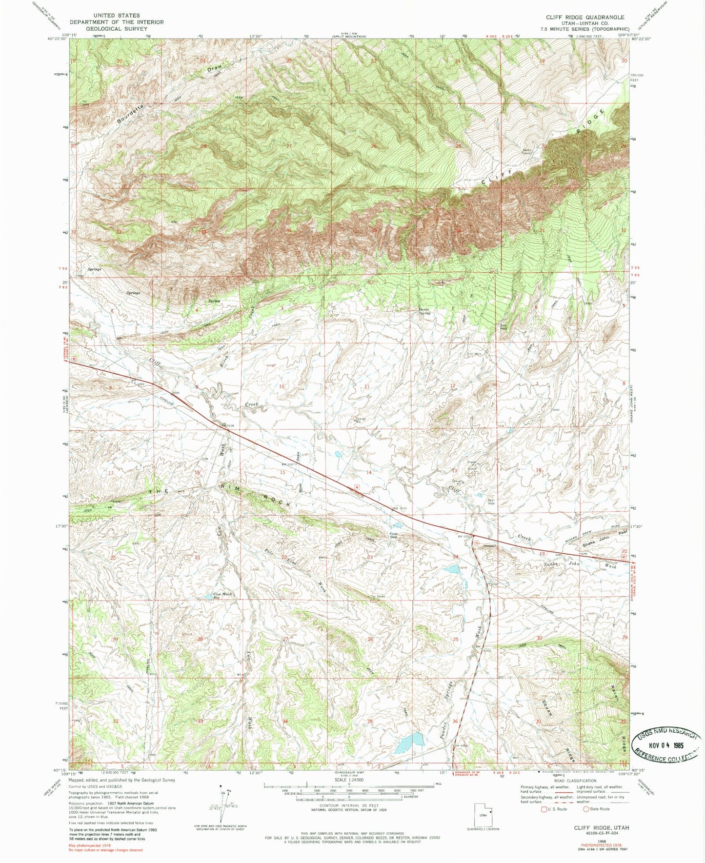
Historical USGS topographic quad map of Cliff Ridge in the state of Utah. Map scale may vary for some years, but is generally around 1:24,000. Print size is approximately 24" x 27"
This quadrangle is in the following counties: Uintah.
The map contains contour lines, roads, rivers, towns, and lakes. Printed on high-quality waterproof paper with UV fade-resistant inks, and shipped rolled.
Contains the following named places: Birch Creek, Blind Draw, Bourdette Draw, Cliff Ridge, Cow Wash, Cow Wash Reservoir, Davis Spring, First Gap, Musket Shot Springs, Pole Line Wash, Powder Springs Wash, Snake John Wash, The Rim Rock, ZIP Code: 84035