MyTopo
Classic USGS Cliffs Plateau North Dakota 7.5'x7.5' Topo Map
Regular price
$16.95
Regular price
Sale price
$16.95
Unit price
per
Couldn't load pickup availability
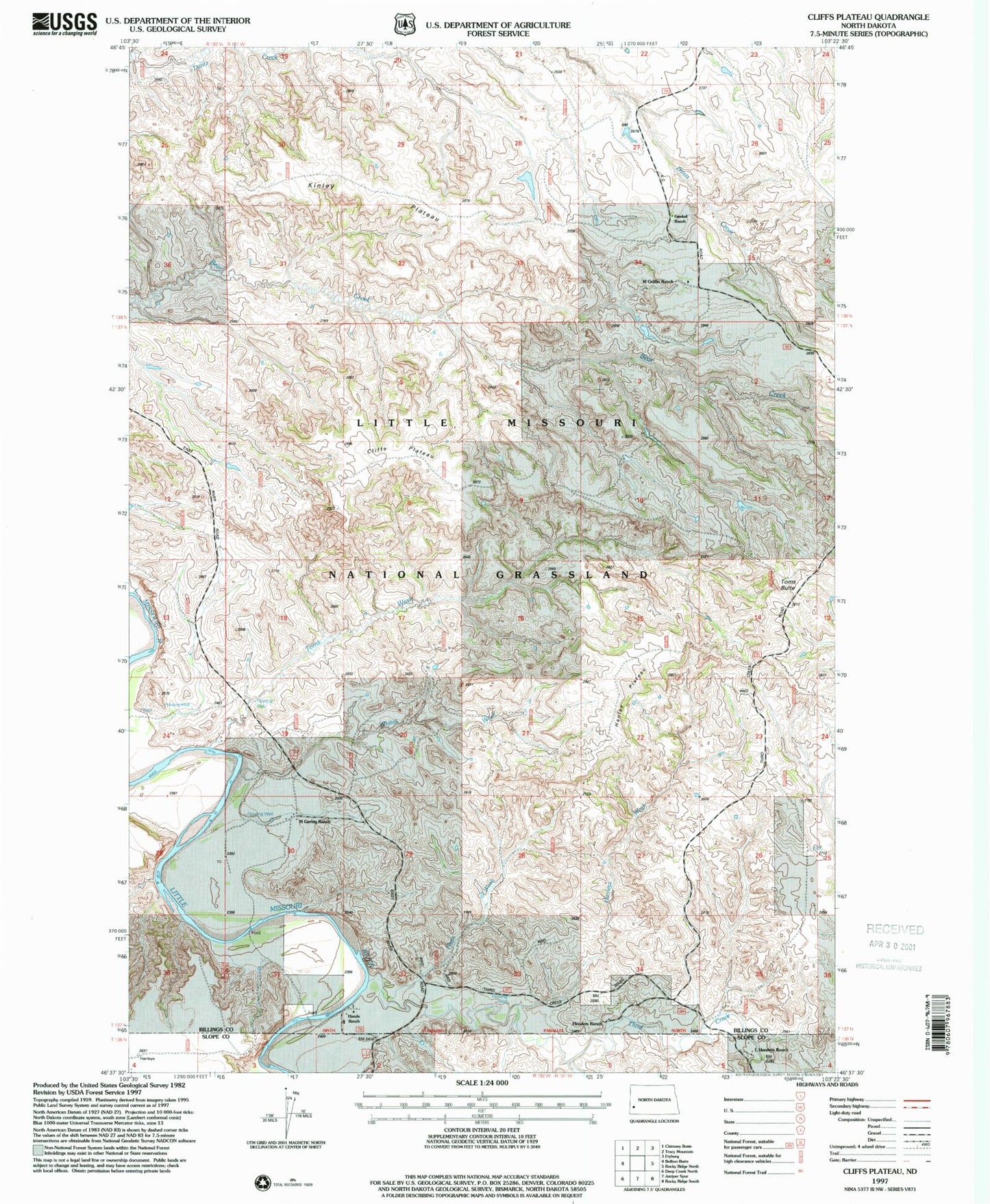
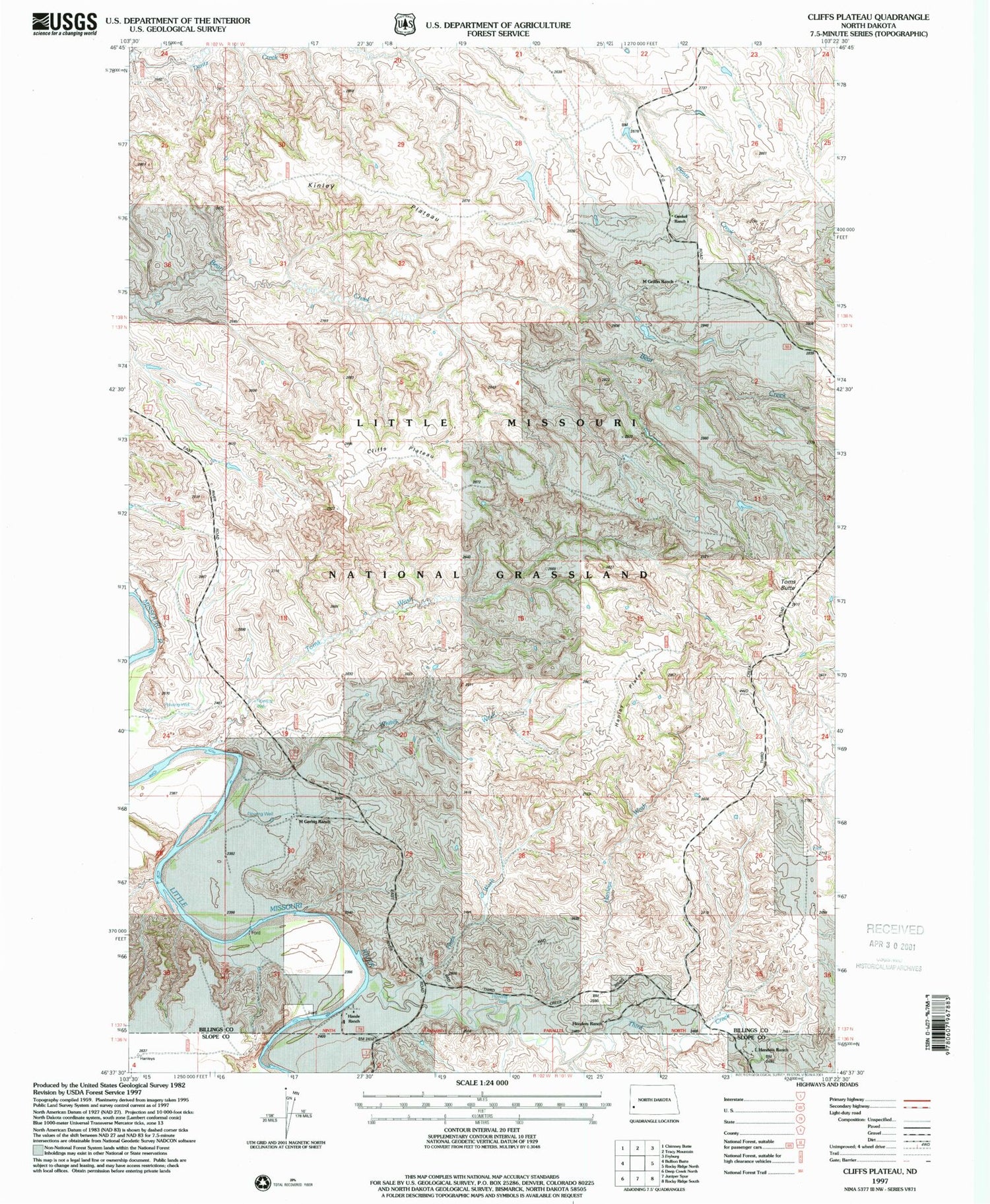
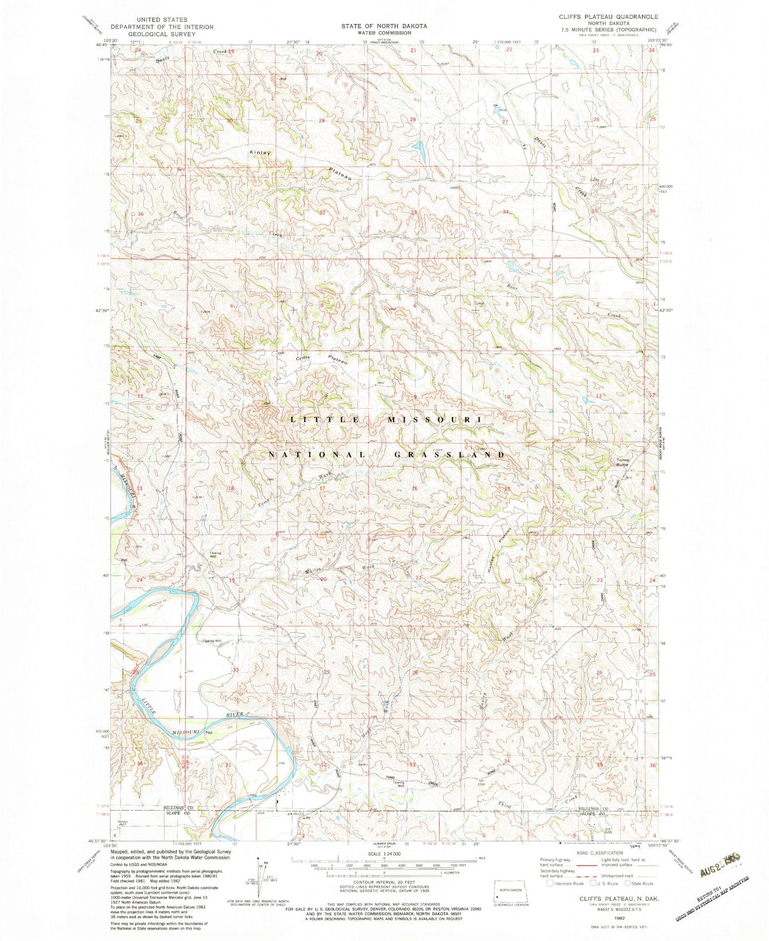
Historical USGS topographic quad map of Cliffs Plateau in the state of North Dakota. Map scale may vary for some years, but is generally around 1:24,000. Print size is approximately 24" x 27"
This quadrangle is in the following counties: Billings, Slope.
The map contains contour lines, roads, rivers, towns, and lakes. Printed on high-quality waterproof paper with UV fade-resistant inks, and shipped rolled.
Contains the following named places: Cliffs Plateau, Gunkel Ranch, Hanley Plateau, Hanley Wash, Henders Ranch, Hops Wash, Kinley Plateau, L Henders Ranch, Little Missouri National Grassland, M Gerbig Ranch, M Griffin Ranch, Third Creek, Toms Butte, Toms Wash, Whites Wash