MyTopo
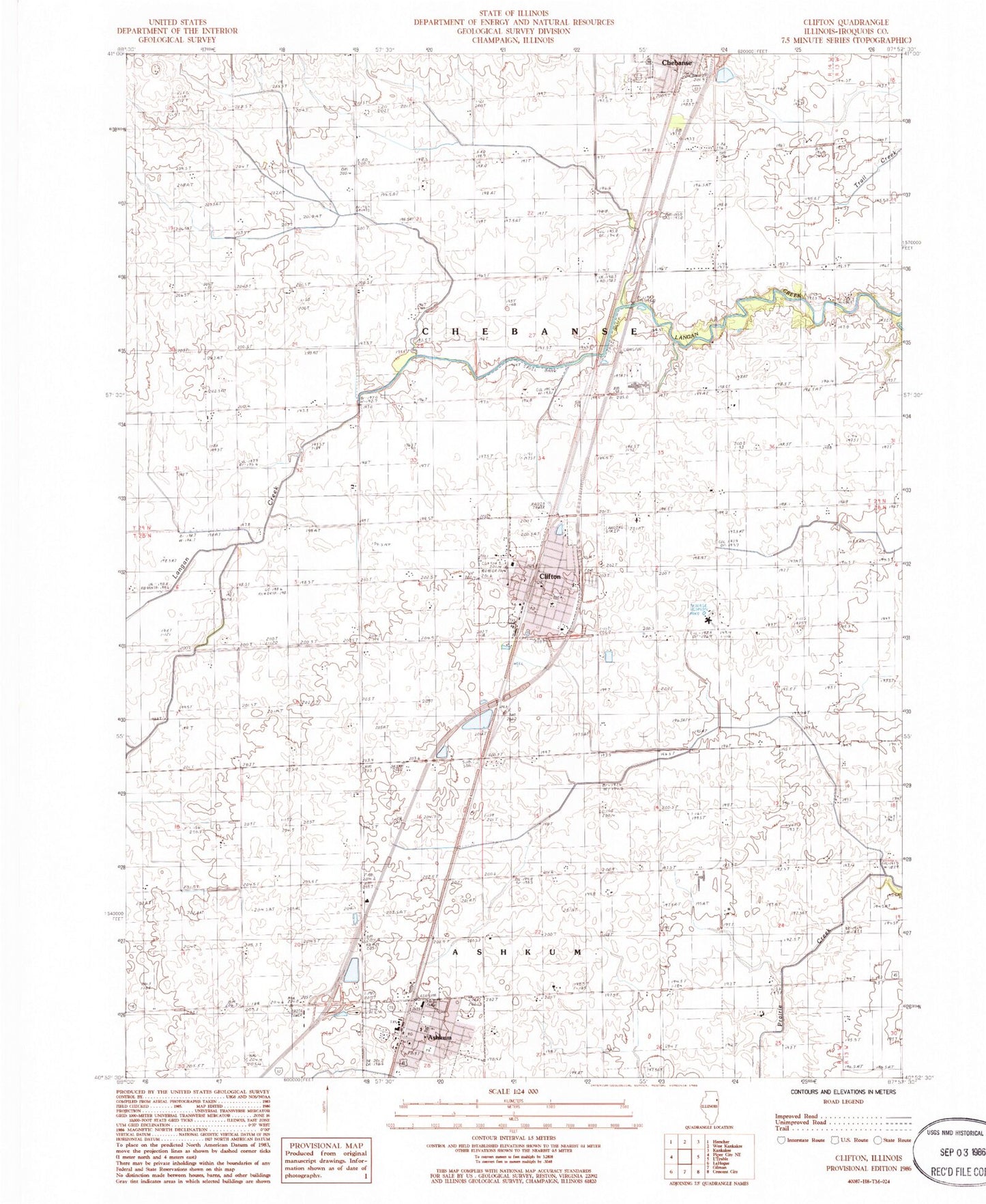
Classic USGS Clifton Illinois 7.5'x7.5' Topo Map
Couldn't load pickup availability
Historical USGS topographic quad map of Clifton in the state of Illinois. Map scale may vary for some years, but is generally around 1:24,000. Print size is approximately 24" x 27"
This quadrangle is in the following counties: Iroquois.
The map contains contour lines, roads, rivers, towns, and lakes. Printed on high-quality waterproof paper with UV fade-resistant inks, and shipped rolled.
Contains the following named places: Ashkum, Ashkum Elementary School, Ashkum Post Office, Ashkum Township Fire Protection District, Ashkum United Methodist Church, Brown School, Central High School, Chebanse Elementary School, Chebanse Township Rural Fire Protection District, Clifton, Clifton Baptist Church, Clifton Elementary School, Clifton Post Office, Clifton Wesleyan Church, Heller School, Illinois State Police Department District 21, John L Nash Middle School, Leggottville School, Saint Mary and Joseph Cemetery, Saint Mary and Josephs Church, Swival School, Tatro School, Township of Ashkum, Township of Chebanse, Village of Ashkum, Village of Clifton, Zion Lutheran Church, Zion Lutheran Church of Clifton, ZIP Codes: 60911, 60927