
MyTopo
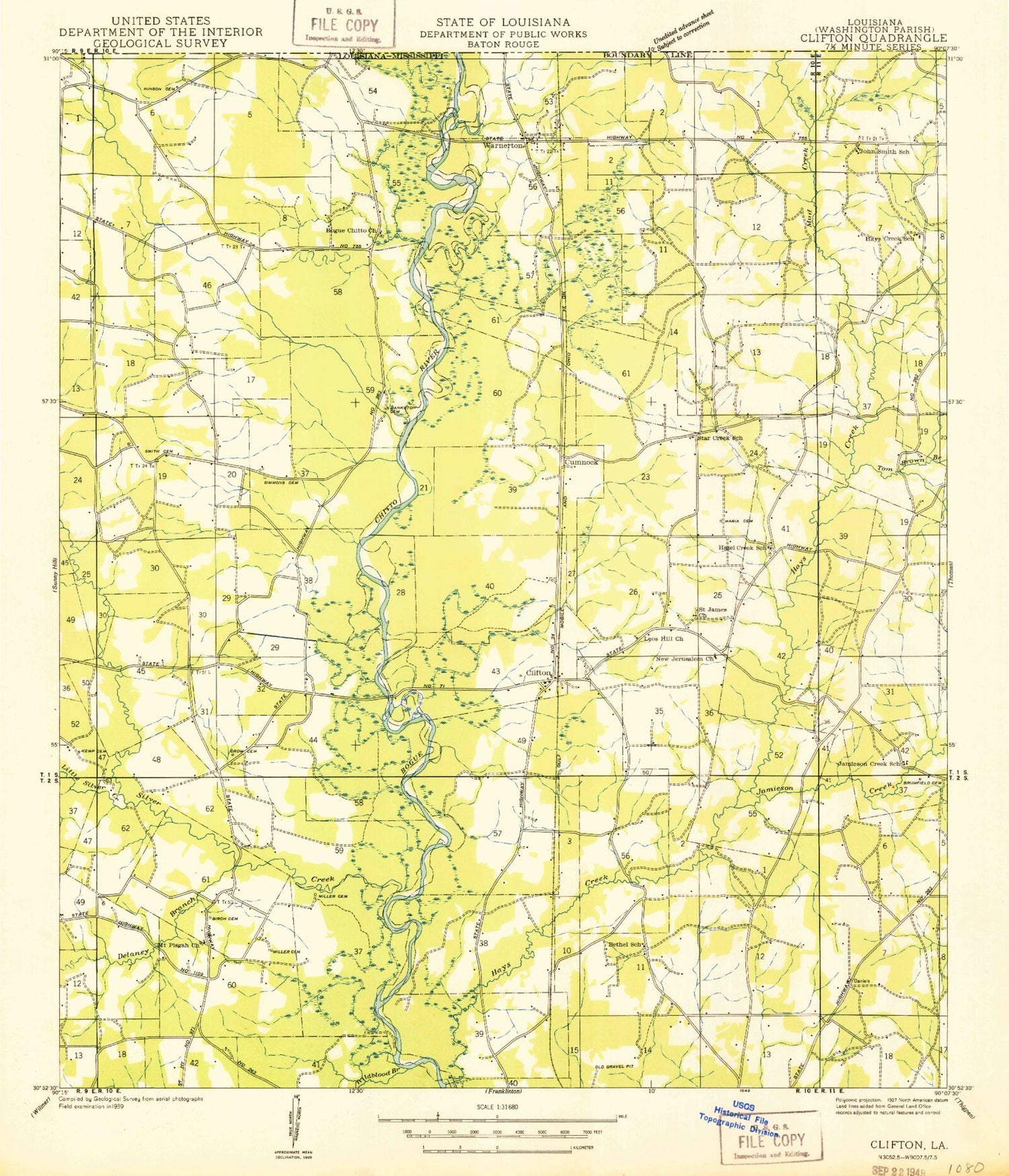
Classic USGS Clifton Louisiana 7.5'x7.5' Topo Map
Couldn't load pickup availability
Historical USGS topographic quad map of Clifton in the state of Louisiana. Map scale may vary for some years, but is generally around 1:24,000. Print size is approximately 24" x 27"
This quadrangle is in the following counties: Washington.
The map contains contour lines, roads, rivers, towns, and lakes. Printed on high-quality waterproof paper with UV fade-resistant inks, and shipped rolled.
Contains the following named places: Alford Cemetery, Bankston Cemetery, Bayou Beth, Bethel Church, Bickham Cemetery, Bogue Chitto Baptist Church, Bogue Chitto Mountain, Bridges Mill, Brockdale Church, Brown Branch, Brown Cemetery, Brumfield Cemetery, Bulloch Cemetery, Burch Cemetery, Clifton, Clifton Church, Clifton Post Office, Cumnock, Delany Branch, Dyson, Haley Cemetery, Hays Creek, Hays Creek Church, Hays Creek School, Hinson Cemetery, James Cemetery, Jamieson Creek, Jerusalem Church, Jimson Creek School, Kemp Cemetery, Lear Hill Church, Lighthouse Church, Little Silver Creek, Magee Cemetery, Miller Cemetery, Moriah Cemetery, Morris Cemetery, Mount Pisgah Church, Mount Point School, Mud Creek, Oak Grove School, Pierces Mill, Saint James Cemetery, Seale Cemetery, Silver Creek, Simmons Cemetery, Smith Cemetery, Star Creek School, Star Hill Baptist Church, Star Hill Cemetery, Toomer Cemetery, Ward Nine, Warner Cemetery, Warnerton, Washington Parish Fire District 3 Hays Creek Volunteer Fire Department, Wildblood Branch, Wilson Cemetery, Winan Memorial Cemetery


