MyTopo
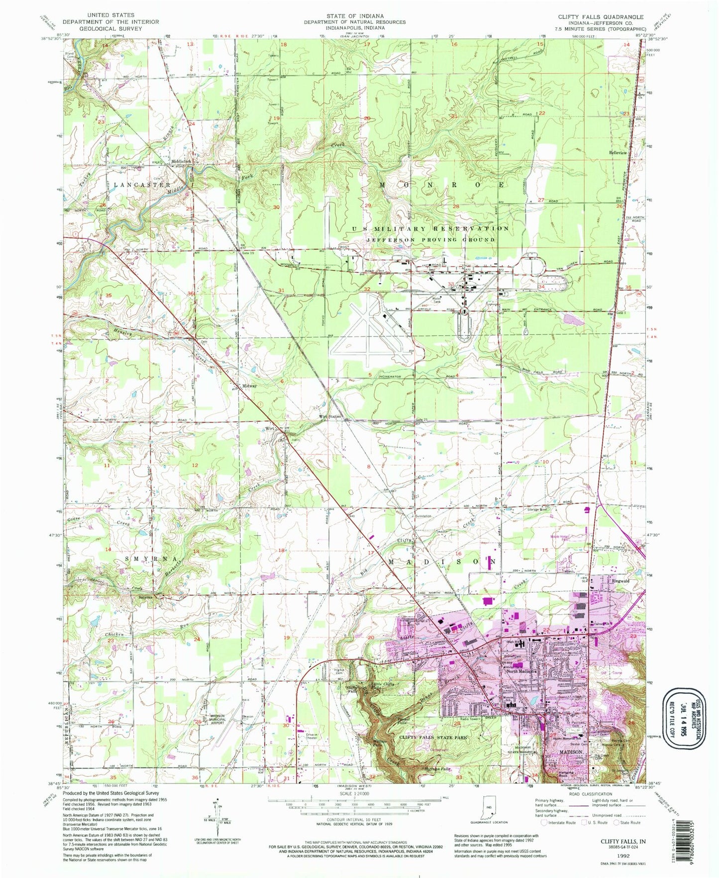
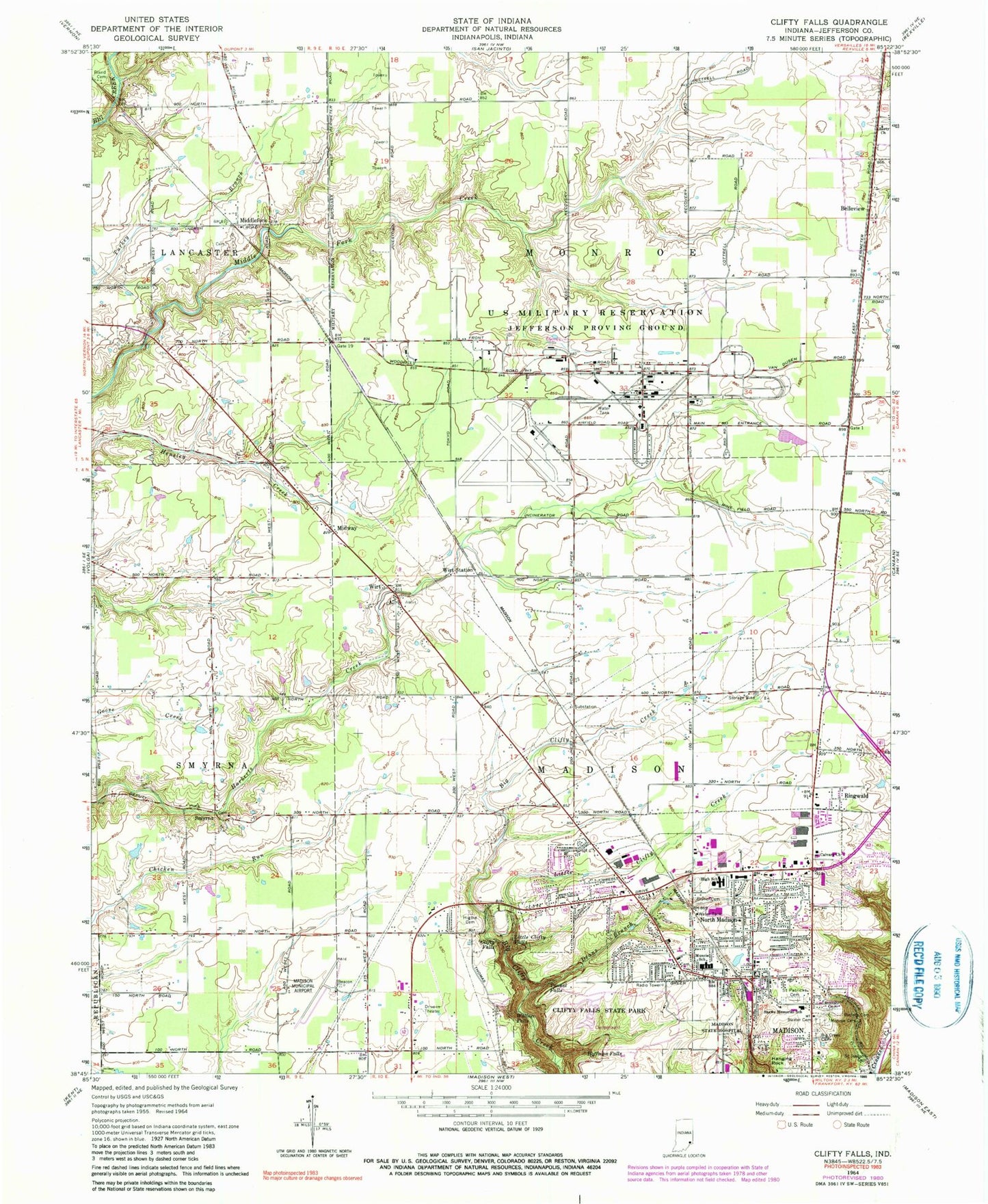
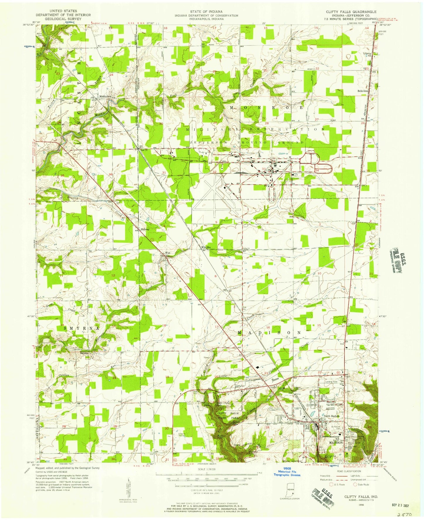
Classic USGS Clifty Falls Indiana 7.5'x7.5' Topo Map
Couldn't load pickup availability
Historical USGS topographic quad map of Clifty Falls in the state of Indiana. Typical map scale is 1:24,000, but may vary for certain years, if available. Print size: 24" x 27"
This quadrangle is in the following counties: Jefferson.
The map contains contour lines, roads, rivers, towns, and lakes. Printed on high-quality waterproof paper with UV fade-resistant inks, and shipped rolled.
Contains the following named places: Baxter Cemetery, Bayless Cemetery, Belleview, Big Creek Cemetery, Bland Cemetery, Bryner Miner Cemetery, Calvary Church, Clifty Falls, Clifty Falls State Park, Deans Branch, Fairmount Cemetery, Hanging Rock, Higbie Cemetery, Hoffman Falls, Liberty Church, Little Clifty Creek, Little Clifty Falls, Middlefork, Midway, Monroe Cemetery, Emery O Muncie Elementary School, North Madison, Ringwald, Saint Joseph Cemetery, Saint Patricks Cemetery, Shawe Memorial High School, Smyrna, Tunnel Falls, Wallace Falls, Wirt, Wirt Station, Madison Municipal Airport, Stony Point, Jefferson County, Brights Station, Calloway Station (historical), Mud Luck Post Office (historical), Stony Point Post Office (historical), Township of Madison, Township of Monroe, City of Madison, Jefferson Proving Grounds, Madison Fire Department Station 5, Madison Fire Department Station 6, Madison Township Volunteer Fire Department, Burke's Airport (historical), Giltner Airport, Faith Alliance Church, Grace Baptist Church, Resurrection Lutheran Church, Grace Fellowship Church, First Church of the Nazarene, North Madison Baptist Church, Faith Lutheran Church, Indiana Veterans Memorial Cemetery, North Madison Post Office, Jewish Cemetery, Baxter Cemetery, Bayless Cemetery, Belleview, Big Creek Cemetery, Bland Cemetery, Bryner Miner Cemetery, Calvary Church, Clifty Falls, Clifty Falls State Park, Deans Branch, Fairmount Cemetery, Hanging Rock, Higbie Cemetery, Hoffman Falls, Liberty Church, Little Clifty Creek, Little Clifty Falls, Middlefork, Midway, Monroe Cemetery, Emery O Muncie Elementary School, North Madison, Ringwald, Saint Joseph Cemetery, Saint Patricks Cemetery, Shawe Memorial High School, Smyrna, Tunnel Falls, Wallace Falls, Wirt, Wirt Station, Madison Municipal Airport, Stony Point, Jefferson County, Brights Station, Calloway Station (historical), Mud Luck Post Office (historical), Stony Point Post Office (historical), Township of Madison, Township of Monroe, City of Madison, Jefferson Proving Grounds, Madison Fire Department Station 5, Madison Fire Department Station 6, Madison Township Volunteer Fire Department, Burke's Airport (historical), Giltner Airport, Faith Alliance Church, Grace Baptist Church, Resurrection Lutheran Church, Grace Fellowship Church, First Church of the Nazarene, North Madison Baptist Church, Faith Lutheran Church, Indiana Veterans Memorial Cemetery, North Madison Post Office, Jewish Cemetery