MyTopo
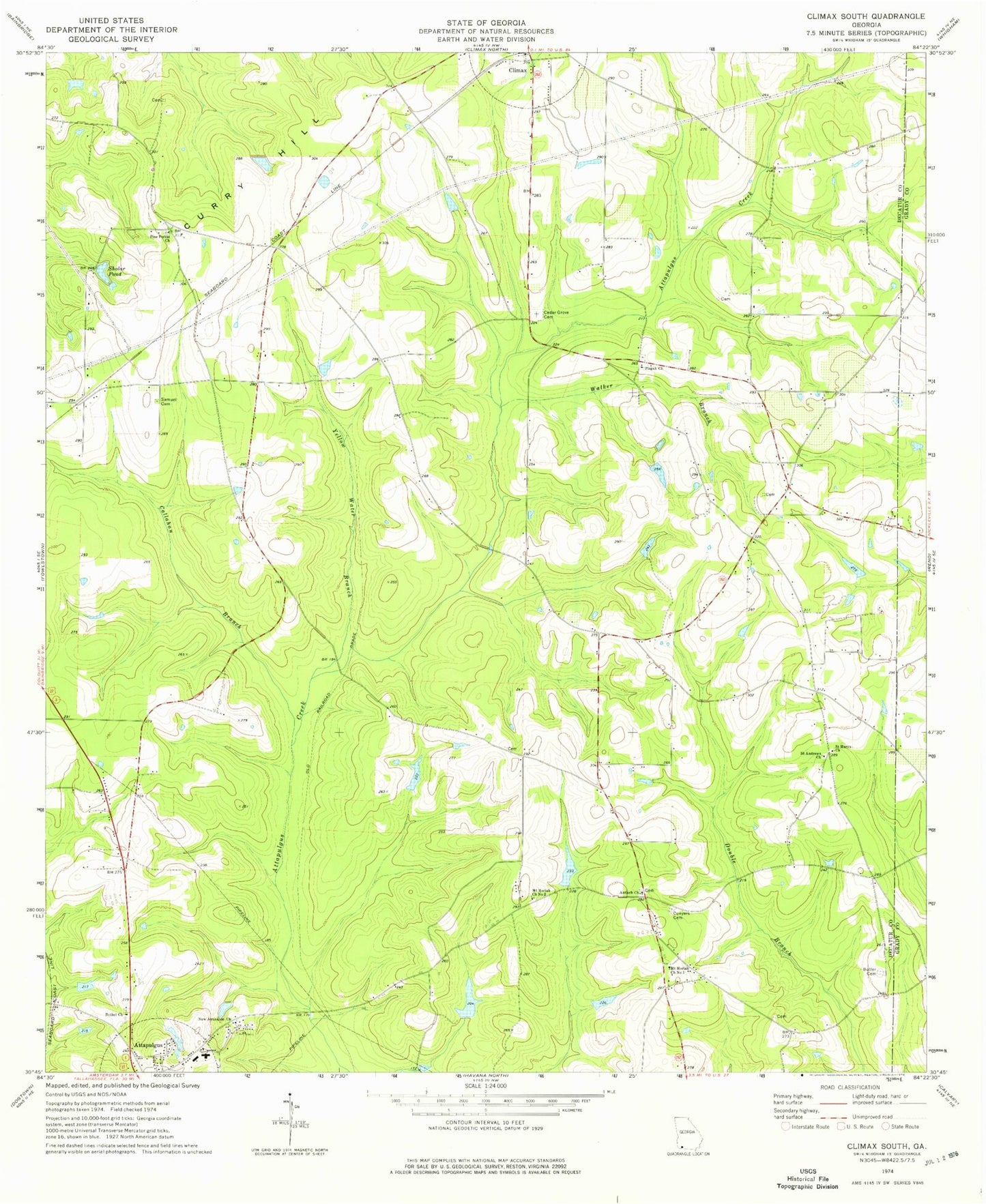
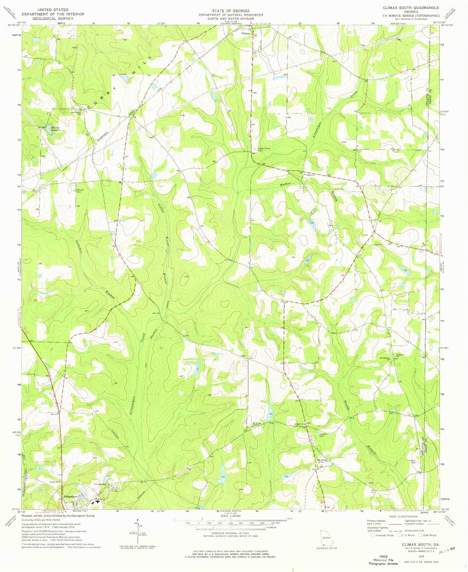
Classic USGS Climax South Georgia 7.5'x7.5' Topo Map
Couldn't load pickup availability
Historical USGS topographic quad map of Climax South in the state of Georgia. Map scale may vary for some years, but is generally around 1:24,000. Print size is approximately 24" x 27"
This quadrangle is in the following counties: Decatur, Grady.
The map contains contour lines, roads, rivers, towns, and lakes. Printed on high-quality waterproof paper with UV fade-resistant inks, and shipped rolled.
Contains the following named places: Advent Church, Antioch Church, Attapulgus Division, Bell-Dixon School, Bethel Church, Bethel Church Cemetery, Beulah Thomas Church, Beulah Thomas Church Cemetery, Butler Cemetery, Callahan Branch, Cedar Grove Cemetery, Climax Division, Coastal Loan Company Lake, Coastal Loan Company Lake Dam, Conyers Cemetery, Dubarco Incorporated Lake, Dubarco Incorporated Lake Dam, Lillian E Williams Elementary School, Mount Moriah Church Number 1, Mount Moriah Church Number 2, Mount Moriah School, New Jerusalem Church, Otisco, Pine Forest Church, Pine Forest Church Cemetery, Pisgah Church, Pisgah Church Cemetery, Saint Andrews Church, Saint Mary Church, Saint Marys Church, Samuel Cemetery, Sholar Pond, Walker Branch, Yellow Water Branch