MyTopo
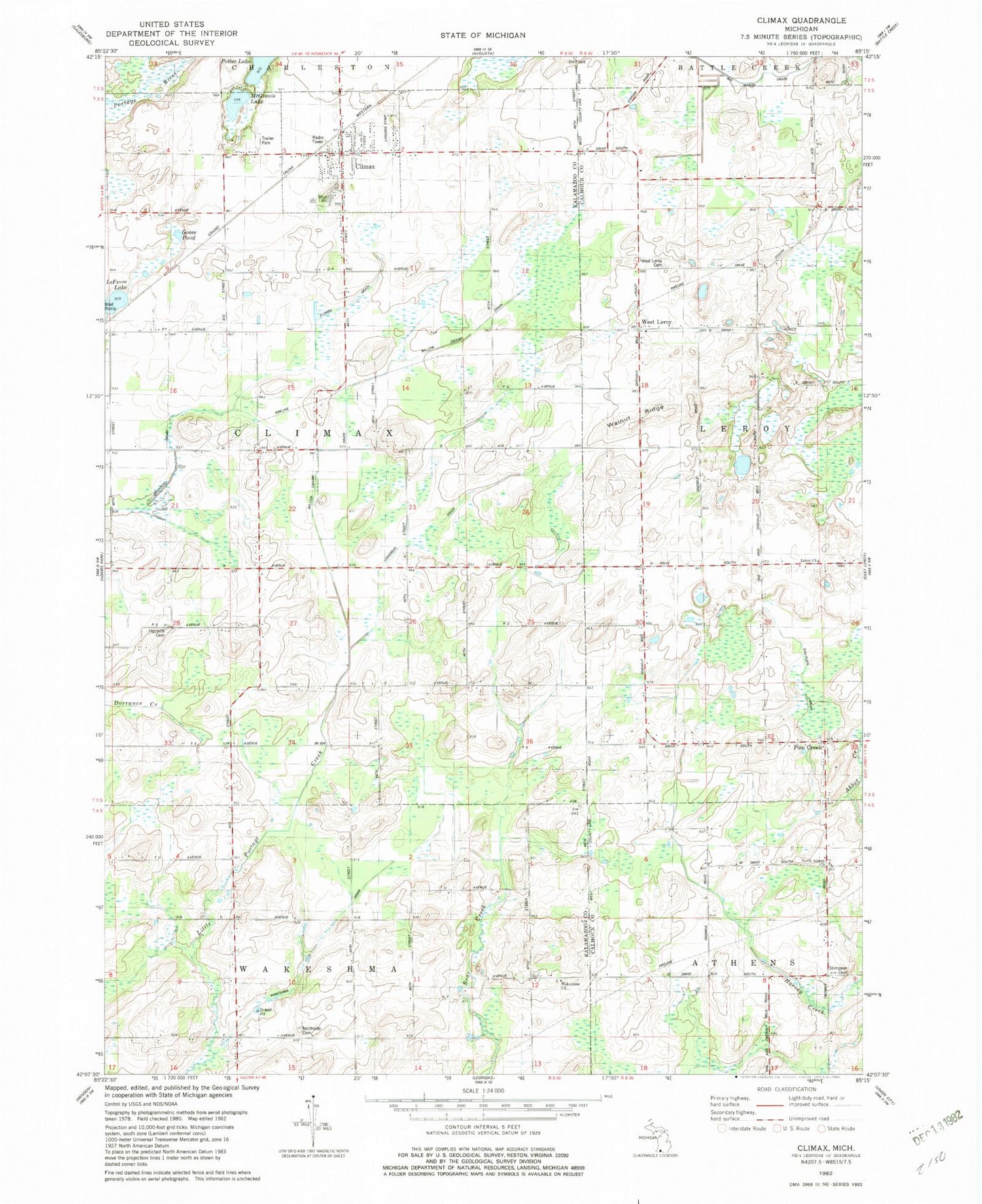
Classic USGS Climax Michigan 7.5'x7.5' Topo Map
Couldn't load pickup availability
Historical USGS topographic quad map of Climax in the state of Michigan. Map scale may vary for some years, but is generally around 1:24,000. Print size is approximately 24" x 27"
This quadrangle is in the following counties: Calhoun, Kalamazoo.
The map contains contour lines, roads, rivers, towns, and lakes. Printed on high-quality waterproof paper with UV fade-resistant inks, and shipped rolled.
Contains the following named places: Athens Church, Berger School, Bigelow School, Climax, Climax Mobile Home Park, Climax Post Office, Climax Station, Climax Township Fire Department, Climax Township Hall, Climax United Methodist Church, Climax-Scotts Junior/Senior High School, Daniel B. Eldred House Historical Marker, Eldred Drain, Gardners Corners, Goose Pond, Harrison Cemetery, Harvey School, Hiscock School, Johnson Drain, Langeland Climax Chapel, Lawrence Memorial Library, Le Ferre Lake, Longman Drain, Lynn School, McGinnis Lake, North Athens Baptist Church, North Athens Cemetery, North Fulton Cemetery, Pine Creek, Pinecreek Post Office, Potter Lake, Prairie Home Cemetery, School Number 4, Seeley School, South Climax Post Office, South Leroy Congregational Cemetery, Stimpson Cemetery, Township of Climax, Village of Climax, Wakeshma Church, Wakeshma Drain, Wakeshma Post Office, Walnut Ridge, West Leroy, West Leroy Bible Church, West Leroy Cemetery, West Leroy Post Office, Willow Swamp Drain, WRKR-FM (Portage), ZIP Code: 49034