MyTopo
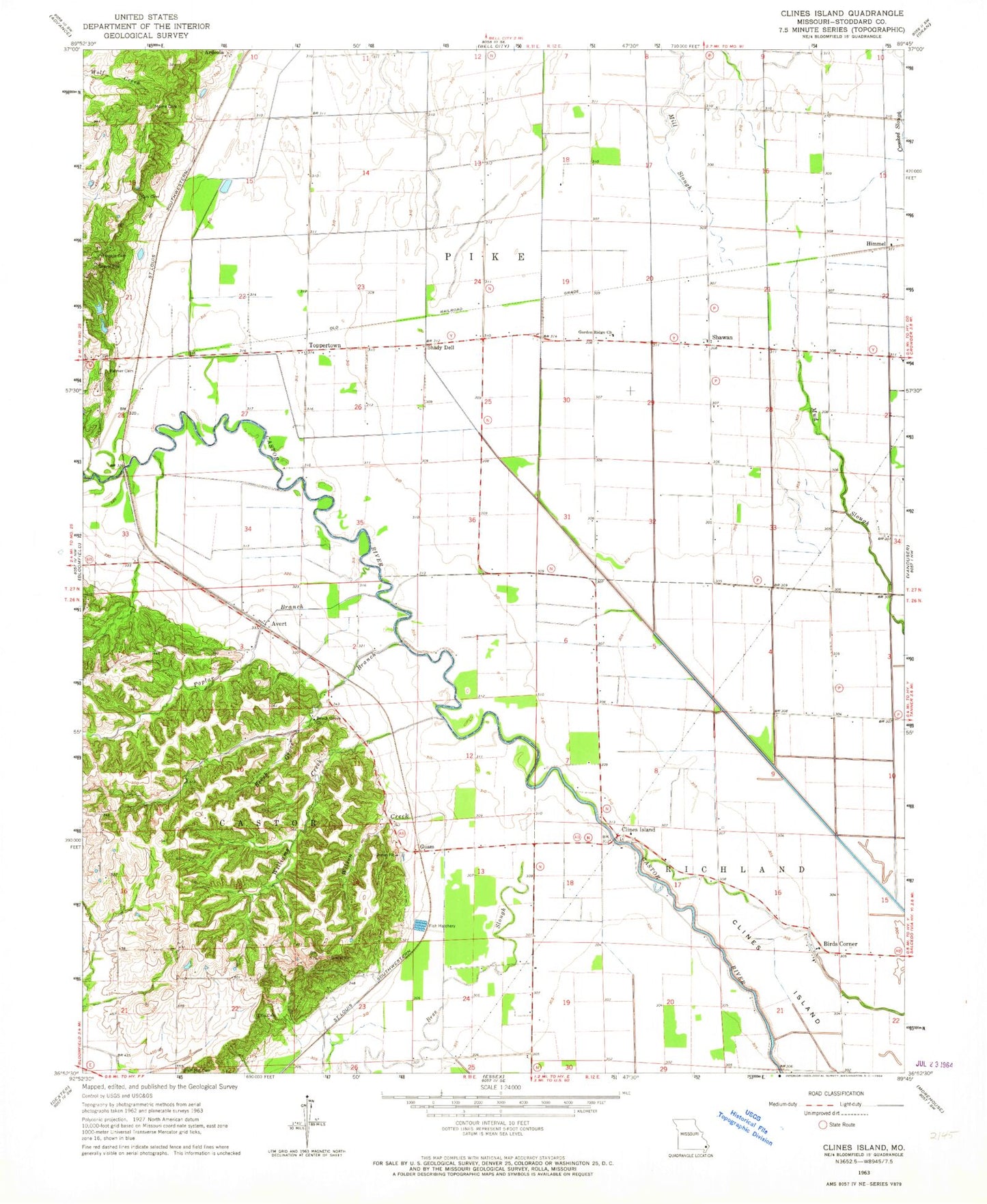
Classic USGS Clines Island Missouri 7.5'x7.5' Topo Map
Couldn't load pickup availability
Historical USGS topographic quad map of Clines Island in the state of Missouri. Map scale may vary for some years, but is generally around 1:24,000. Print size is approximately 24" x 27"
This quadrangle is in the following counties: Stoddard.
The map contains contour lines, roads, rivers, towns, and lakes. Printed on high-quality waterproof paper with UV fade-resistant inks, and shipped rolled.
Contains the following named places: Artesian Well, Avert, Beech Grove Branch, Beech Grove Church, Beech Grove School, Birds Corner, Bridges Post Office, Clines Island, Clines Island School, Ditch Number 24, Ditch Number 30, Ditch Number 33, Ditch Number 34, Durnell, Ellis Cemetery, Garden Ridge Church, Garden Ridge School, Guam, Himmel, Hopkins Cemetery, Indiana Spur, Lewis Lake Dam, Mill Slough, Montgomery Lake Lower Dam, Montgomery Lake Upper Dam, Moore Cemetery, Oak Ridge Cemetery, Palmer Cemetery, Poplar Branch, Rice Lake, Rice Lake Dam East, Rice Lake West Dam, Shady Dell, Shawan, Shawnan School, South Master School, Toppertown, Williams, Williams Creek, Wilson Creek, Zeta, ZIP Code: 63735