
MyTopo
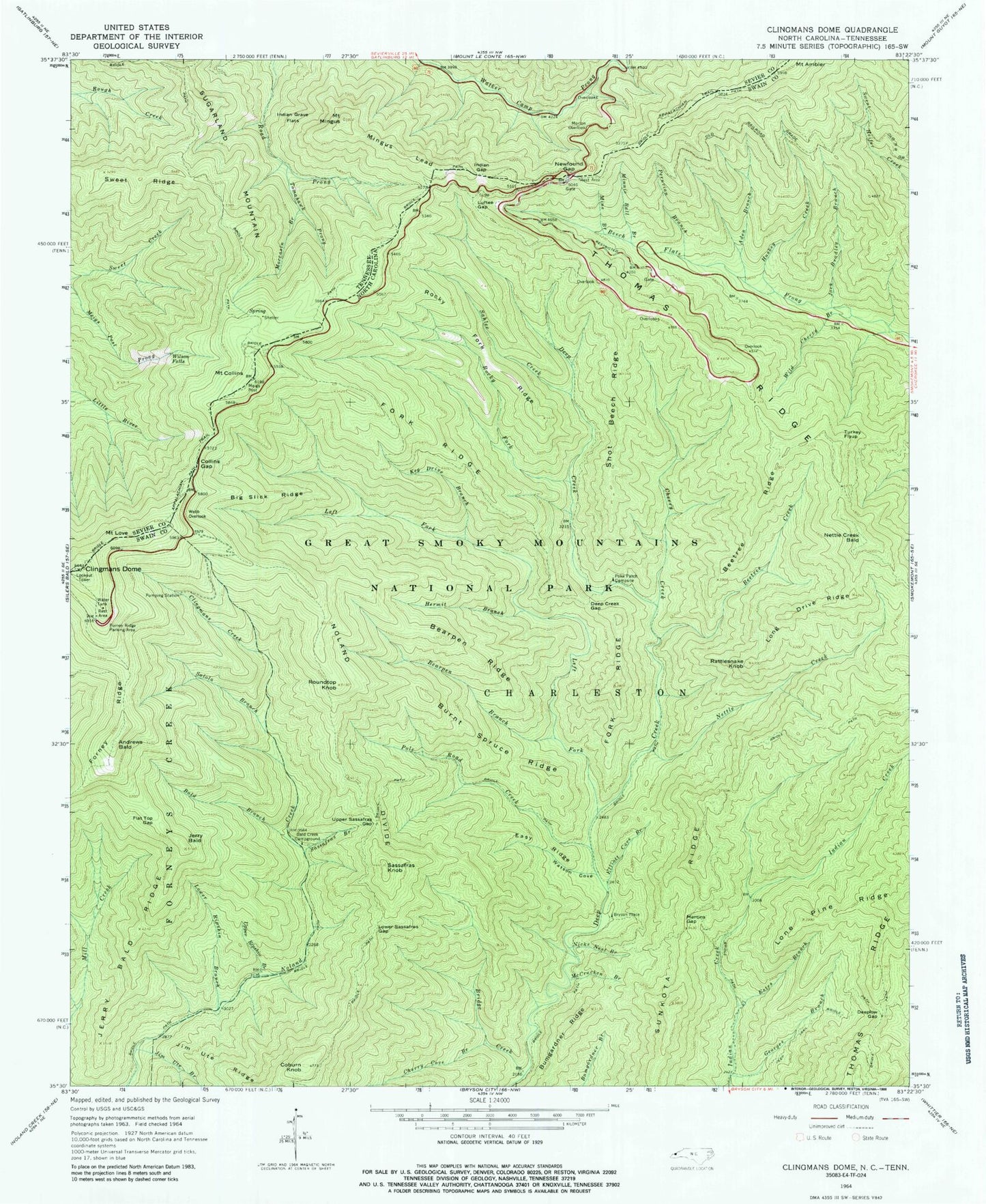
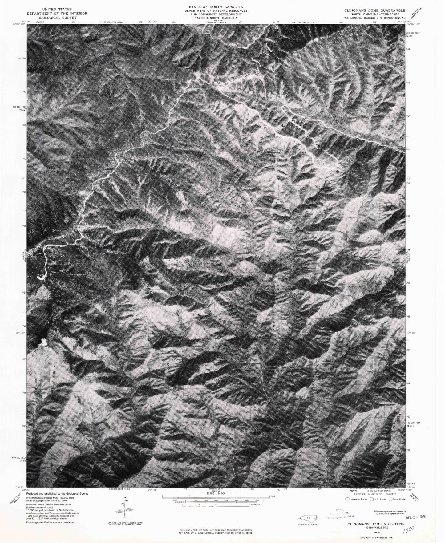
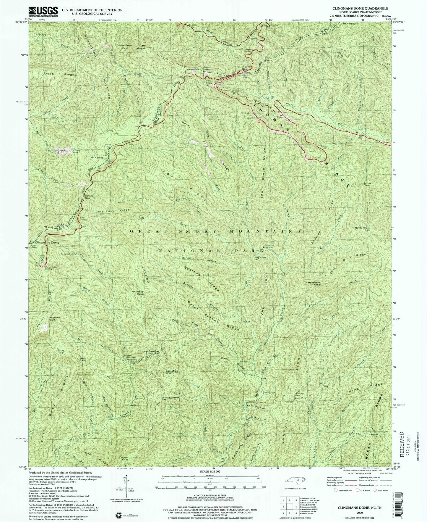
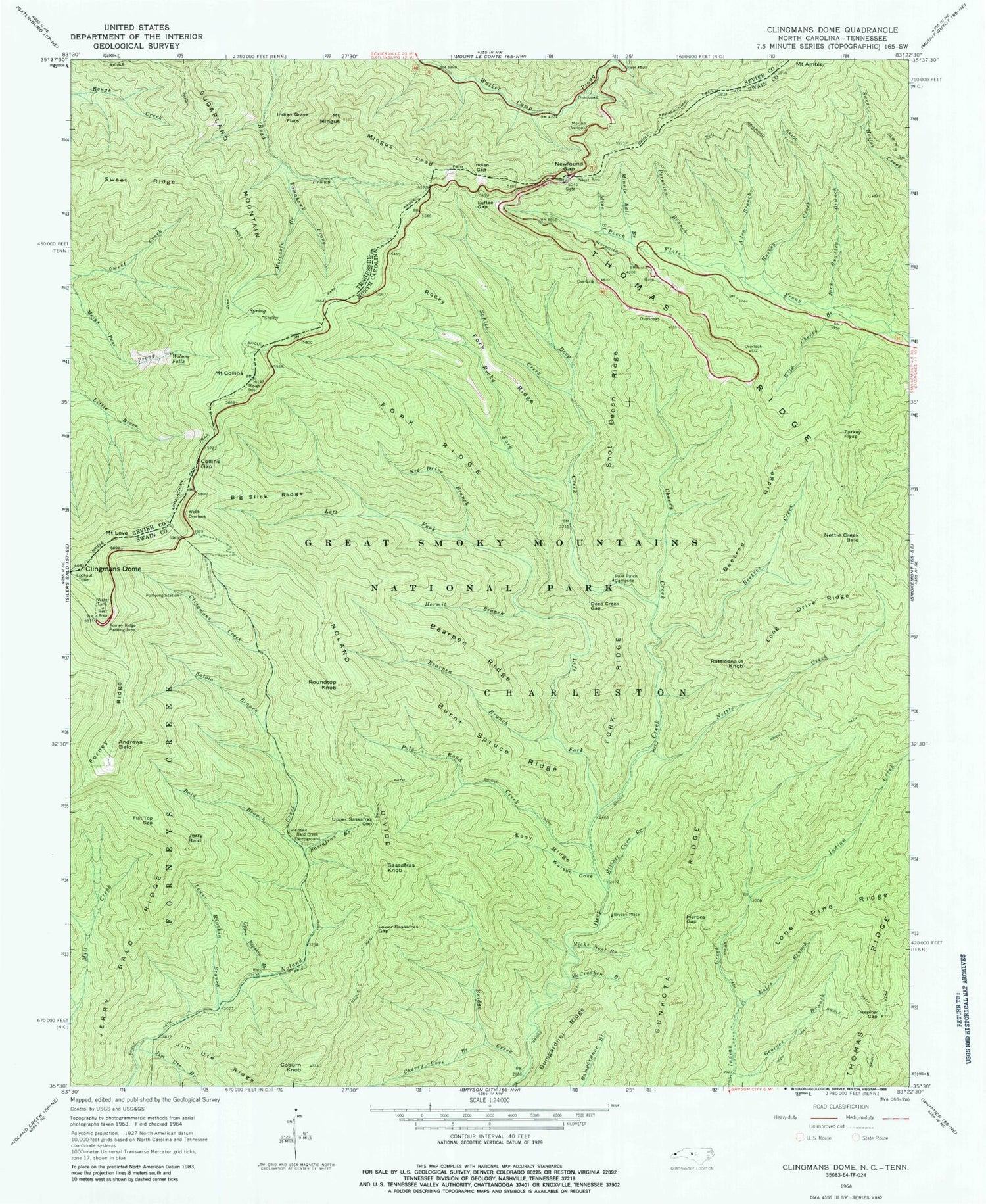
USGS Classic Clingmans Dome North Carolina 7.5'x7.5' Topo Map
Couldn't load pickup availability
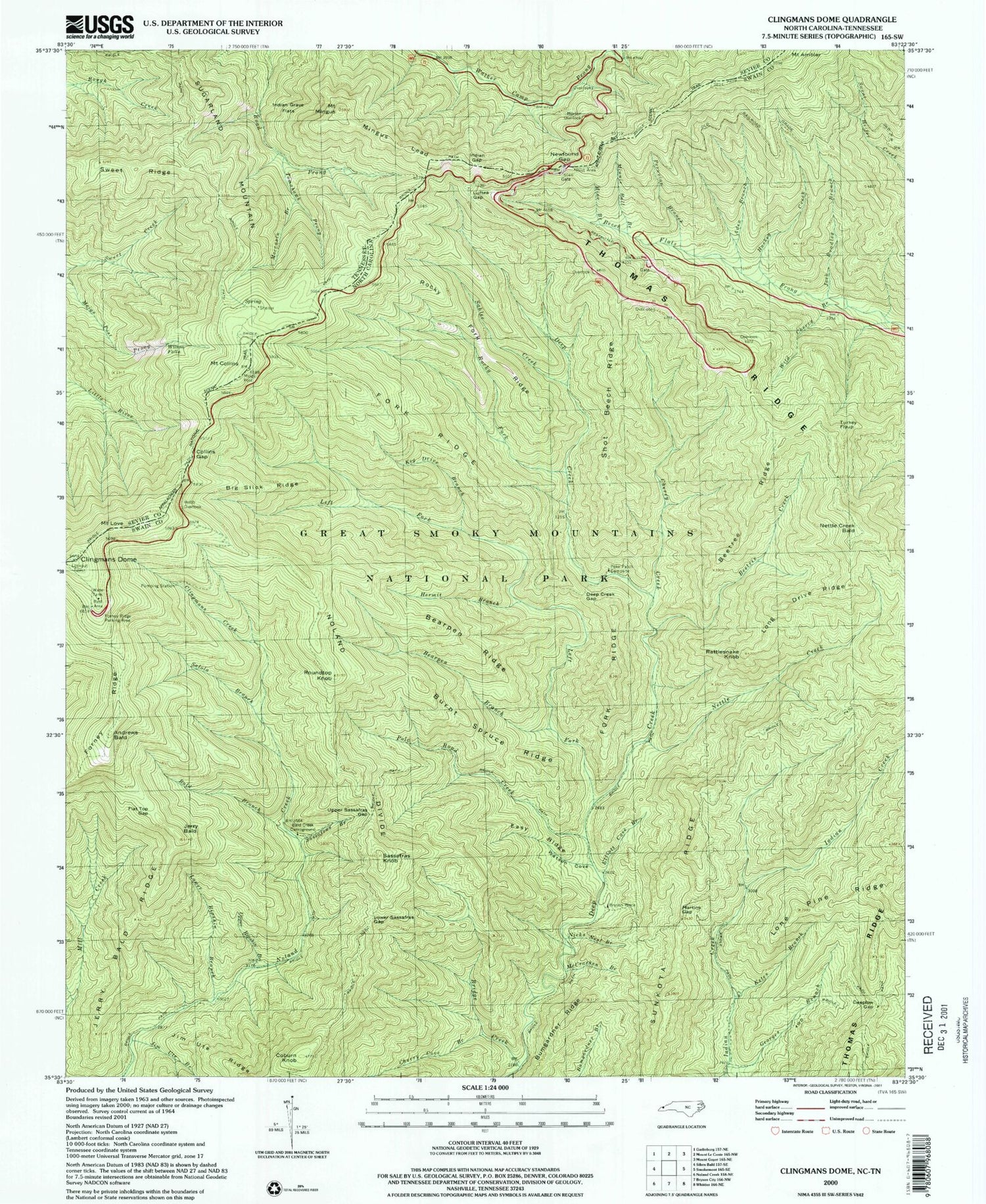
Historical USGS topographic quad map of Clingmans Domein the states of North Carolina, Tennessee. Scale: 1:24000. Print size: 24" x 27"
This quadrangle is in the following counties: Sevier, Swain.
The map contains contour lines, roads, rivers, towns, lakes, and grids including latitude / longitude and UTM / MGRS. Printed on high-quality waterproof paper with UV fade-resistant inks.
Contains the following named places: Aden Branch, Bald Branch, Bald Creek Campground, Bearpen Branch, Bearpen Ridge, Beetree Creek, Beetree Ridge, Big Slick Ridge, Bridge Creek, Bumgardner Ridge, Burnt Spruce Ridge, Cherry Creek, Clingmans Creek, Coburn Knob, Deep Creek Gap, Deeplow Gap, Easy Ridge, Elliott Cove Branch, Estes Branch, Flat Top Gap, Fork Ridge, Forney Ridge Parking Area, Georges Branch, Hermit Branch, Huskey Creek, Jack Bradley Branch, Jerry Bald, Jerry Bald Ridge, Jim Ute Ridge, Keg Drive Branch, Left Fork Deep Creek, Lone Pine Ridge, Long Drive Ridge, Lower Ripshin Branch, Lower Sassafras Gap, Luftee Gap, Martins Gap, McCracken Branch, Mine Branch, Minnie Ball Branch, Nettle Creek, Nicks Nest Branch, Peruvian Branch, Poke Patch Campsite, Pole Road Creek, Rattlesnake Knob, Rocky Fork, Rocky Fork Ridge, Roundtop Knob, Sahlee Creek, Salola Branch, Sassafras Branch, Sassafras Knob, Shot Beech Ridge, Upper Ripshin Branch, Upper Sassafras Gap, Watson Cove, Webb Overlook, Wild Cherry Branch, Indian Gap, Newfound Gap, Mount Weaver, Cherry Cove Branch, Forney Ridge, Jim Ute Branch, Noland Divide, Sunkota Ridge, Thomas Ridge, Andrews Bald, Bryson Place, Nettle Creek Bald, Turkey Flyup, Mount Ambler, Mount Collins, Mount Love, Collins Gap, Mingus Lead, Clingmans Dome, Clingmans Dome Visitor Center, Jerry Flats Cemetery, Left Fork Deep Creek, Indian Gap, Newfound Gap, Mount Ambler, Mount Collins, Mount Love, Sugarland Mountain, Sweet Ridge, Tomahawk Prong, Wilson Falls, Collins Gap, Indian Grave Flats, Mingus Lead, Moccasin Branch, Morton Overlook, Mount Mingus, Clingmans Dome, Mount Collins Shelter