
MyTopo
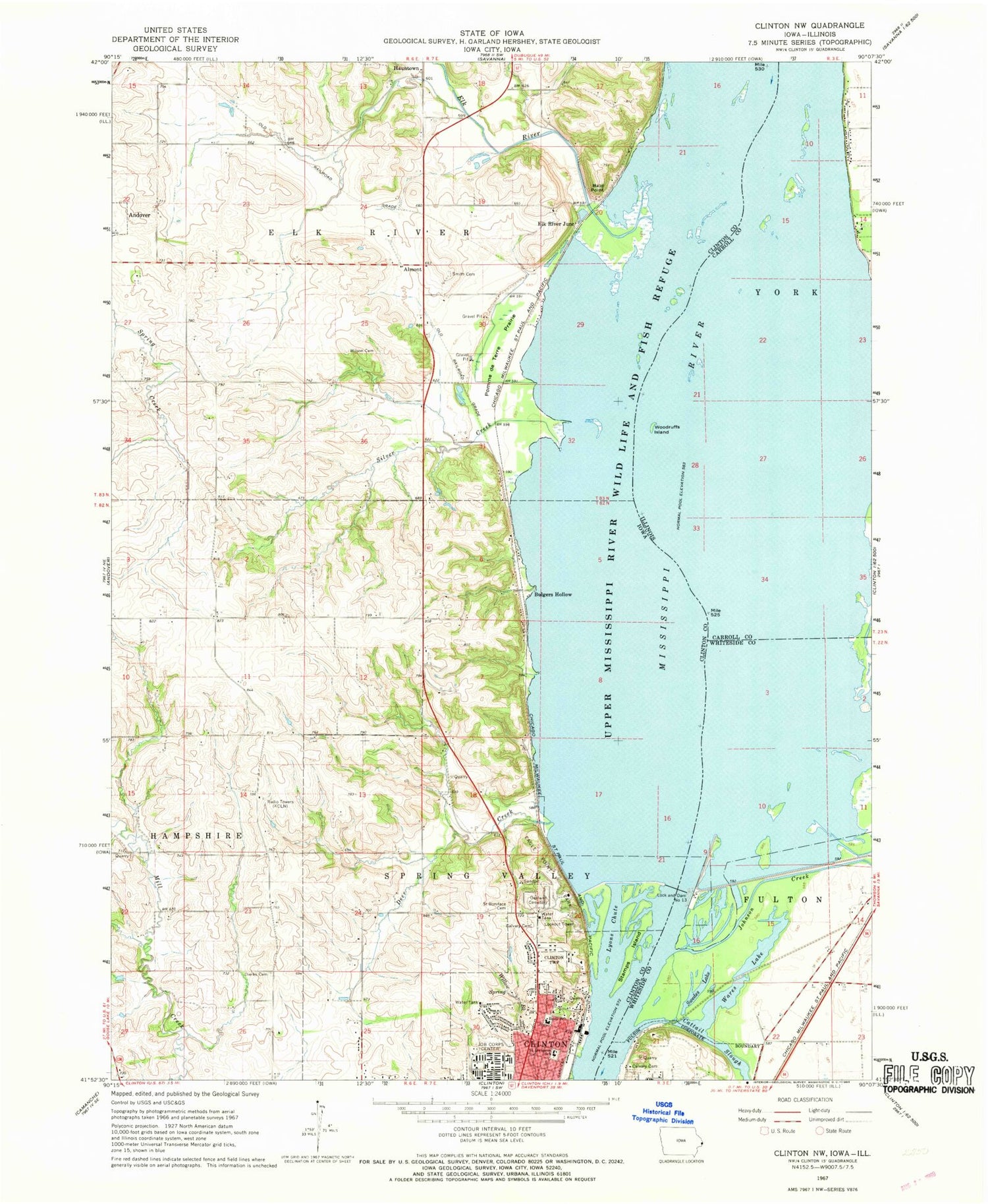
Classic USGS Clinton NW Iowa 7.5'x7.5' Topo Map
Couldn't load pickup availability
Historical USGS topographic quad map of Clinton NW in the states of Iowa, Illinois. Map scale may vary for some years, but is generally around 1:24,000. Print size is approximately 24" x 27"
This quadrangle is in the following counties: Carroll, Clinton, Whiteside.
The map contains contour lines, roads, rivers, towns, and lakes. Printed on high-quality waterproof paper with UV fade-resistant inks, and shipped rolled.
Contains the following named places: Almont, Almont Post Office, Bald Point, Buell School, Bulgers Hollow, Calvary Cemetery, Cattail Slough, Clinton County Historical Society Museum, Deer Creek, Dierks Cemetery, Eagle Heights Elementary School, Eagle Point Nursing and Rehabilitation Center, Eagle Point Park, Elk River, Elk River Junction, Elk River Post Office, Elk River Slough, First Church of the Nazarene, Flannery School, Gomers Lake, Hauntown Cemetery, Jehovahs Witnesses North Congregation, Johnson Creek, KCLN-FM (Clinton), KLNT-AM (Clinton), KNJY-FM (Clinton), Lock and Dam 13, Lock and Dam No, Lock and Dam Number 13, Lyons Chute, Lyons Middle School, Lyons Quarry, Mead, Mead Post Office, Oakland Cemetery, Pomme de Terre Prairie, Pool 13, Saint Boniface Cemetery, Saint Irenaeus Calvary Cemetery, Saint Irenaeus Catholic Church, Saint Irenaeus School, Sibyl, Silver Creek, Smith Cemetery, Soaring Eagles Nature Center, Stamps Island, Swedes Lake, Township of Elk River, Township of Fulton, Walkyns Glen, Wares Lake, Watkyns Glen Post Office, Willow Brook, Wilson Cemetery, Woodruffs Island, ZIP Code: 52701


