
MyTopo
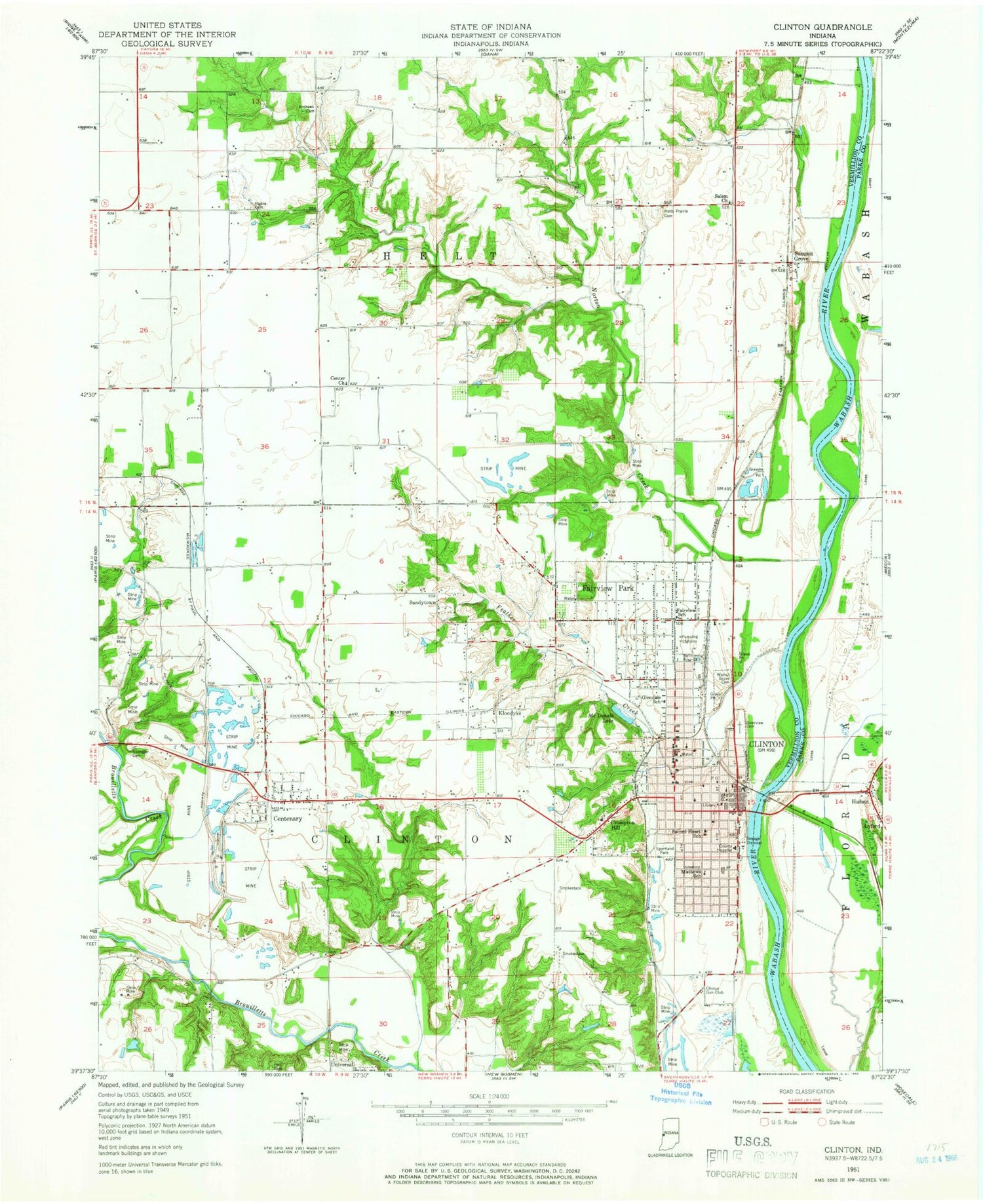
Classic USGS Clinton Indiana 7.5'x7.5' Topo Map
Couldn't load pickup availability
Historical USGS topographic quad map of Clinton in the state of Indiana. Map scale may vary for some years, but is generally around 1:24,000. Print size is approximately 24" x 27"
This quadrangle is in the following counties: Parke, Vermillion.
The map contains contour lines, roads, rivers, towns, and lakes. Printed on high-quality waterproof paper with UV fade-resistant inks, and shipped rolled.
Contains the following named places: Andrews Cemetery, Centenary, Center Church, Central Elementary School, City of Clinton, Clinton, Clinton Airport, Clinton Fire Department, Clinton Gun Club, Clinton Police Department, Clinton Post Office, Clinton Township Fire Department, Crompton Hill, Ernie Pyle School, Fairview Park, Fairview Park Volunteer Fire Department, Fairview School, Feather Creek, Glendale Elementary School, Hall Cemetery, Helts Prairie Cemetery, Higbie Cemetery, Hudnut, Klondyke, Matthews-South Elementary School, McDonald Lake, Norton Creek, Riverside Cemetery, Sacred Heart School, Salem Church, Sandytown, Spangler Cemetery, Sportland Park, Summit Grove, Town of Fairview Park, Township of Clinton, Union Hospital Clinton, Van Duyn School, Vermillion County Emergency Medical Services Station 2, Walnut Grove Cemetery, ZIP Code: 47842


