MyTopo
Classic USGS Clintonville North Wisconsin 7.5'x7.5' Topo Map
Couldn't load pickup availability
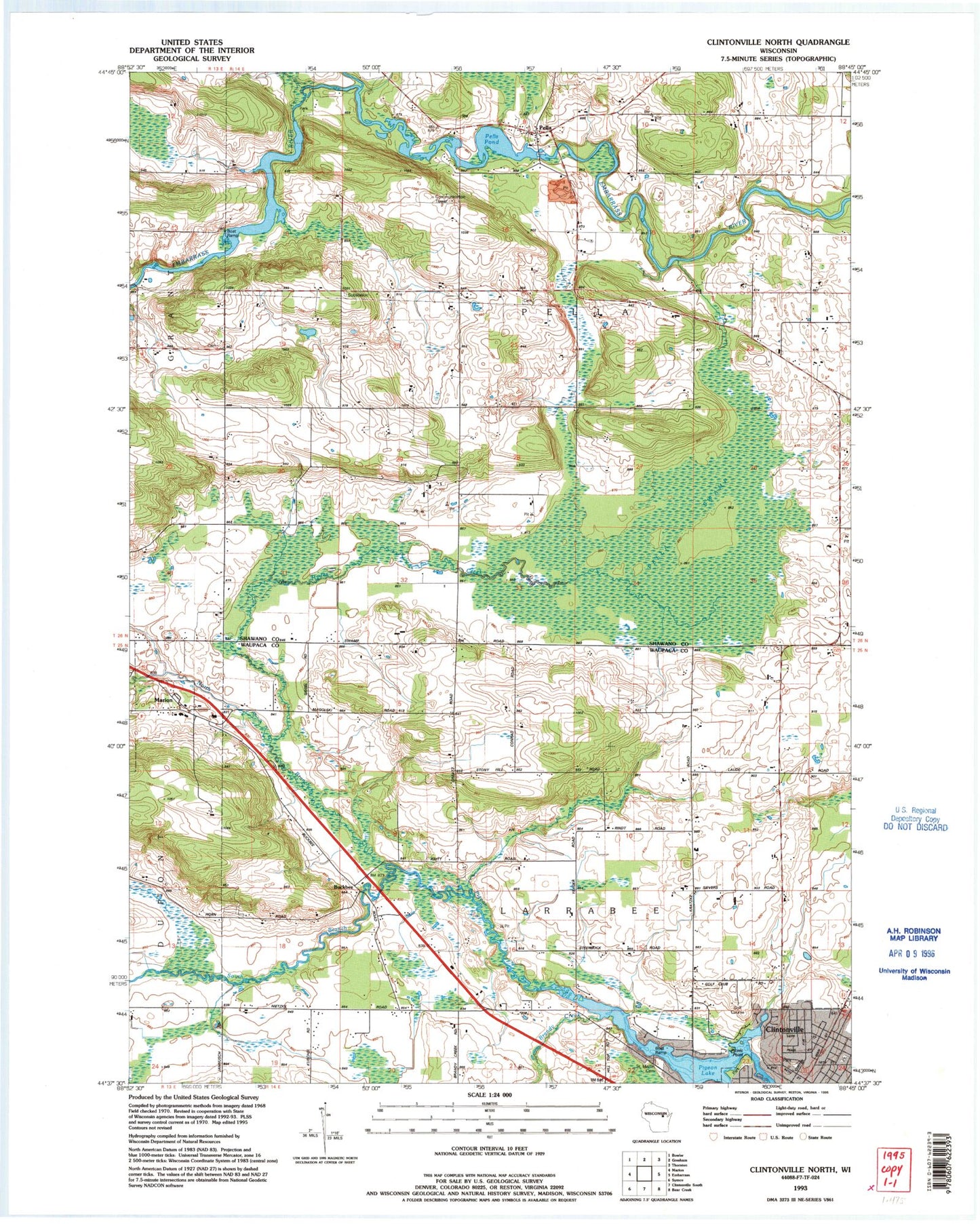
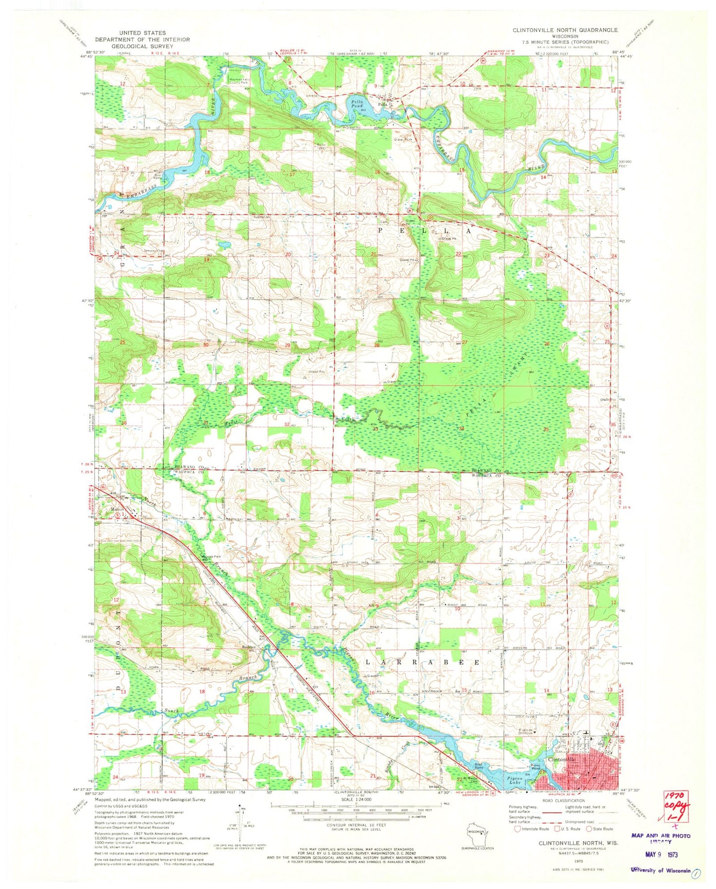
Historical USGS topographic quad map of Clintonville North in the state of Wisconsin. Map scale may vary for some years, but is generally around 1:24,000. Print size is approximately 24" x 27"
This quadrangle is in the following counties: Shawano, Waupaca.
The map contains contour lines, roads, rivers, towns, and lakes. Printed on high-quality waterproof paper with UV fade-resistant inks, and shipped rolled.
Contains the following named places: Bethlehem Lutheran Church, Brandy Creek, Buckbee, Clintonville High School, Clintonville Middle School, Dellwood Early Learning Center School, Excelsior School, Fairview School, Hayman Falls County Park, Hayman Falls Pond 260, Hayman Falls WP 94-18 Dam, Hydes Creek, Immanuel Lutheran Church, Morning Star School, North Branch Embarrass River, North Branch Pigeon River, Pella, Pella 1882c38 Dam, Pella Census Designated Place, Pella Pond, Pella Swamp, Pella Township Fire Department, Picnic Point, Pigeon Lake, Riverside Golf Club, Saint Martin Cemetery, Sandy Hollow School, South Branch Pigeon River, Town of Larrabee, Town of Pella, ZIP Code: 54928