MyTopo
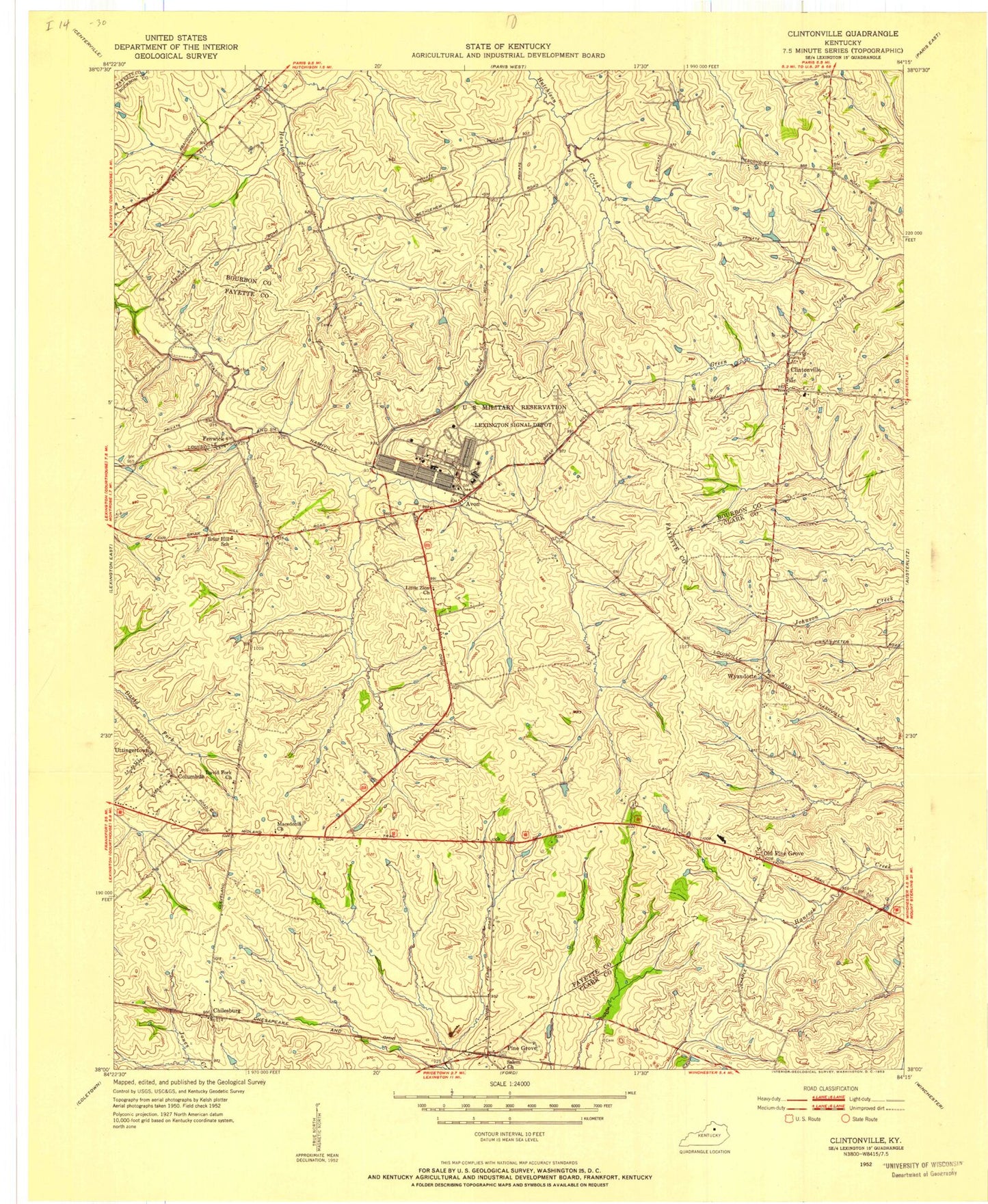
Classic USGS Clintonville Kentucky 7.5'x7.5' Topo Map
Couldn't load pickup availability
Historical USGS topographic quad map of Clintonville in the state of Kentucky. Map scale may vary for some years, but is generally around 1:24,000. Print size is approximately 24" x 27"
This quadrangle is in the following counties: Bourbon, Clark, Fayette.
The map contains contour lines, roads, rivers, towns, and lakes. Printed on high-quality waterproof paper with UV fade-resistant inks, and shipped rolled.
Contains the following named places: Air Castle Airport, Ava Lawn, Avon, Briar Hill School, Chilesburg, Clark County Hemp Historical Marker, Clintonville, Clintonville Volunteer Fire Department, Coal Field, Columbus, Combs Ferry Station, Creech Army Air Field Heliport, David Fork Church, Duvalls Bluff, Ebenezer Methodist Church, Fenwick, Hutchenson Station Volunteer Fire Department, Jasper Post Office, Lexington Fire Department Station 17, Lexington Fire Department Station 23, Lexington-Fayette Northeast Division, Little Zion Church, Locust Lawn, Macedonia Church, Old Pine Grove, Pine Grove, Pine Grove Post Office, Pine Grove Railroad Station, Salem Church, Uttingertown, Van Meter Station, Verna Hills, Wayland Heights Addition, Wild Blue Airport, WLFX-FM (Winchester), Wyandotte, Wyandotte Railroad Station, Yorktown, ZIP Code: 40516