MyTopo
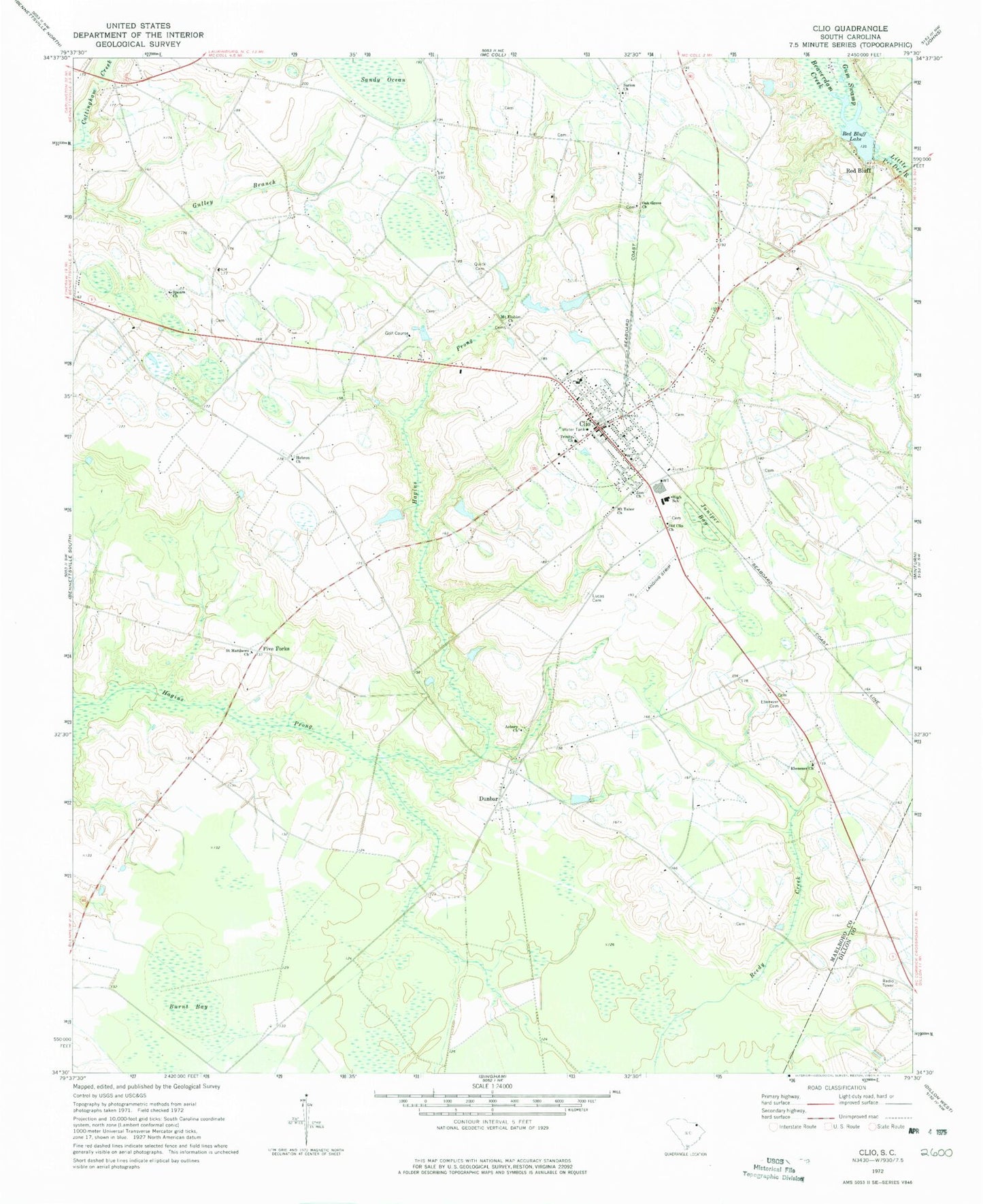
Classic USGS Clio South Carolina 7.5'x7.5' Topo Map
Couldn't load pickup availability
Historical USGS topographic quad map of Clio in the state of South Carolina. Map scale may vary for some years, but is generally around 1:24,000. Print size is approximately 24" x 27"
This quadrangle is in the following counties: Dillon, Marlboro.
The map contains contour lines, roads, rivers, towns, and lakes. Printed on high-quality waterproof paper with UV fade-resistant inks, and shipped rolled.
Contains the following named places: Asbury Church, Beaverdam Creek, Bel Acres Pond Dam D-3451, Bennett Pond, Beulah Church, Burnt Bay, Clio, Clio City Hall, Clio Crop Care Airport, Clio Division, Clio Elementary School, Clio Historic District, Clio Middle School, Clio Police Department, Clio Post Office, Clio Rescue Squad, Clio Rural Fire Department Clio, Clio Rural Fire Department Eastside, Cross Roads School, Dunbar, Dunbar Presbyterian Church, Dunbar School, Ebenezer Church, Ebenezer Memorial Garden, First Baptist Church, First Presbyterian Church, Five Forks, Gulley Branch, Gum Swamp Creek, Hagins Prong, Harmony School, Hebron, Hebron Academy, Hebron Cemetery, Hebron Church, Hebron School, Holiness Church, Juniper Bay, Lincoln School, Lucas Cemetery, Mack Lamar Airport, McDonalds, McInnis, McInnis Pond Dam D-3434, McLaurin Bay, Mount Elohim Church, Mount Tabor Church, Oak Grove Church, Oak Grove School, Old Clio Church, Quick Cemetery, Red Bluff, Red Bluff Lake, Saint Matthews Church, Sandy Ocean, Sarion Church, Smith Pond, South Carolina Noname 35016 D-3455 Dam, South Carolina Noname 35029 D-3456 Dam, South Carolina Noname 35040 D-2944 Dam, Spears Church, Town of Clio, Trinity Church, Wesley Church, Wesley School, Willis School, Zion Church, ZIP Code: 29525