
MyTopo
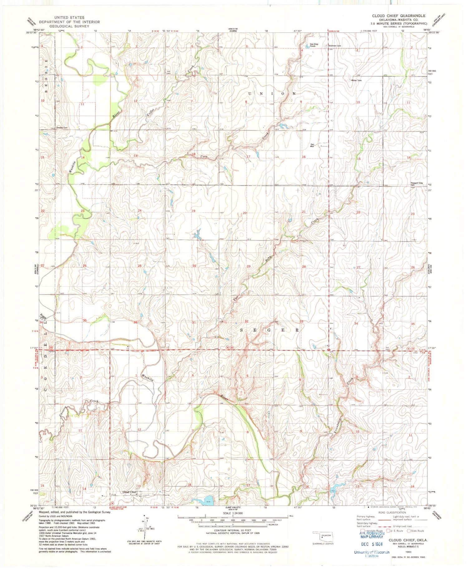
Classic USGS Cloud Chief Oklahoma 7.5'x7.5' Topo Map
Regular price
$16.95
Regular price
Sale price
$16.95
Unit price
per
Couldn't load pickup availability
Historical USGS topographic quad map of Cloud Chief in the state of Oklahoma. Map scale may vary for some years, but is generally around 1:24,000. Print size is approximately 24" x 27"
This quadrangle is in the following counties: Washita.
The map contains contour lines, roads, rivers, towns, and lakes. Printed on high-quality waterproof paper with UV fade-resistant inks, and shipped rolled.
Contains the following named places: Boggy Creek, Brethren Cemetery, Cavalry Creek, Cloud Chief, Coffee Creek, Corn Creek, Friendship Creek, Oak Creek Site 10 Dam, Oak Creek Site 10 Reservoir, Oknoname 149040 Dam, Oknoname 149040 Reservoir, Pleasant View Cemetery, Shelley Cemetery, Two Baby Creek, ZIP Code: 73024


