
MyTopo
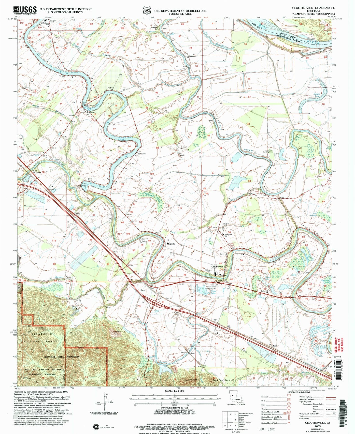
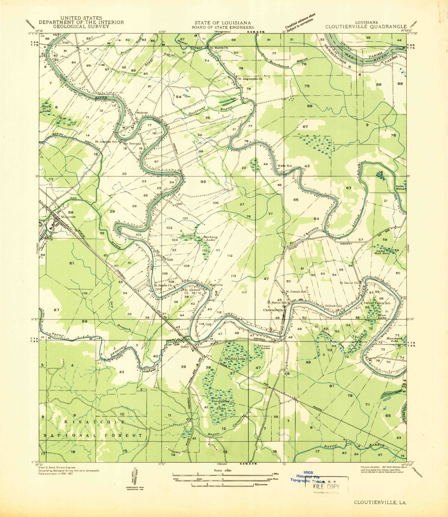
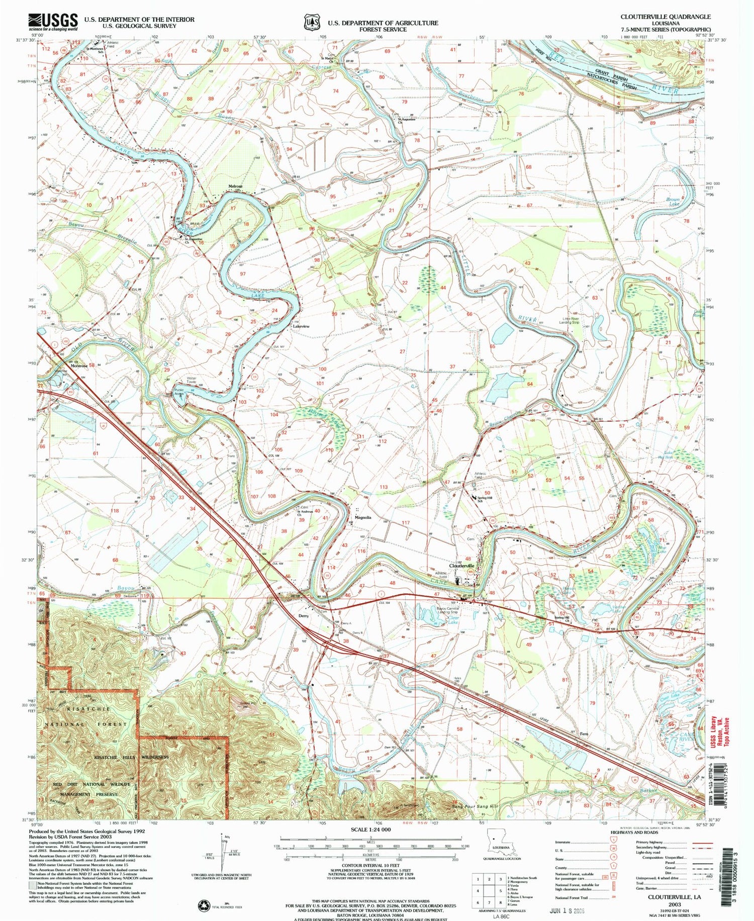
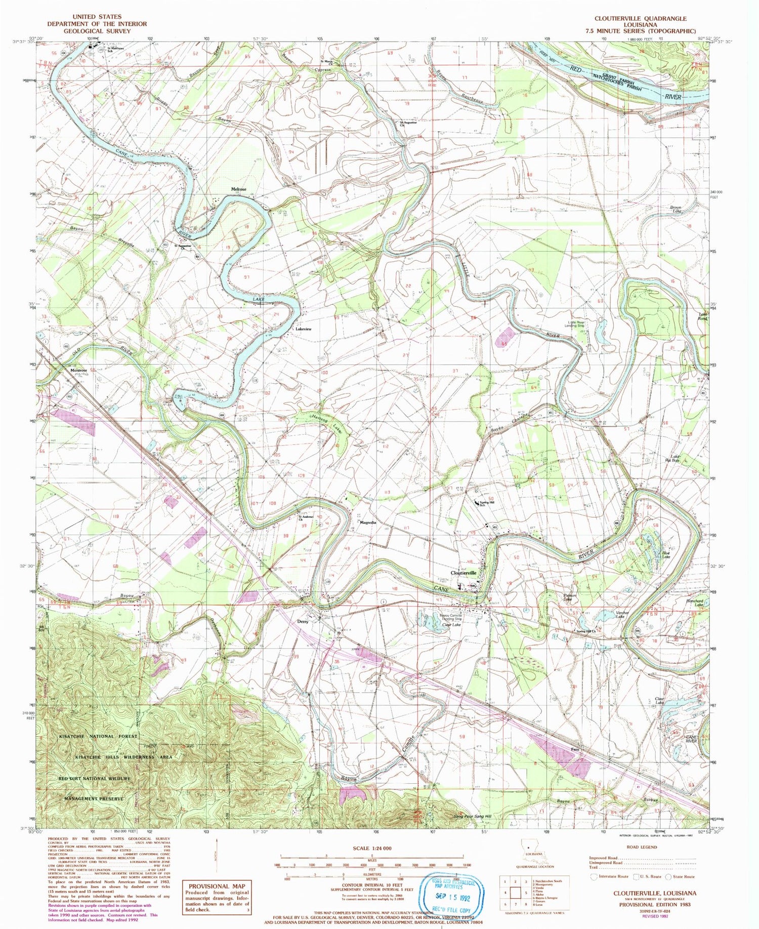
Classic USGS Cloutierville Louisiana 7.5'x7.5' Topo Map
Couldn't load pickup availability
Historical USGS topographic quad map of Cloutierville in the state of Louisiana. Map scale may vary for some years, but is generally around 1:24,000. Print size is approximately 24" x 27"
This quadrangle is in the following counties: Grant, Natchitoches.
The map contains contour lines, roads, rivers, towns, and lakes. Printed on high-quality waterproof paper with UV fade-resistant inks, and shipped rolled.
Contains the following named places: Bayou Bourbeaux, Bayou Brevelle, Bayou Camitte, Bayou Camitte Landing Strip, Bayou Charette, Blue Lake, Boggy Bayou, Brown Lake, Cane River Lake Dam, Clear Lake, Cloutier Plantation, Cloutierville, Cloutierville Elementary and Junior High School, Cloutierville Post Office, Cordosche Island, Derry, Derry Plantation, Derry Post Office, Fern, Fordoche Lake, Frost Jackson Swamp, Hales Spur, Henryville, Hertzog Lake, Hertzog Swamp, Jack Lake, James Ferry, Lake Rat Bois, Lakeview, Little River Canal, Little River Landing Strip, Magnolia, Magnolia Plantation, Melrose, Melrose Ferry, Melrose Plantation, Melrose Post Office, Montrose, Natchitoches Fire Protection District 1, Old River, Palion Talion School, Parish Governing Authority District 11, Pauls Lake, Pierson Lake, Pollockville, Red River National Wildlife Refuge, Saint Andrews Church, Saint Augustine Church, Saint Augustines School, Saint Davids Church, Saint James Church, Saint Josephs School, Saint Marks School, Saint Marys Church, Saint MArys Church, Saint Marys School, Sang Pour Sang Hill, Shallow Lake, Spillway Bayou, Spring Hill Church, Spring Hill School, Vercher Lake, ZIP Codes: 71416, 71452