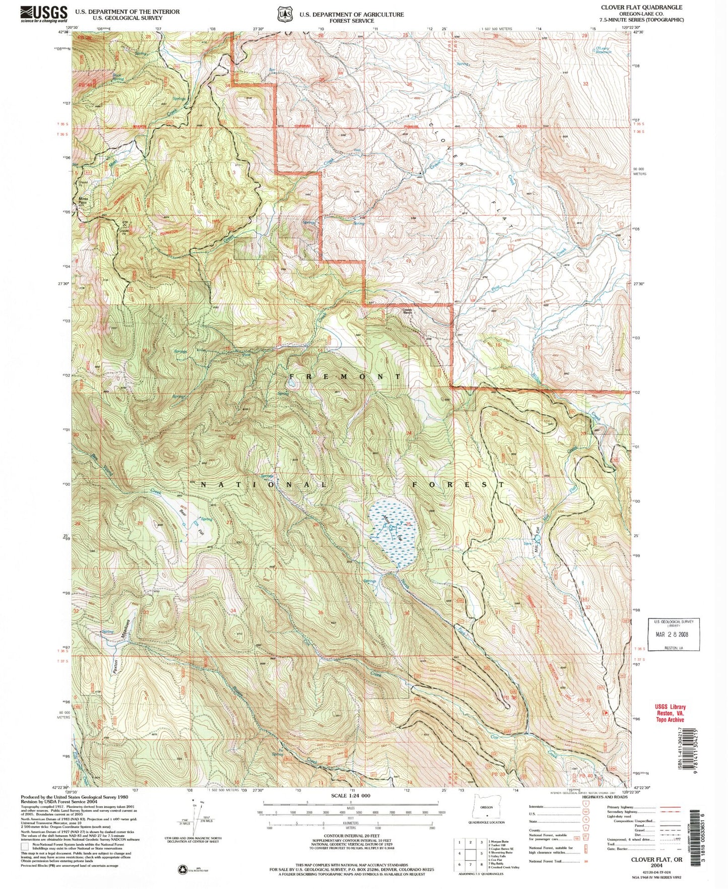
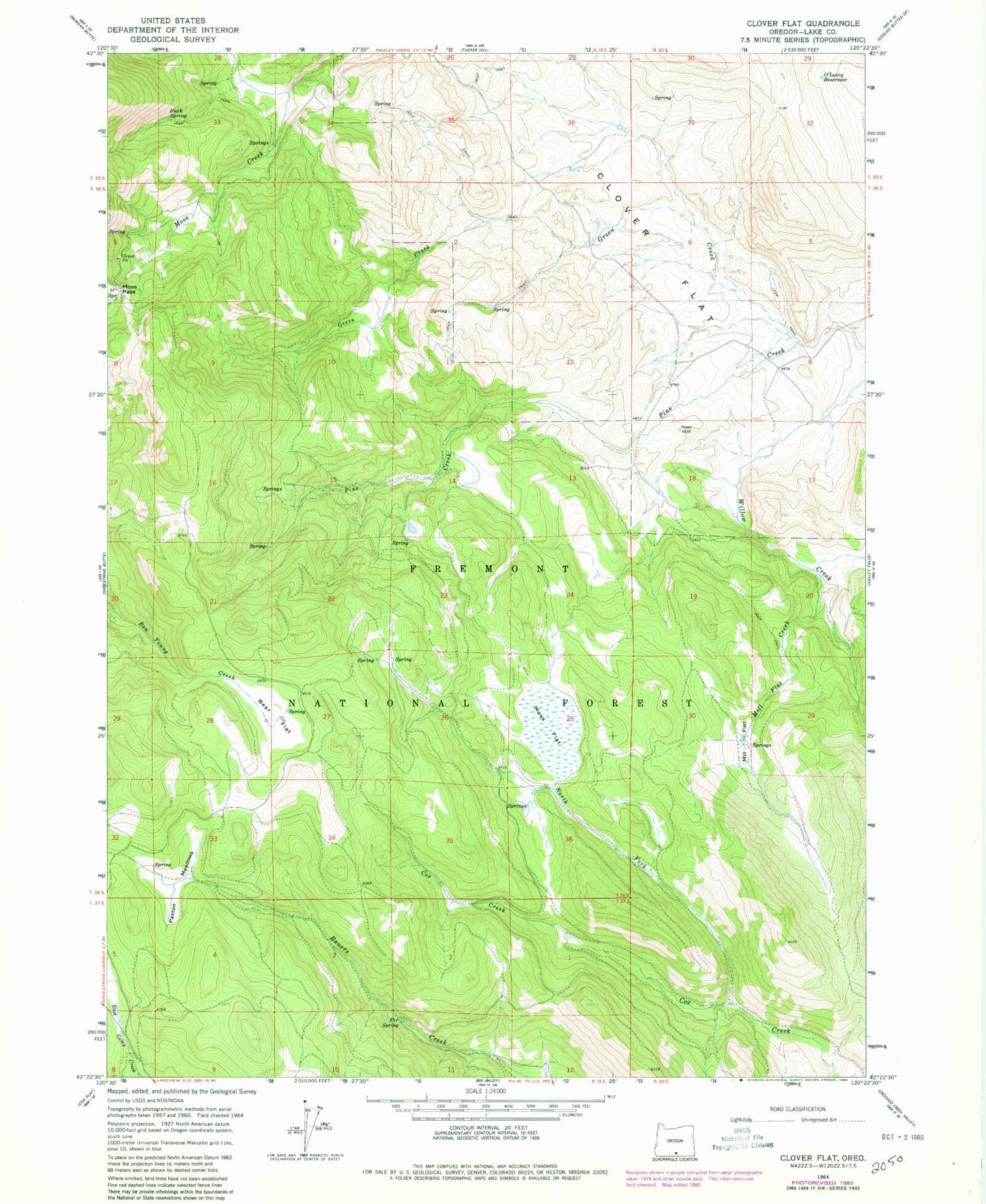
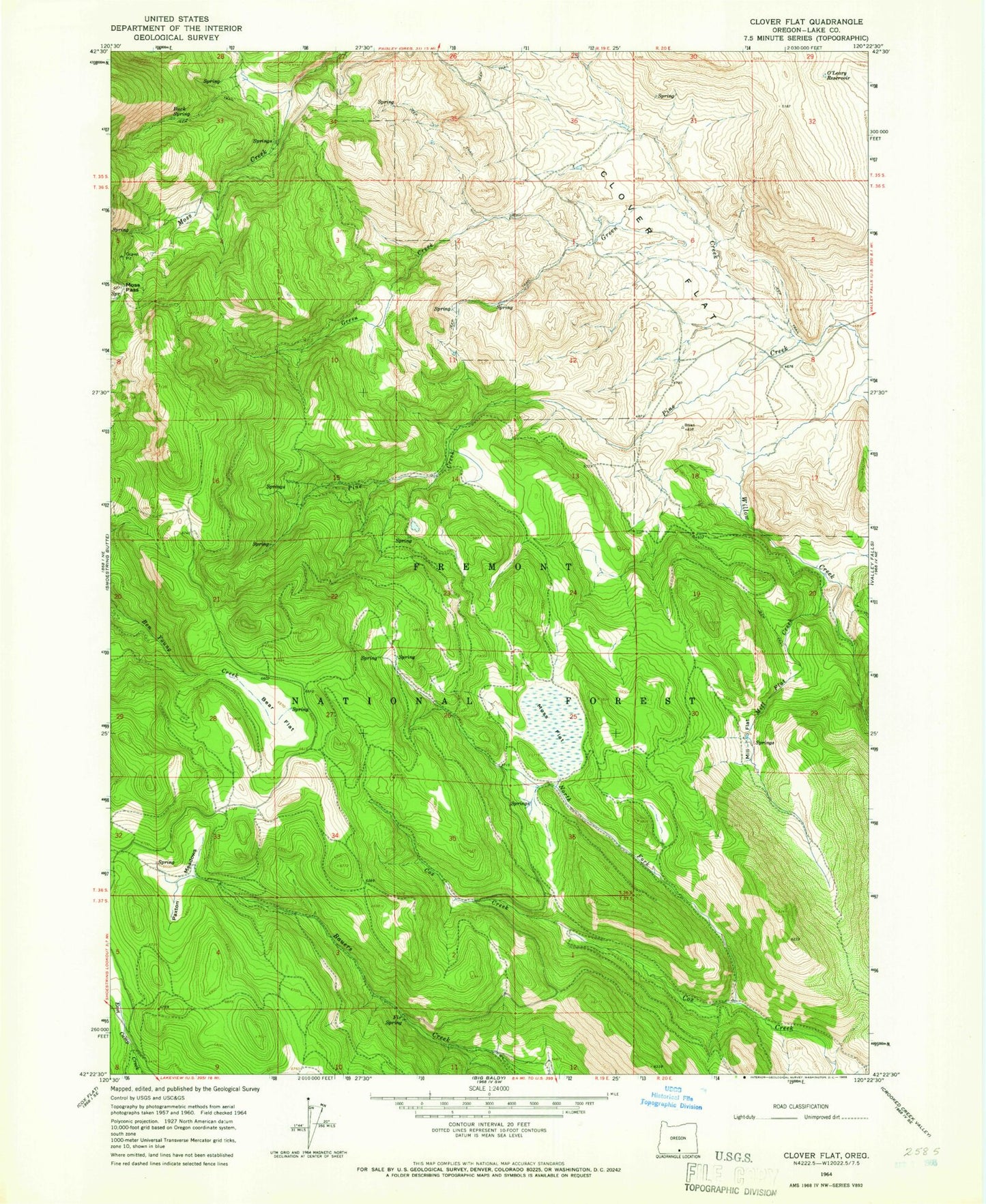
MyTopo
Classic USGS Clover Flat Oregon 7.5'x7.5' Topo Map
Regular price
$16.95
Regular price
Sale price
$16.95
Unit price
per
Couldn't load pickup availability
Historical USGS topographic quad map of Clover Flat in the state of Oregon. Map scale may vary for some years, but is generally around 1:24,000. Print size is approximately 24" x 27"
This quadrangle is in the following counties: Lake.
The map contains contour lines, roads, rivers, towns, and lakes. Printed on high-quality waterproof paper with UV fade-resistant inks, and shipped rolled.
Contains the following named places: Bear Flat, Buck Spring, Clover Flat, Clover Flat Post Office, Counts Ranch, Cox Pass Trailhead, Fir Spring, Green Creek, Mill Flat, Mill Flat Creek, Moss Flat, Moss Flat Spring, Moss Pass, North Fork Cox Creek, O'Leary Reservoir, Paxton Meadows, Red Knoll Reservoir, Whitaker