MyTopo
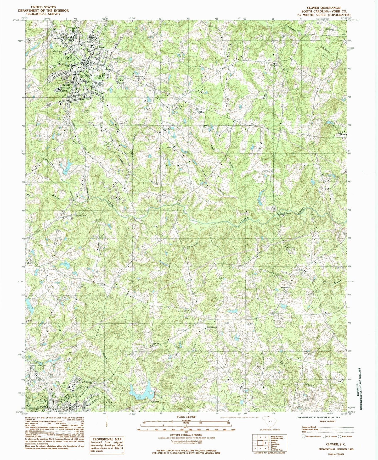
Classic USGS Clover South Carolina 7.5'x7.5' Topo Map
Couldn't load pickup availability
Historical USGS topographic quad map of Clover in the state of South Carolina. Map scale may vary for some years, but is generally around 1:24,000. Print size is approximately 24" x 27"
This quadrangle is in the following counties: York.
The map contains contour lines, roads, rivers, towns, and lakes. Printed on high-quality waterproof paper with UV fade-resistant inks, and shipped rolled.
Contains the following named places: Abiding Presence Lutheran Church, Allison Creek Church, Belton Pond Dam D-3660, Beth Shiloh Presbyterian Church, Bethel, Bethel Fire Department Station 3, Bethel Presbyterian Church, Bethel School, Bethel-Lake Wylie Airport, Beth-Shiloh School, Bright Light Freewill Baptist Church, Calabash Branch, Camp Run, Church of God, Church of the Nazarene, Clover, Clover Chapel Cemetery, Clover Division, Clover Fire Department, Clover High School, Clover Junior High School, Clover Middle School, Clover Plaza Shopping Center, Clover Police Department, Clover Post Office, Clover Public Library, Clover Rescue Squad, Divine Savior Catholic Church, English Gardens, Episcopal Childrens Home, Fairview Church, Fairview School, Fishing Creek Cemetery, Fishing Creek Watershed Dam Number One, Gold Hill Baptist Church, Gold Hill School, Green Pond Church, Grist Branch, Jerusalem Church, John B Harvey Bridge, Johnson Branch, Kinard Elementary School, Lincoln Estates, Morris Branch, Mount Harmony Church, New Home Church, New Home School, Pine Bluff School, Poplar Acres, Rock Branch, Saint Paul Baptist Church, South Carolina Noname 46005 D-3678 Dam, South Carolina Noname 46008 D-3659 Dam, South Carolina Noname 46023 D-3658 Dam, Town of Clover, Union Baptist Church, Walker Branch, York Division, Zion Church, ZIP Code: 29710


