MyTopo
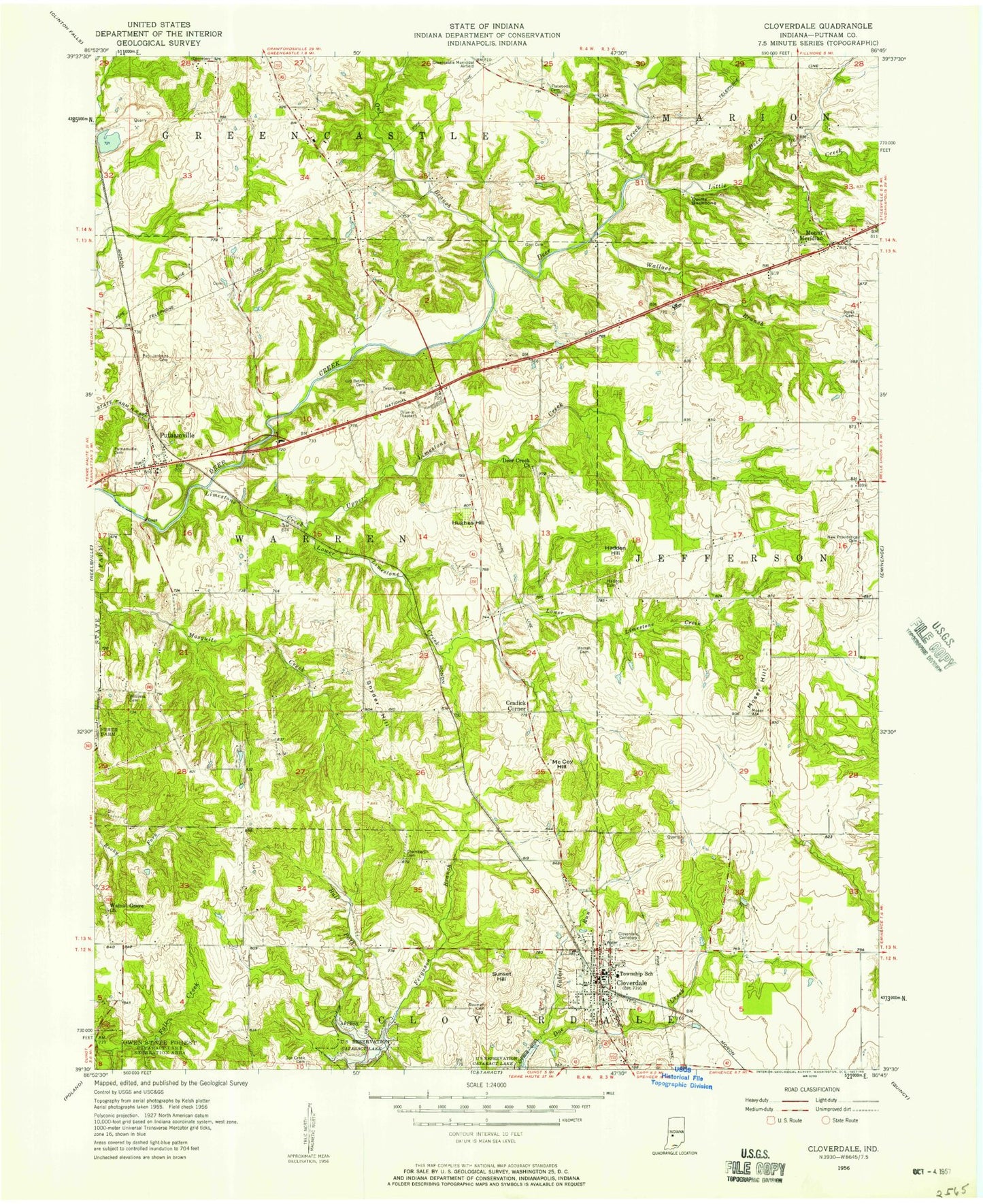
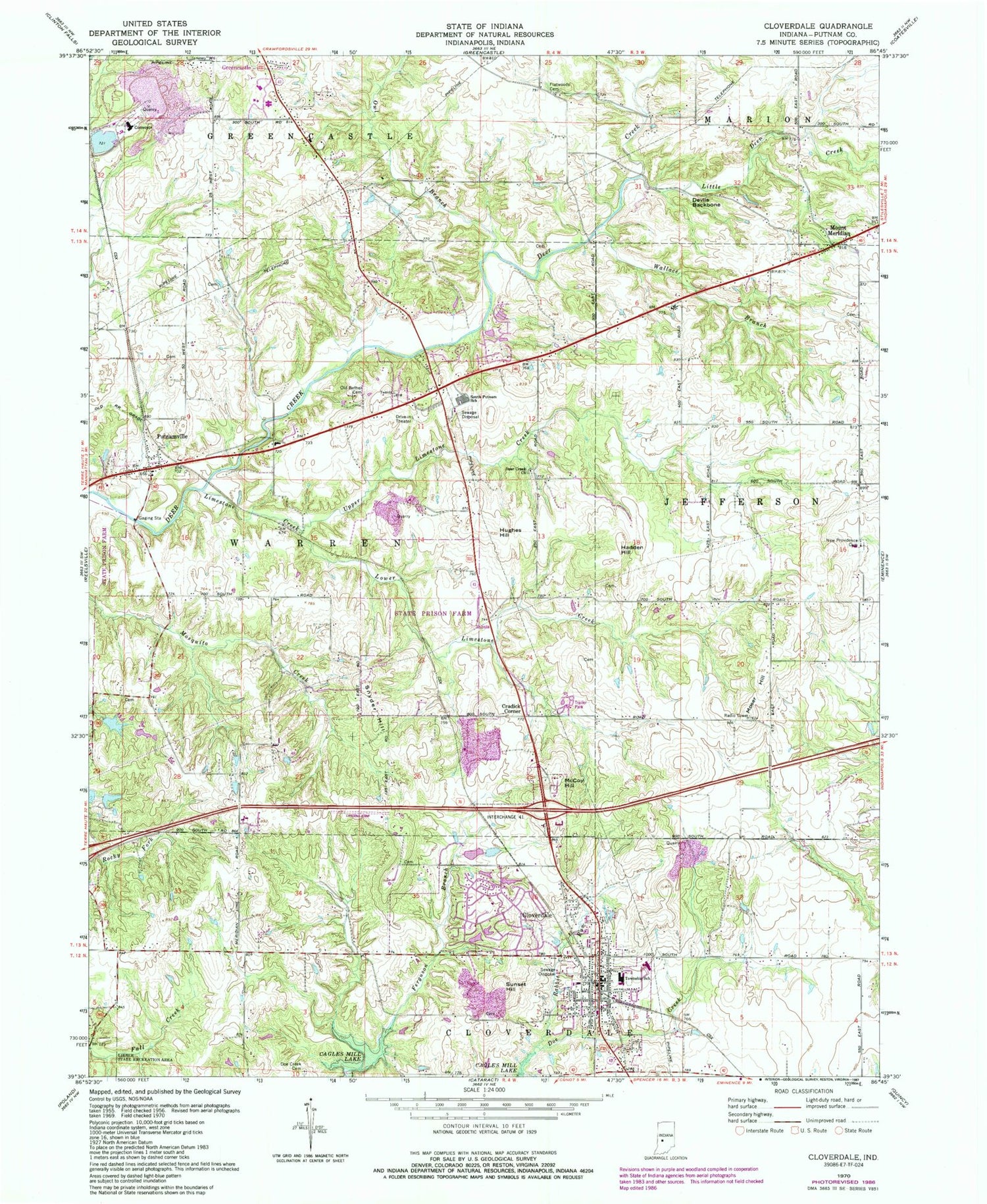
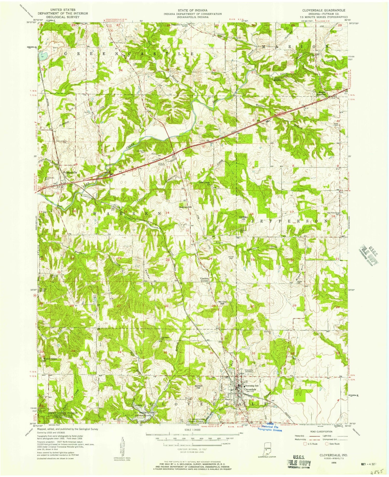
Classic USGS Cloverdale Indiana 7.5'x7.5' Topo Map
Couldn't load pickup availability
Historical USGS topographic quad map of Cloverdale in the state of Indiana. Map scale may vary for some years, but is generally around 1:24,000. Print size is approximately 24" x 27"
This quadrangle is in the following counties: Putnam.
The map contains contour lines, roads, rivers, towns, and lakes. Printed on high-quality waterproof paper with UV fade-resistant inks, and shipped rolled.
Contains the following named places: Clover Knoll Airport, Cloverdale, Cloverdale Elementary School, Cloverdale Junior/Senior High School, Cloverdale Police Department, Cloverdale Post Office, Cloverdale Quarry, Cloverdale Township Volunteer Fire Department, Cradick Corner, Deer Creek Church, Devils Backbone, Doe Creek Cemetery, Dogwood Springs Lake, Dogwood Springs Lake Dam, Flatwoods Cemetery, Greyhound Lake, Greyhound Lake Dam, Hadden Hill, Hughes Hill, Limedale Quarry, Limestone Creek, Little Deer Creek, Lower Limestone Creek, McCoy Hill, Moser Hill, Mount Meridian, New Providence Cemetery, Old Bethel Cemetery, Owens Field, Owl Branch, Putnam County Hospital, Putnam County Operation Life - Cloverdale Substation, Putnam County Stone Pit, Putnamville, Rabbit Run, Sanders Gyroport, Snyder Hill, South Putnam High School, Sunset Hill, Town of Cloverdale, Township of Cloverdale, Township of Warren, Upper Limestone Creek, Wallace Branch, Westland, ZIP Code: 46120