MyTopo
Classic USGS Cloverdale Iowa 7.5'x7.5' Topo Map
Couldn't load pickup availability
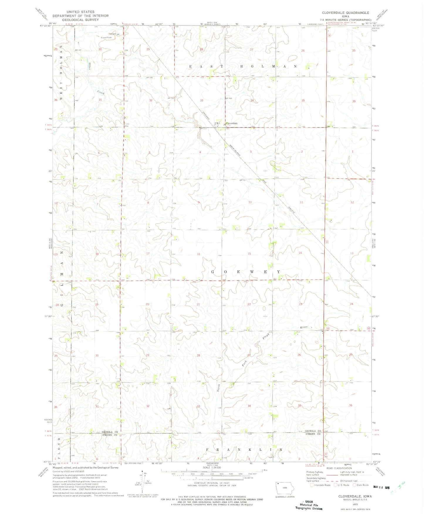
Historical USGS topographic quad map of Cloverdale in the state of Iowa. Map scale may vary for some years, but is generally around 1:24,000. Print size is approximately 24" x 27"
This quadrangle is in the following counties: O'Brien, Osceola.
The map contains contour lines, roads, rivers, towns, and lakes. Printed on high-quality waterproof paper with UV fade-resistant inks, and shipped rolled.
Contains the following named places: Budden Farms, C and J Farms, Cloverdale, Cloverdale Post Office, D and J Farms, Dagel Unit - Otter Creek Wildlife Management Area, Doorenbos Farm, Goewey Prairie Cemetery, Goewey Prairie Preserve, Gopher, Gopher Post Office, Helmers Farms, High Plains Dairy, L R Holstein Farm, Leinen Pits Access, Morfitt Farms, Nustar Farms, Ommen Farms, Redwood Farms, Roelf-Johnson Wildlife Management Area, Sibley Unit - Otter Creek Wildlife Management Area, Sterler Seed Farm, Township of Goewey, Vanderpol Farms, Verdoorn Farm