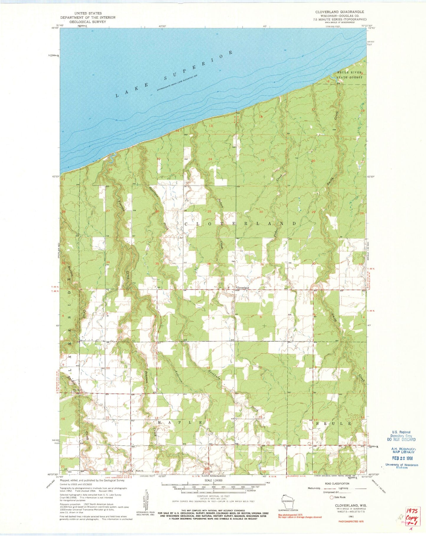
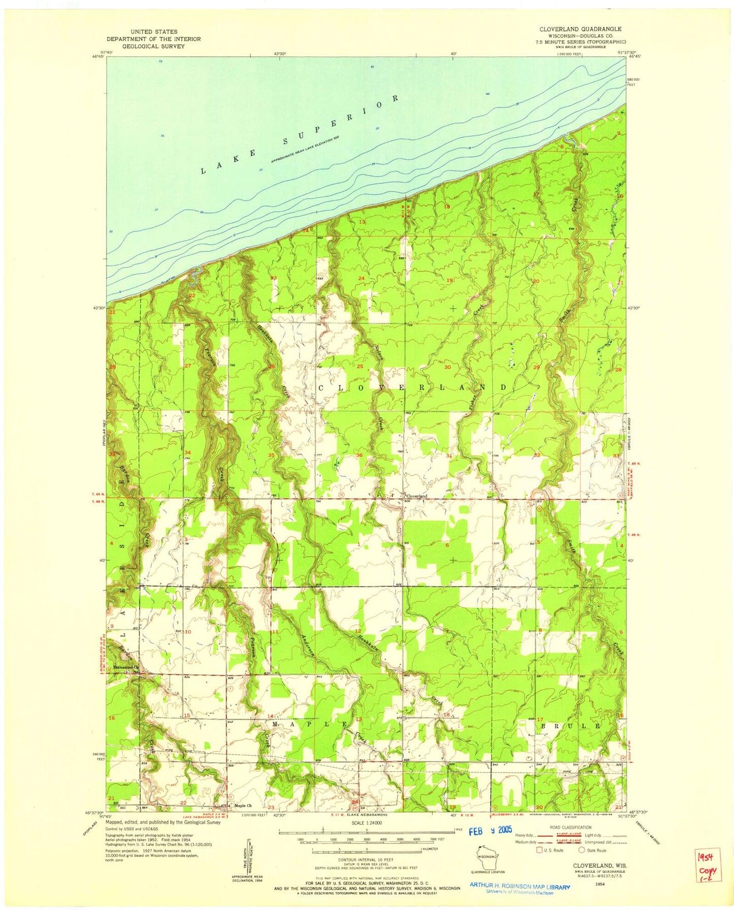
MyTopo
Classic USGS Cloverland Wisconsin 7.5'x7.5' Topo Map
Regular price
$16.95
Regular price
Sale price
$16.95
Unit price
per
Couldn't load pickup availability
Historical USGS topographic quad map of Cloverland in the state of Wisconsin. Map scale may vary for some years, but is generally around 1:24,000. Print size is approximately 24" x 27"
This quadrangle is in the following counties: Douglas.
The map contains contour lines, roads, rivers, towns, and lakes. Printed on high-quality waterproof paper with UV fade-resistant inks, and shipped rolled.
Contains the following named places: Anderson Creek, Bardon Creek, Bear Beach State Natural Area, Cloverland, Cloverland Volunteer Fire Department, Emmanuel Church, Fisher Creek, Haukkala Creek, Maple Church, Nelson Creek, Pearson Creek, Smith Creek, Town of Cloverland, ZIP Code: 54854