MyTopo
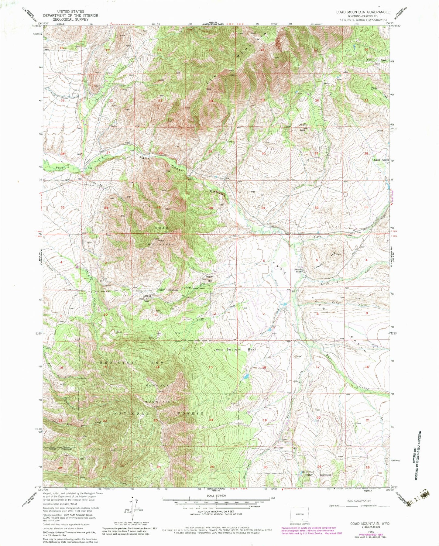
Classic USGS Coad Mountain Wyoming 7.5'x7.5' Topo Map
Couldn't load pickup availability
Historical USGS topographic quad map of Coad Mountain in the state of Wyoming. Map scale may vary for some years, but is generally around 1:24,000. Print size is approximately 24" x 27"
This quadrangle is in the following counties: Carbon.
The map contains contour lines, roads, rivers, towns, and lakes. Printed on high-quality waterproof paper with UV fade-resistant inks, and shipped rolled.
Contains the following named places: Beaver Pond, Brush Creek, Coad Mountain, Finn Creek, Fox Creek, Indian Hill, Ivans Grove, Jack Creek, Jack Hill, Johnson Ranch, Lee Creek, Little Brush Creek Ditch, Little Pass Creek, Loco Bottom Basin, Lone Tree Creek, Middle Creek, North Rankin Creek, Oberg Pass, Pass Creek Canyon, Paulson Hill, Pennock Mountain, Rankin Creek, Rosebud Pit Number Two, South Creek, Thode Creek