MyTopo
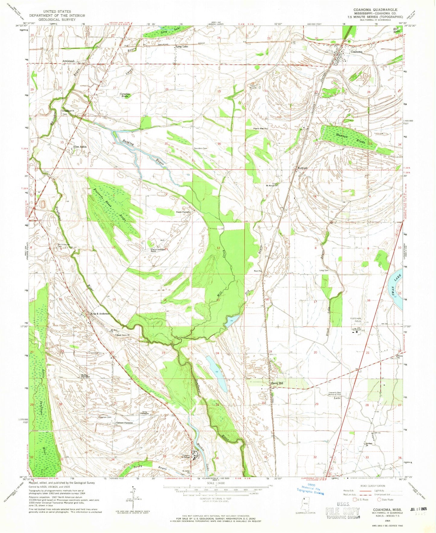
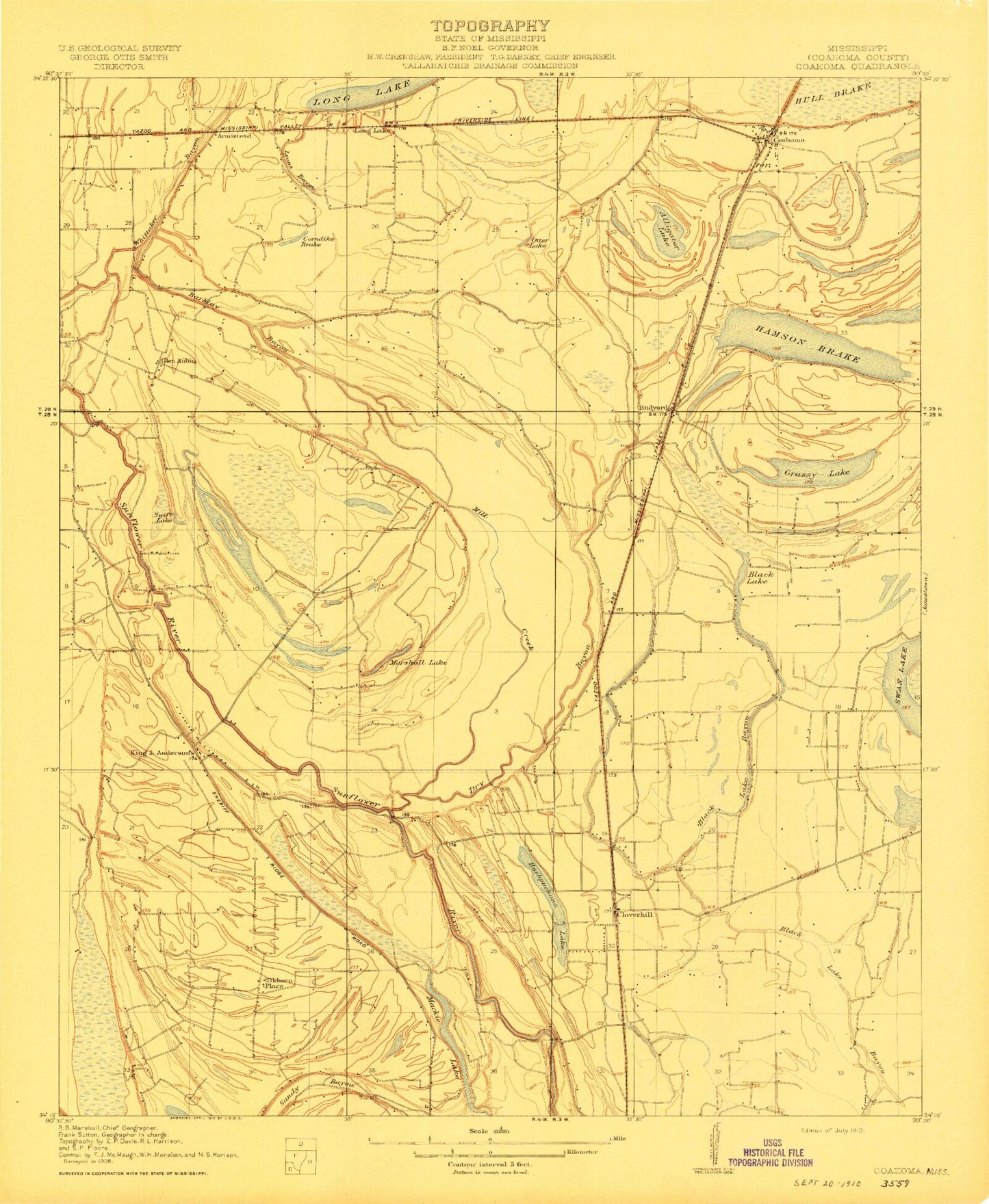
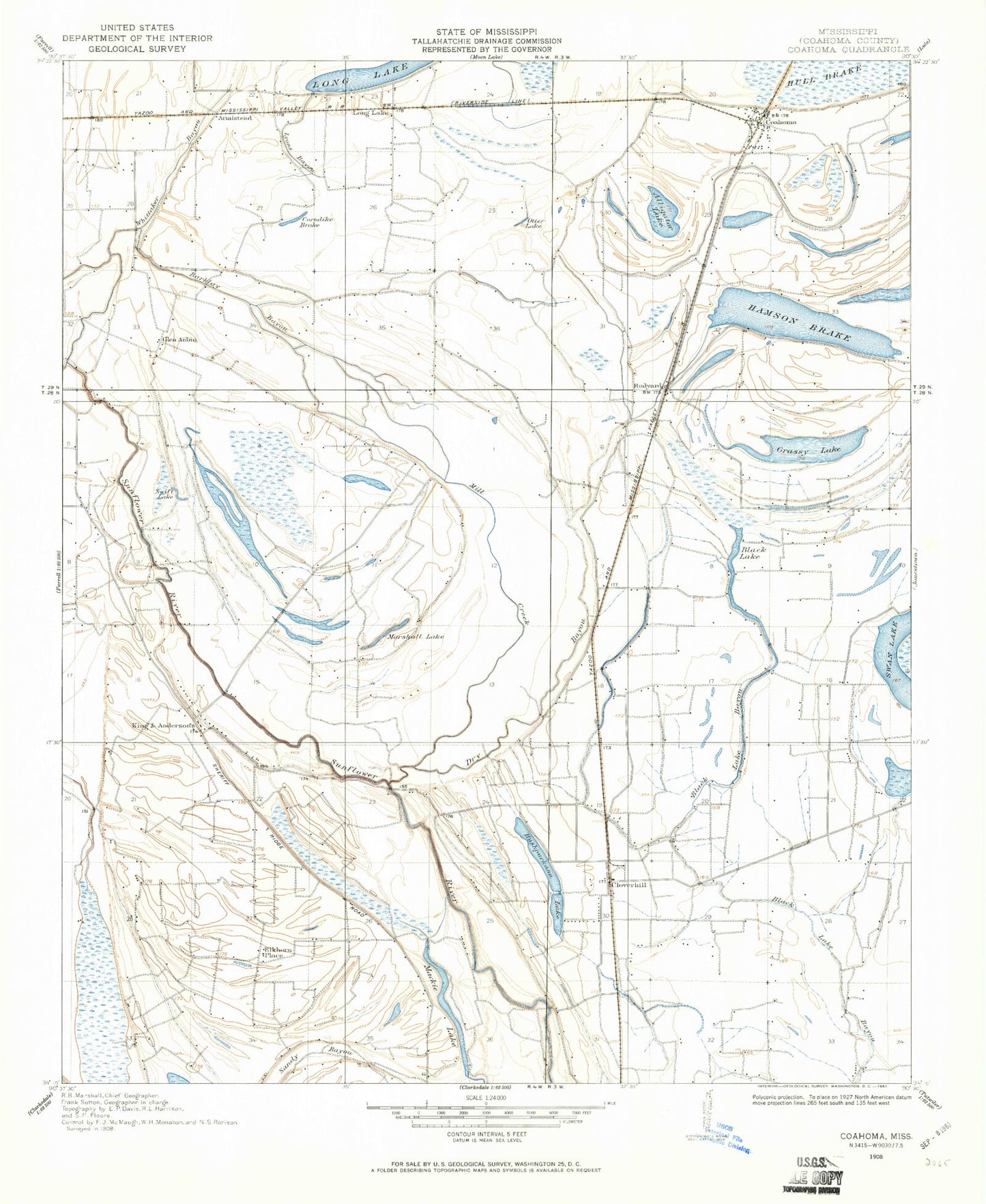
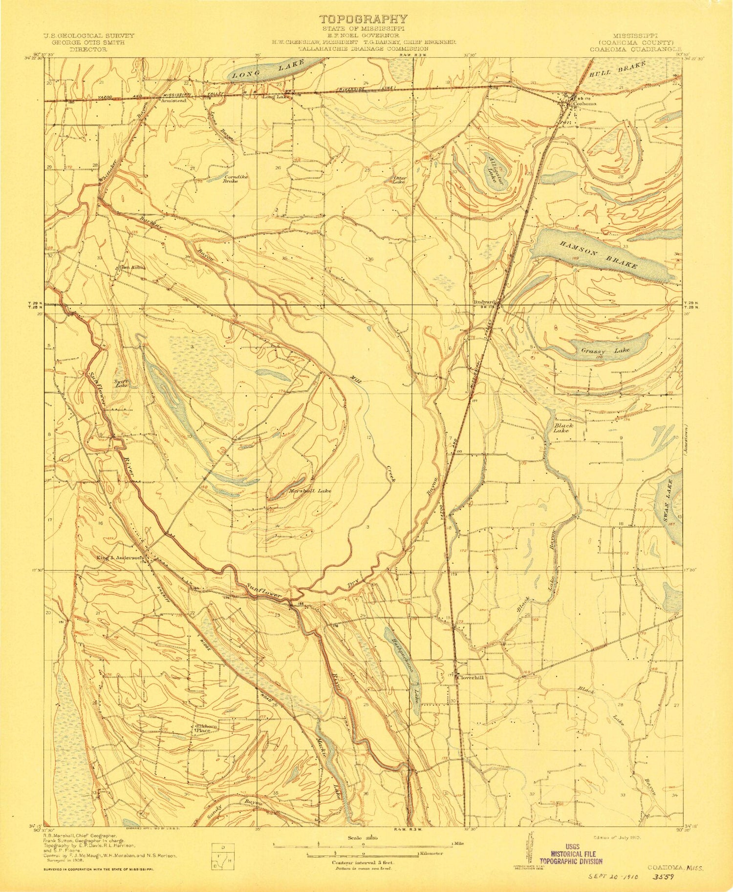
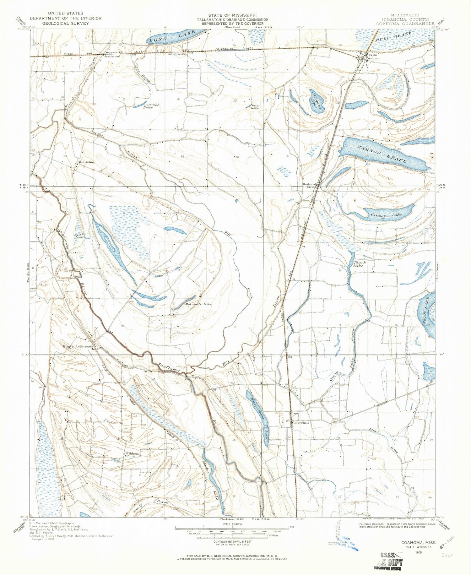
Classic USGS Coahoma Mississippi 7.5'x7.5' Topo Map
Couldn't load pickup availability
Historical USGS topographic quad map of Coahoma in the state of Mississippi. Map scale may vary for some years, but is generally around 1:24,000. Print size is approximately 24" x 27"
This quadrangle is in the following counties: Coahoma.
The map contains contour lines, roads, rivers, towns, and lakes. Printed on high-quality waterproof paper with UV fade-resistant inks, and shipped rolled.
Contains the following named places: Armistead, Armistead Cemetery, Armistead Church, Barkley Bayou, Black Lake Bayou, Buzzards Roost Brake, Clover Hill, Coahoma, Coahoma Community College Fire Department, Coahoma County Agricultural High School, Coahoma Junior College, Coahoma Post Office, Corndike Brake, Dickerson Cemetery, Dry Bayou, Fant Church, Fant School, Fleets Church, Fletcher Field, Glen Aubin, Grassy Lake, Hamson Brake, Heavenly Rest Memorial Park, Hull Plantation, Irvin Plantation, J T Farguson Pond Dam, King and Anderson, King and Anderson Lake Dam, King and Anderson Ranch, Kings Chapel, Kings School, Long Cemetery, Long Lake, Lyons Bayou, Mackie Lake, Maddox Plantation, Mill Creek, Mount Mariah Cemetery, Mount Moriah Church, Mount Zion Church, Oakhurst Plantation, Old Dickerson Cemetery, Pilgrim Rest Church, Prairie Plantation, Reese Church, Rudyard, Saint Clair Church, Saint Johns Church, Saint Johns School, Saunders Cemetery, Saunders Chapel, Shady Grove Church, Sheriff Ridge School, Swan Lake School, Town of Coahoma, Whittaker Bayou, ZIP Codes: 38617, 38631