MyTopo
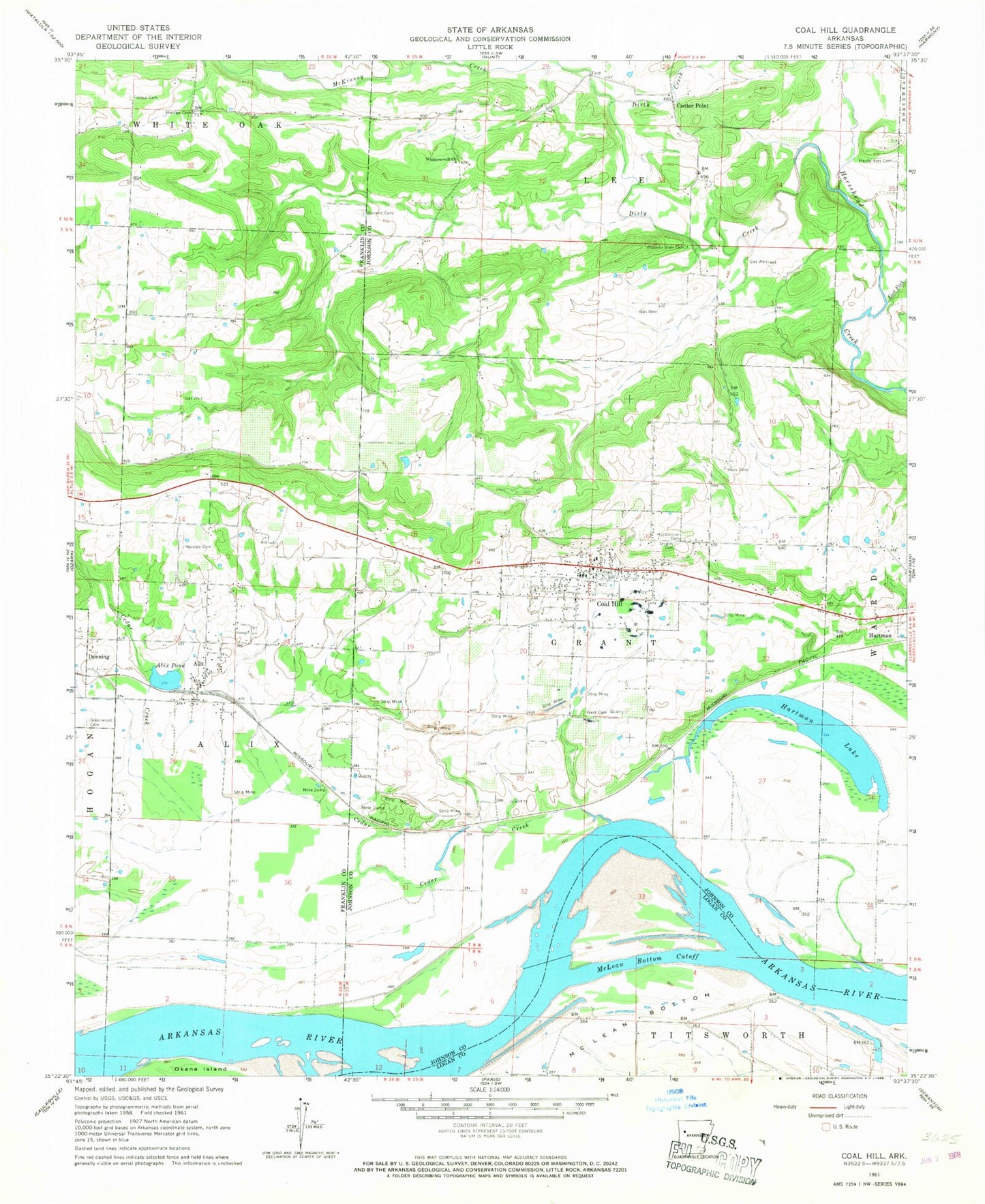
Classic USGS Coal Hill Arkansas 7.5'x7.5' Topo Map
Couldn't load pickup availability
Historical USGS topographic quad map of Coal Hill in the state of Arkansas. Map scale may vary for some years, but is generally around 1:24,000. Print size is approximately 24" x 27"
This quadrangle is in the following counties: Franklin, Johnson, Logan.
The map contains contour lines, roads, rivers, towns, and lakes. Printed on high-quality waterproof paper with UV fade-resistant inks, and shipped rolled.
Contains the following named places: Alix, Alix Census Designated Place, Alix Gas Field, Alix Pond, Alix Post Office, Altus Gas Field, Assembly of God Church, Burnett Cemetery, Cedar Creek, Center Point, Center Point Missionary Baptist Church, Church of Christ, City of Coal Hill, Coal Hill, Coal Hill Cemetery, Coal Hill City Park, Coal Hill Gas Field, Coal Hill Police Department, Coal Hill Post Office, Coal Hill Volunteer Fire Department, Dirty Creek, East Fork Horsehead Creek, Ferguson Memorial Presbyterian Church, First Baptist Church, Forbus Cemetery, Free Full Gospel Church, Greenwood Cemetery, Hardgraves Cemetery, Hartman Lake, Hess Cemetery, Houston Cemetery, Huddleston Cemetery, Hurst Memorial Park, McKinney Creek, McLean Bottom Cutoff, Methodist Church, Patsy Creek, Philips Cemetery, Possum Walk Cemetery, Srygley Cemetery, Swiss Family Vineyards Dam, Swiss Family Vineyards Reservoir, Township of Alix, Township of Grant, Township of Lee, United Methodist Church, West Cemetery, Westside High School, Whippoorwill Church, ZIP Codes: 72821, 72832