MyTopo
Classic USGS Coal Mine Hill Montana 7.5'x7.5' Topo Map
Couldn't load pickup availability
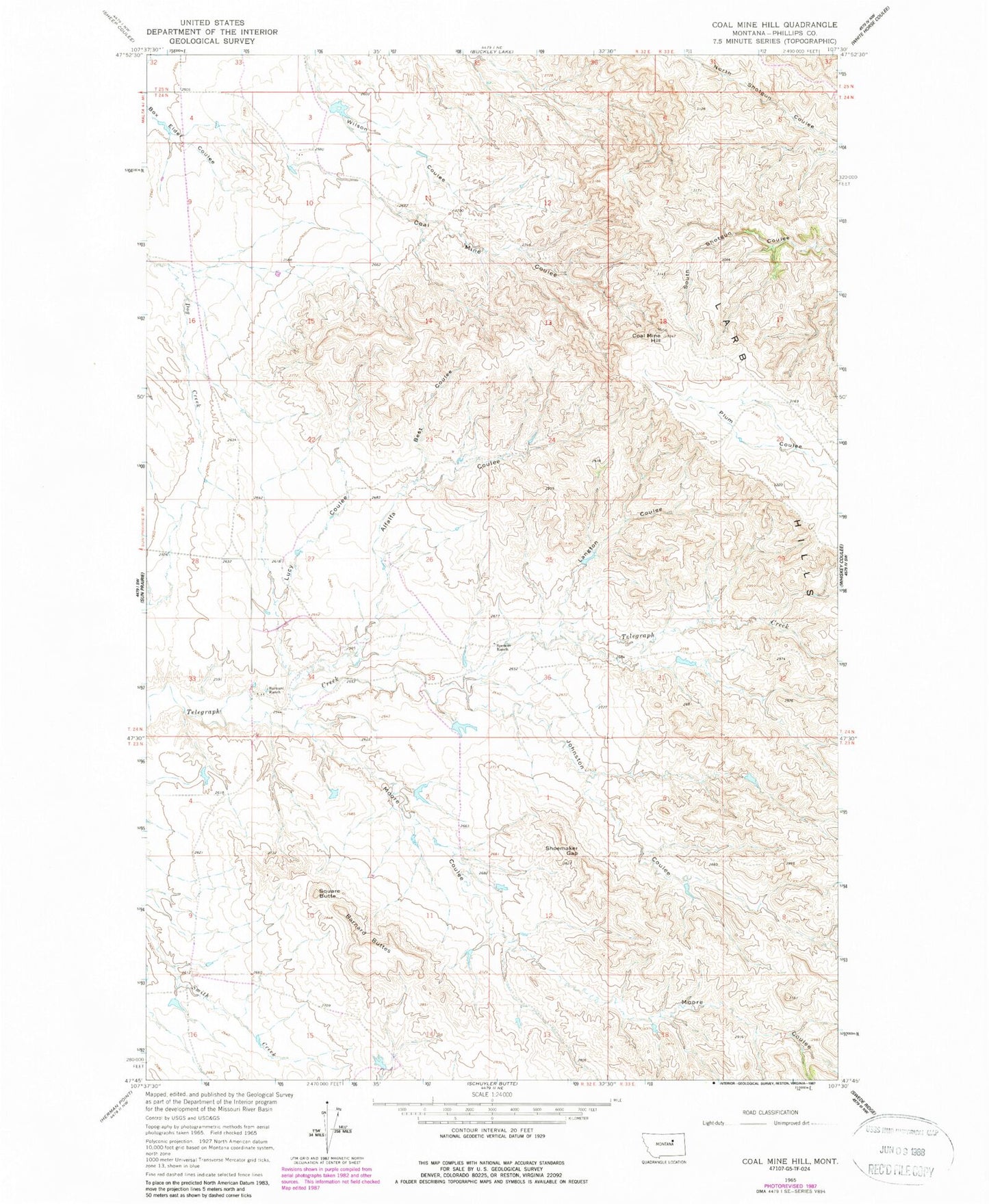
Historical USGS topographic quad map of Coal Mine Hill in the state of Montana. Map scale may vary for some years, but is generally around 1:24,000. Print size is approximately 24" x 27"
This quadrangle is in the following counties: Phillips.
The map contains contour lines, roads, rivers, towns, and lakes. Printed on high-quality waterproof paper with UV fade-resistant inks, and shipped rolled.
Contains the following named places: 01N33E16AAAD01 Well, 24N32E34DB__01 Well, Alfalfa Coulee, Barnard Buttes, Barnard Ranch, Best Coulee, Coal Mine Coulee, Coal Mine Hill, Johnston Coulee, Kelso Number 5 Dam, Langton Coulee, Larb Hill School, Larb Hills, Lucy Coulee, Moore Coulee, Shoemaker Gap, Spencer Ranch, Spencer School, Square Butte