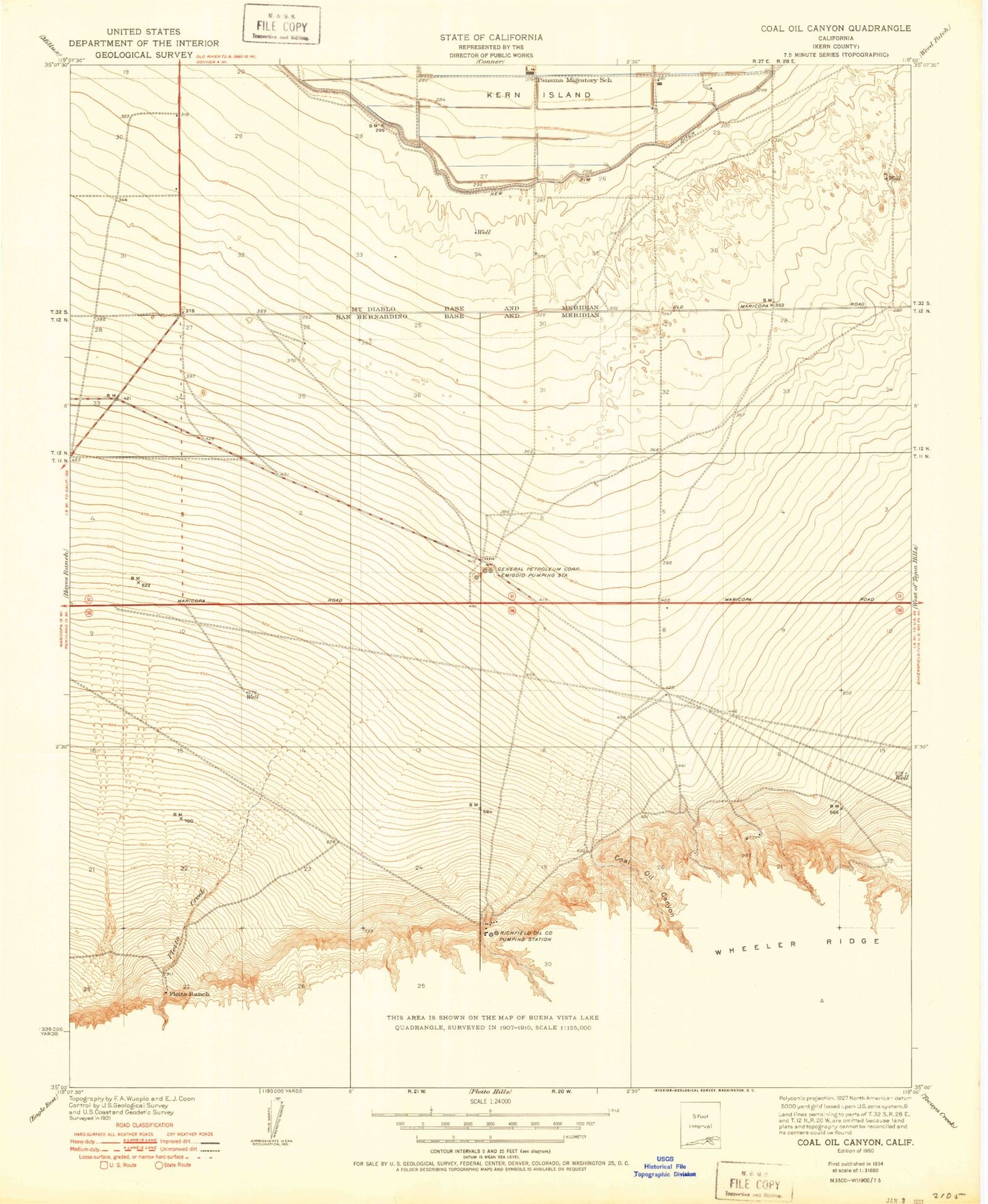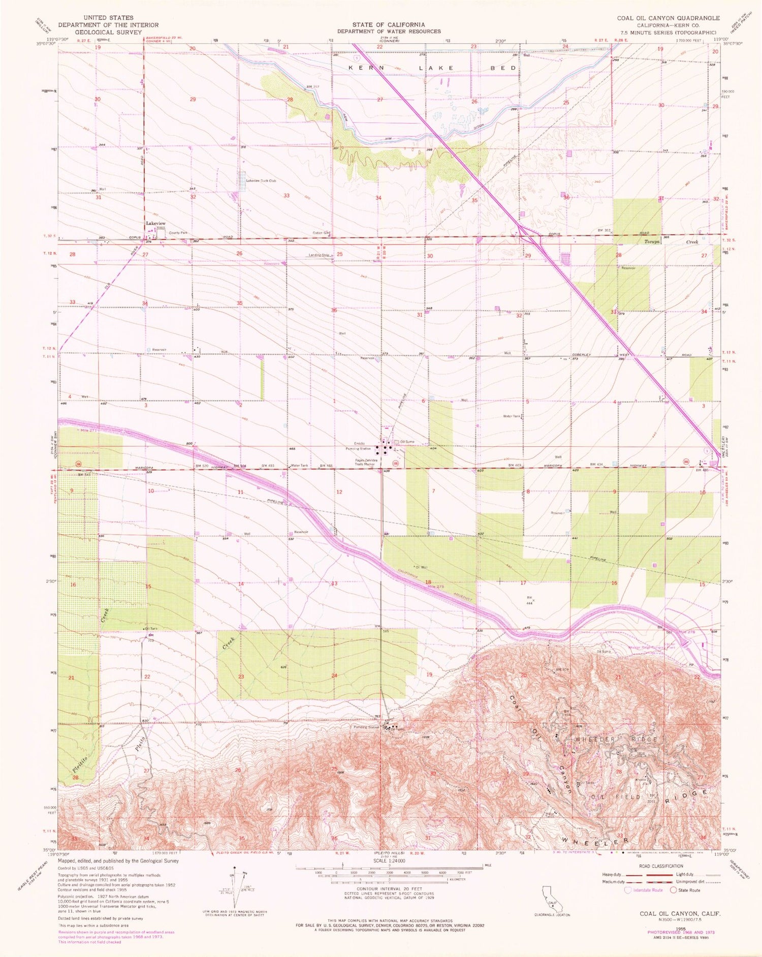
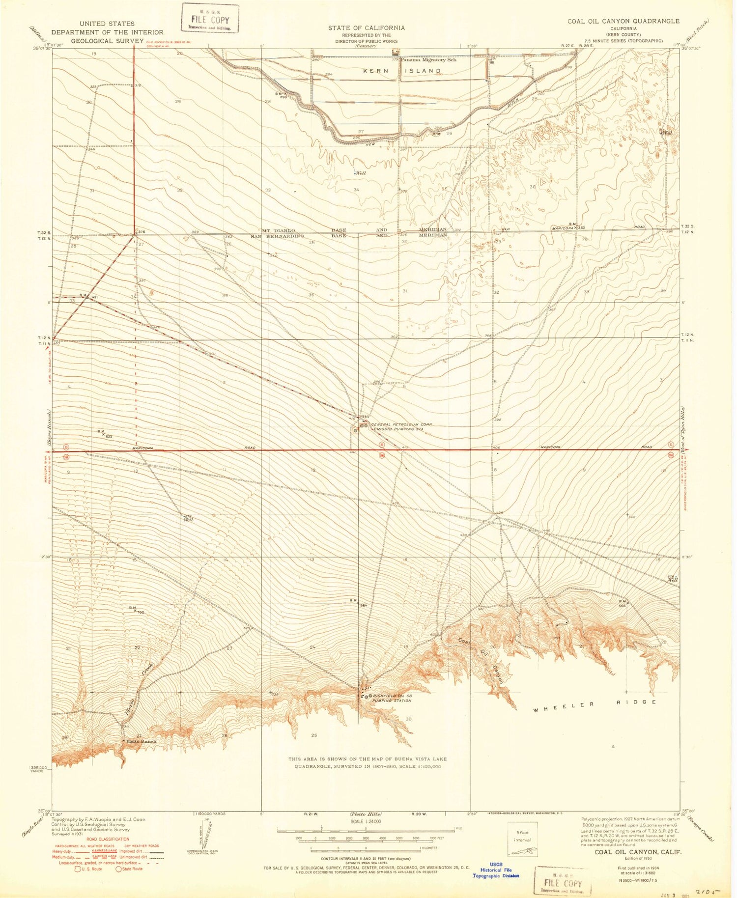
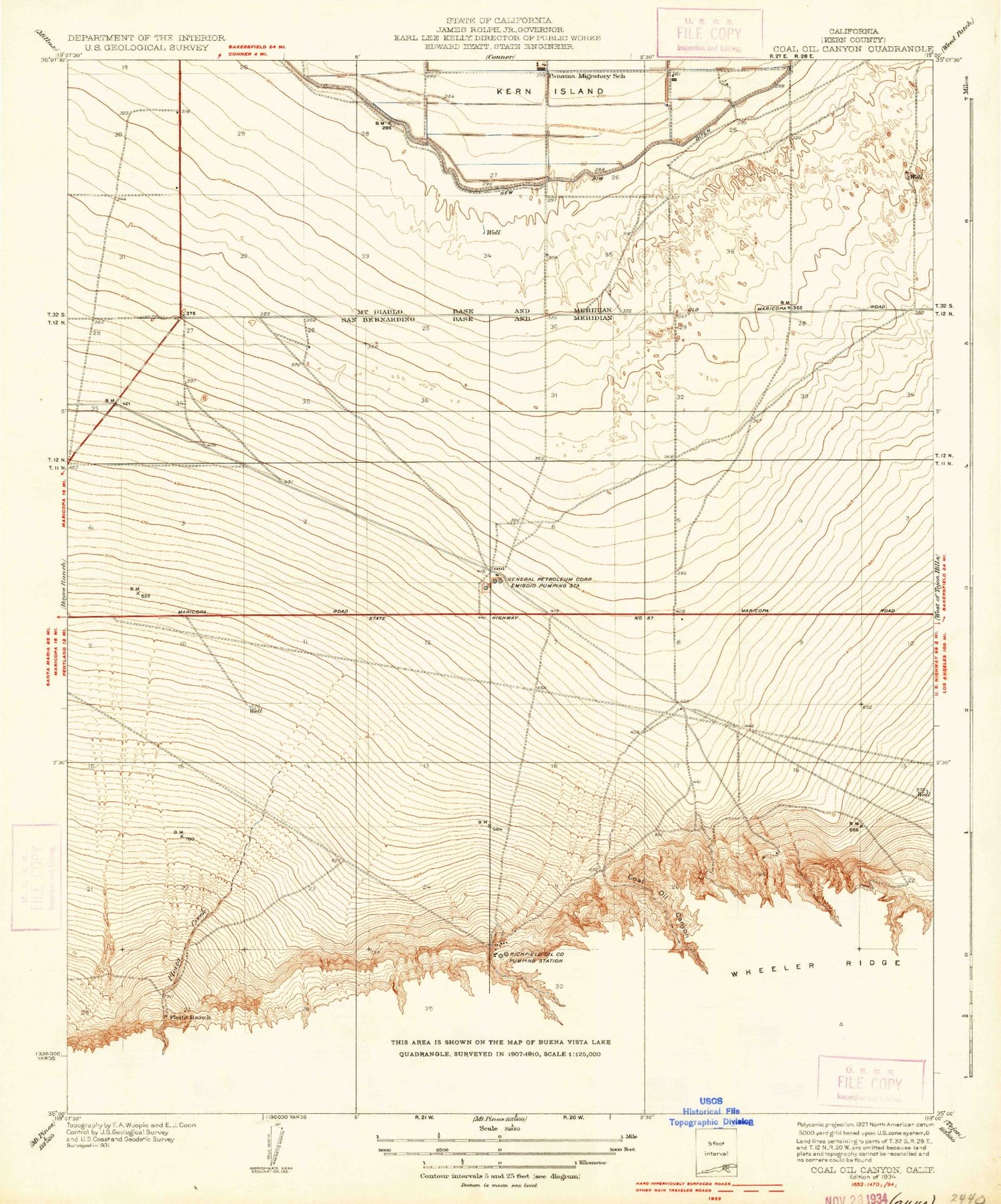
MyTopo
Classic USGS Coal Oil Canyon California 7.5'x7.5' Topo Map
Couldn't load pickup availability
Historical USGS topographic quad map of Coal Oil Canyon in the state of California. Map scale may vary for some years, but is generally around 1:24,000. Print size is approximately 24" x 27"
This quadrangle is in the following counties: Kern.
The map contains contour lines, roads, rivers, towns, and lakes. Printed on high-quality waterproof paper with UV fade-resistant inks, and shipped rolled.
Contains the following named places: Coal Oil Canyon, Emidio Pumping Station, Fages-Zalvidea Trails Marker, John R Teerink Wheeler Ridge Punping Plant, Lakeview, Lakeview Duck Club, New Rim Ditch, Panama Migratory School, Pleitito Creek, Pleito Creek, Pleito Ranch, San Emigdio, Skydive San Joaquin Valley Airport, Tecuya Creek, Telegraph Canyon, Wheeler Ridge, Wheeler Ridge Oil Field