
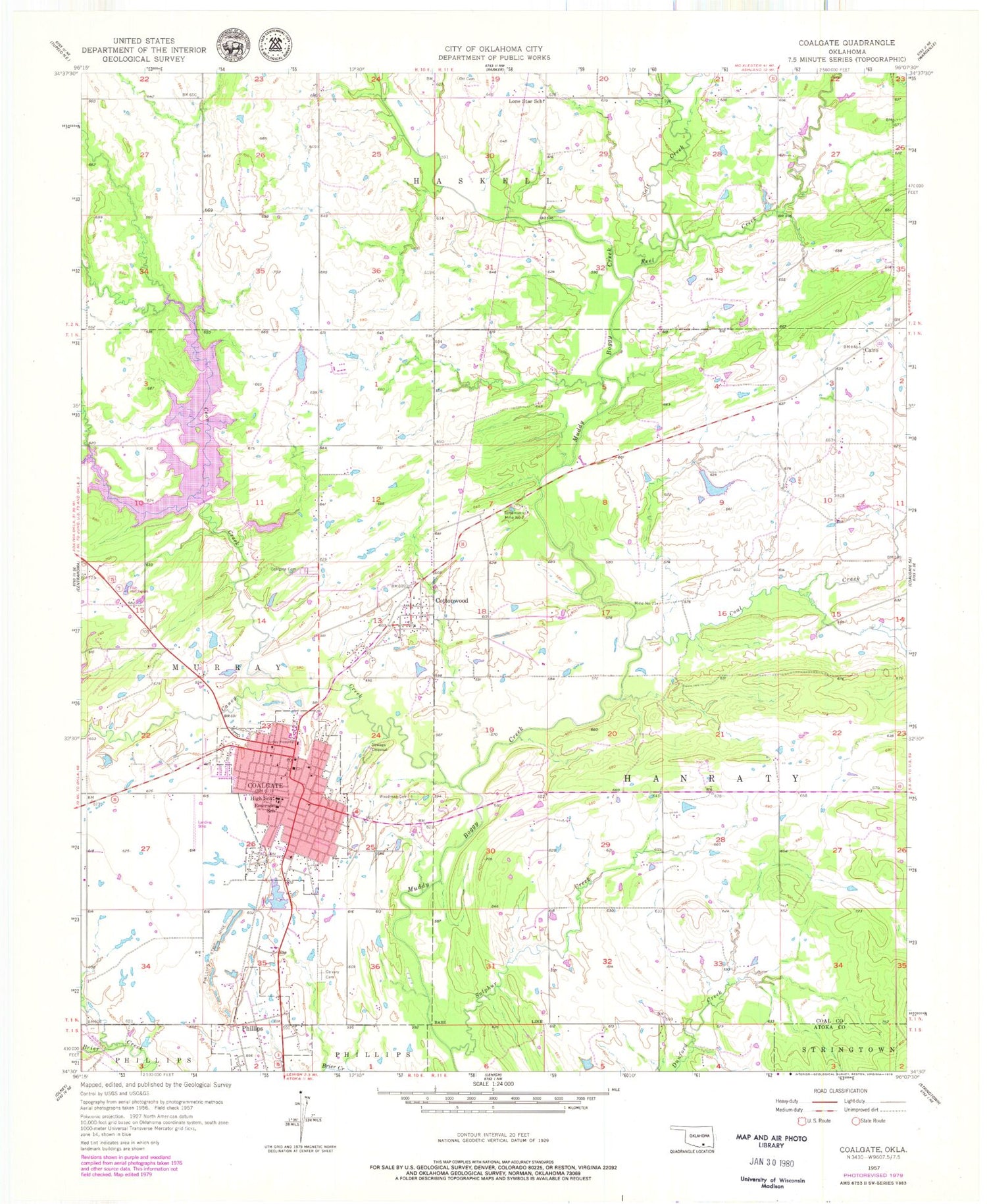
MyTopo
Classic USGS Coalgate Oklahoma 7.5'x7.5' Topo Map
Couldn't load pickup availability
Historical USGS topographic quad map of Coalgate in the state of Oklahoma. Map scale may vary for some years, but is generally around 1:24,000. Print size is approximately 24" x 27"
This quadrangle is in the following counties: Atoka, Coal.
The map contains contour lines, roads, rivers, towns, and lakes. Printed on high-quality waterproof paper with UV fade-resistant inks, and shipped rolled.
Contains the following named places: Bill Lake Dam, Cairo, Calvary Cemetery, Caney Coon Creek Site 2 Dam, Caney Coon Creek Site 2 Reservoir, Caney Creek, Caney-Coon Creek Site 3 Dam, Caney-Coon Creek Site 3 Reservoir, Church of Christ, City of Coalgate, City of Coalgate Airport, Coal County Jail, Coal County Sheriff, Coal Creek, Coalgate, Coalgate Cemetery, Coalgate Fire Department and Emergency Medical Services, Coalgate High School, Coalgate Police Dept, Coalgate Post Office, Coalgate Reservoir, Cook and McEntire Reservoir, Cook Lake Dam, Coon Creek, Cottonwood, Cottonwood Census Designated Place, Cottonwood Elementary School, East Coal Division, Emerson Elementary School, Gill Lake, Keel Creek, Lone Star School, Mary Hurley Hospital, Methodist Church, Mine Number 21, Ott Cemetery, Phillips, Phillips Strip Mine, Saint Peters Episcopal Church, Salt Creek, Sandmann Mine Number 2, Seventh Day Adventist Church, Sulphur Creek, Town of Phillips, Township of Hanraty, Wallace Byrd Middle School, Woodman Cemetery


