MyTopo
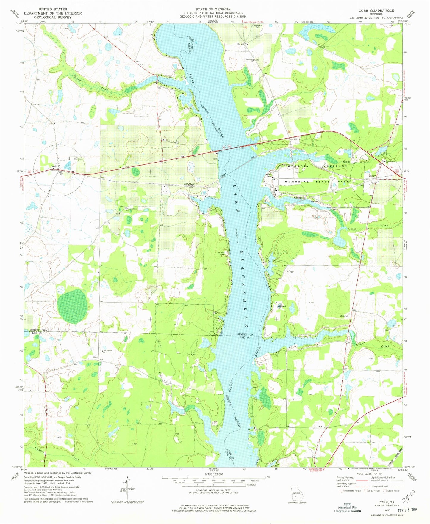
Classic USGS Cobb Georgia 7.5'x7.5' Topo Map
Couldn't load pickup availability
Historical USGS topographic quad map of Cobb in the state of Georgia. Map scale may vary for some years, but is generally around 1:24,000. Print size is approximately 24" x 27"
This quadrangle is in the following counties: Crisp, Lee, Sumter.
The map contains contour lines, roads, rivers, towns, and lakes. Printed on high-quality waterproof paper with UV fade-resistant inks, and shipped rolled.
Contains the following named places: Cedar Creek, Cedar Creek School, Cobb, Cobb Post Office, Collins Branch, Coney, Coxs Ferry, Crisp County Fire Department Station 4, Crisp County Fire Department Station 5, Daphne, Flintside, Georgia Veterans Memorial State Park, Gill Pace Lake, Gill Pace Lake Dam, Gully Creek, Gum Creek, Gum Creek Church, Hugenia Ferry, Lake Blackshear, Lake Blackshear Church, Lower Wheatley Lake, Lower Wheatley Lake Dam, Mile Pond, New Beulah Church, New Zion Church, Pleasant Grove Church, Spring Creek, Spring Hill School, Springhill Church, Sumter County Fire Department Station 4, Wheatley Lake North, Wheatley Lake North Dam, Womack Lake, Womack Lake Dam, ZIP Codes: 31735, 31743