MyTopo
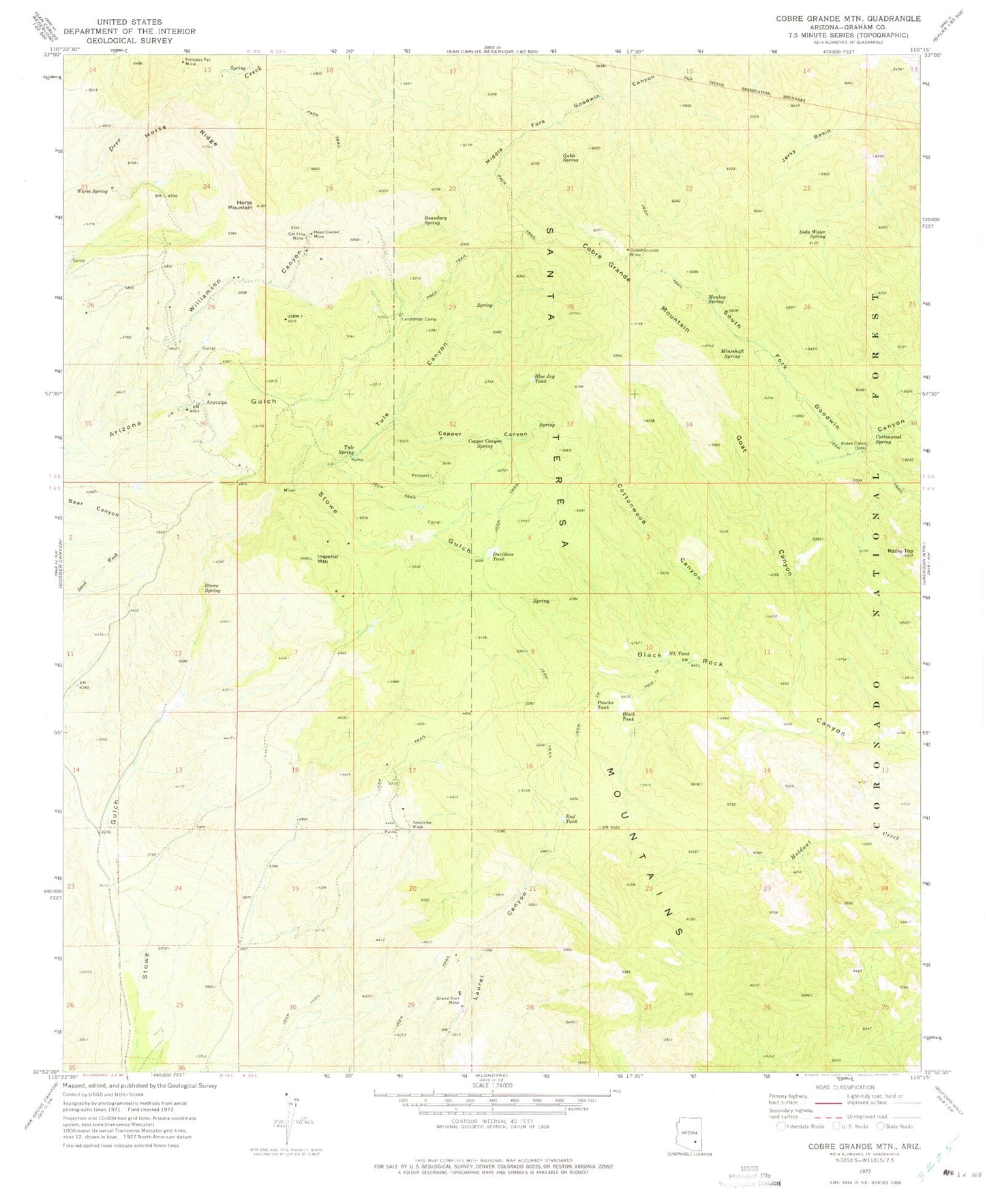
Classic USGS Cobre Grande Mountain Arizona 7.5'x7.5' Topo Map
Couldn't load pickup availability
Historical USGS topographic quad map of Cobre Grande Mountain in the state of Arizona. Map scale may vary for some years, but is generally around 1:24,000. Print size is approximately 24" x 27"
This quadrangle is in the following counties: Graham.
The map contains contour lines, roads, rivers, towns, and lakes. Printed on high-quality waterproof paper with UV fade-resistant inks, and shipped rolled.
Contains the following named places: Aravaipa, Black Tank, Blue Jay Tank, Boundary Spring, Cobre Grande Mine, Cobre Grande Mountain, Copper Canyon, Copper Canyon Spring, Cottonwood Canyon, Cottonwood Spring, Davidson Tank, Gable Spring, Goat Canyon, Grand Reef Mine, Grand Reef Mountain, Head Center Mine, Holdout Trail Sixty Nine, Horse Mountain, Horse Ridge, Imperial Mountain, Jerky Basin, Landsman Camp, Landsman Spring, Mineshaft Spring, Monkey Spring, NL Tank, Poncho Tank, Princess Pat Mine, Reef Basin Sixty Eight Trail, Reef Tank, Rocky Top, Roten Cabin, Sin Fin Mine, Soda Water Spring, Spring Trail Spring, Stowe Spring, Tenstrike Mine, Tule Canyon, Tule Spring, Tunnel Spring, Warm Spring, Williamson Canyon