MyTopo
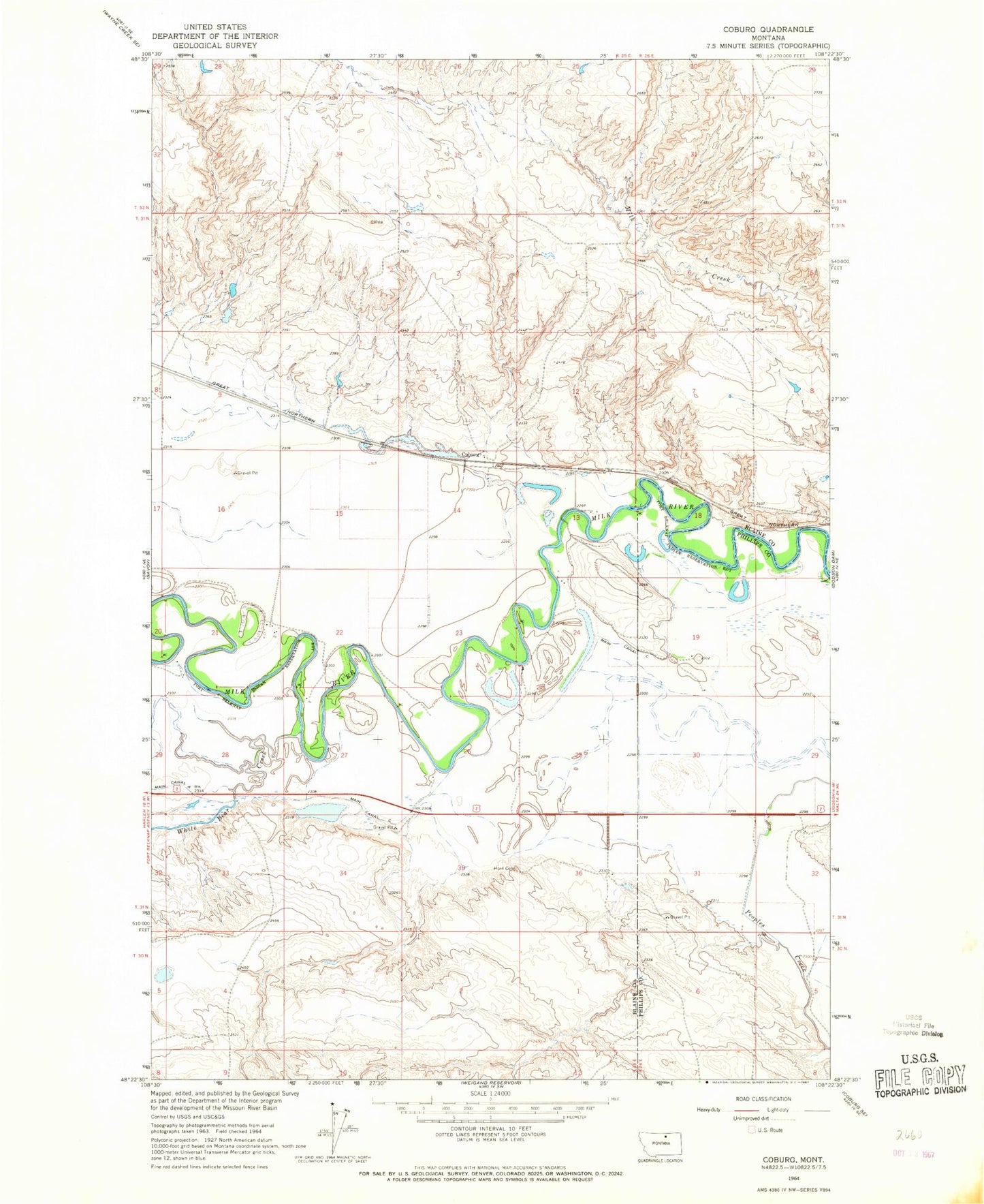
Classic USGS Coburg Montana 7.5'x7.5' Topo Map
Couldn't load pickup availability
Historical USGS topographic quad map of Coburg in the state of Montana. Map scale may vary for some years, but is generally around 1:24,000. Print size is approximately 24" x 27"
This quadrangle is in the following counties: Blaine, Phillips.
The map contains contour lines, roads, rivers, towns, and lakes. Printed on high-quality waterproof paper with UV fade-resistant inks, and shipped rolled.
Contains the following named places: 31N25E21CBCD01 Well, 31N25E24CCAA01 Well, 31N25E24CCB_01 Well, 31N25E24CCB_02 Well, 31N26E19DCCD01 Well, 31N26E32BAD_01 Well, 31N26E32BAD_02 Well, BR-38 Dam, Coburg, Coburg Post Office, Coburg School, Eureka Creek, Main Canal, Mayflower Dam, Milk River Bridge, North Star School, White Bear Creek