MyTopo
Classic USGS Coburn Mountain Montana 7.5'x7.5' Topo Map
Regular price
$16.95
Regular price
Sale price
$16.95
Unit price
per
Couldn't load pickup availability
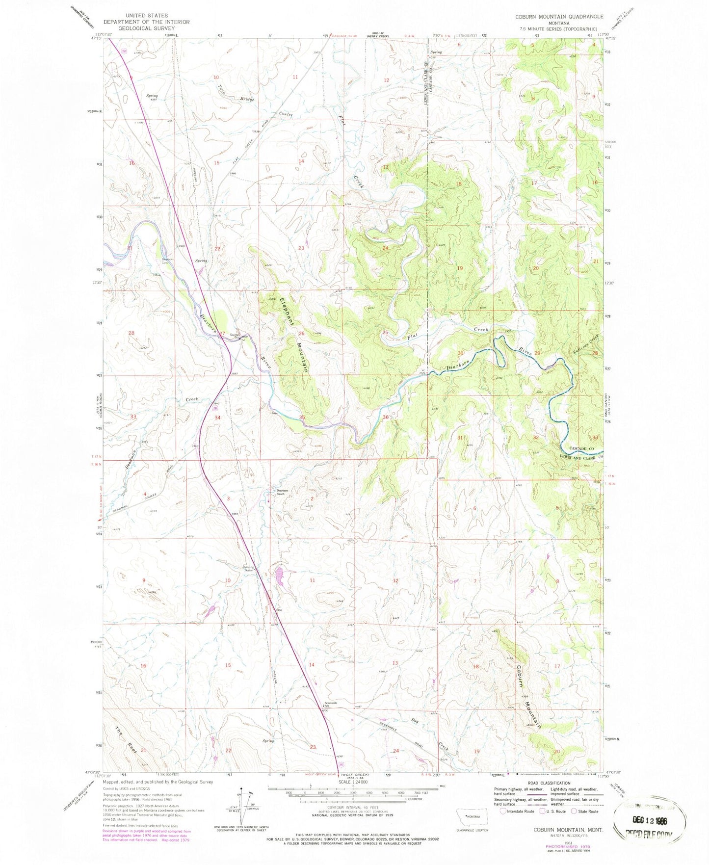
Historical USGS topographic quad map of Coburn Mountain in the state of Montana. Map scale may vary for some years, but is generally around 1:24,000. Print size is approximately 24" x 27"
This quadrangle is in the following counties: Cascade, Lewis and Clark.
The map contains contour lines, roads, rivers, towns, and lakes. Printed on high-quality waterproof paper with UV fade-resistant inks, and shipped rolled.
Contains the following named places: Bar E Airport, Coburn Mountain, Curran-Barrett Number 1 Dam, Deadman Creek, Dearborn, Dearborn Crossing Cemetery, Dearborn Post Office, Dearborn Ranch, Elephant Mountain, Flat Creek, Sevenmile School, Sullivan Creek, Twin Bridge Coulee