MyTopo
Classic USGS Coburn North Dakota 7.5'x7.5' Topo Map
Regular price
$16.95
Regular price
Sale price
$16.95
Unit price
per
Couldn't load pickup availability
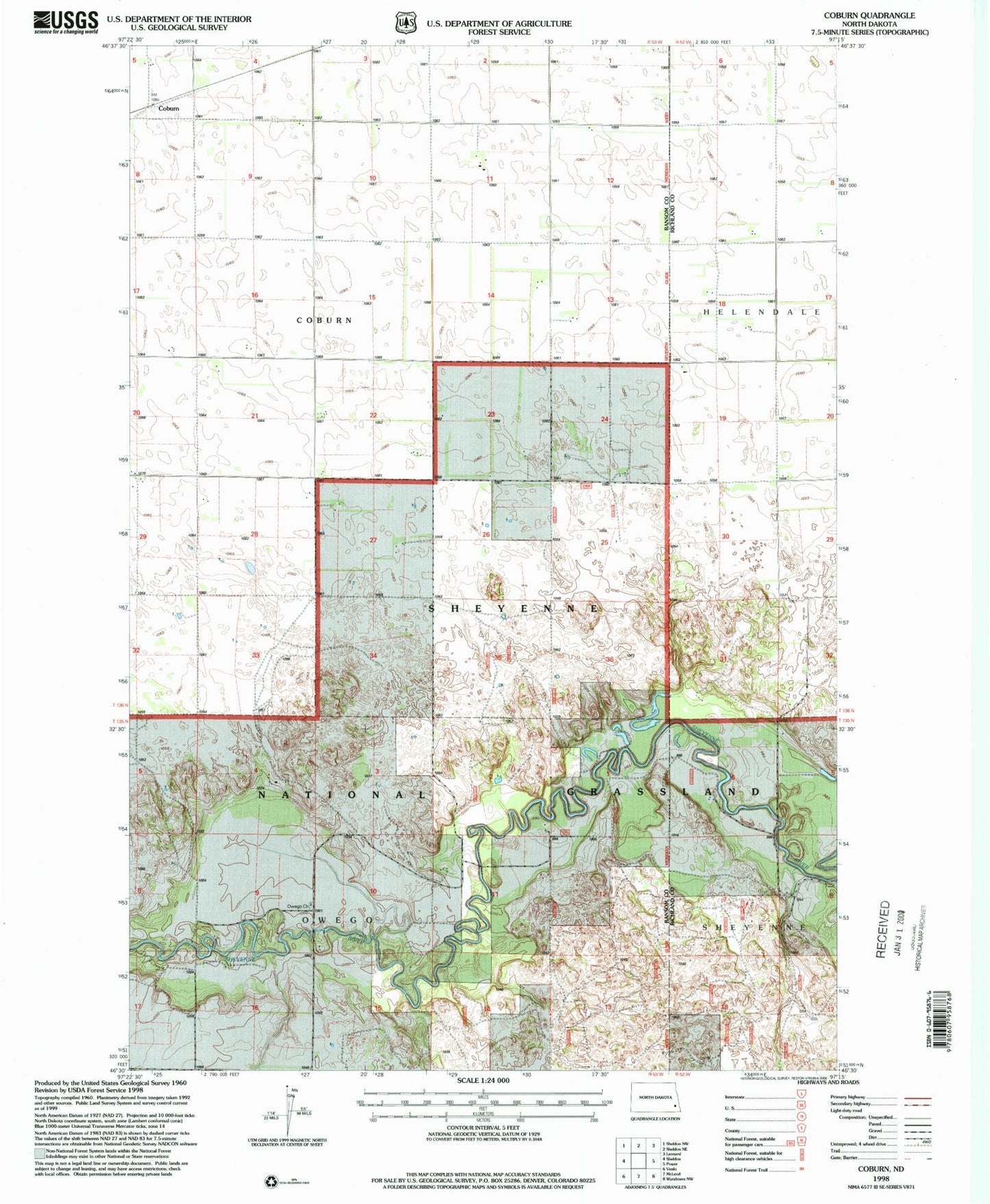
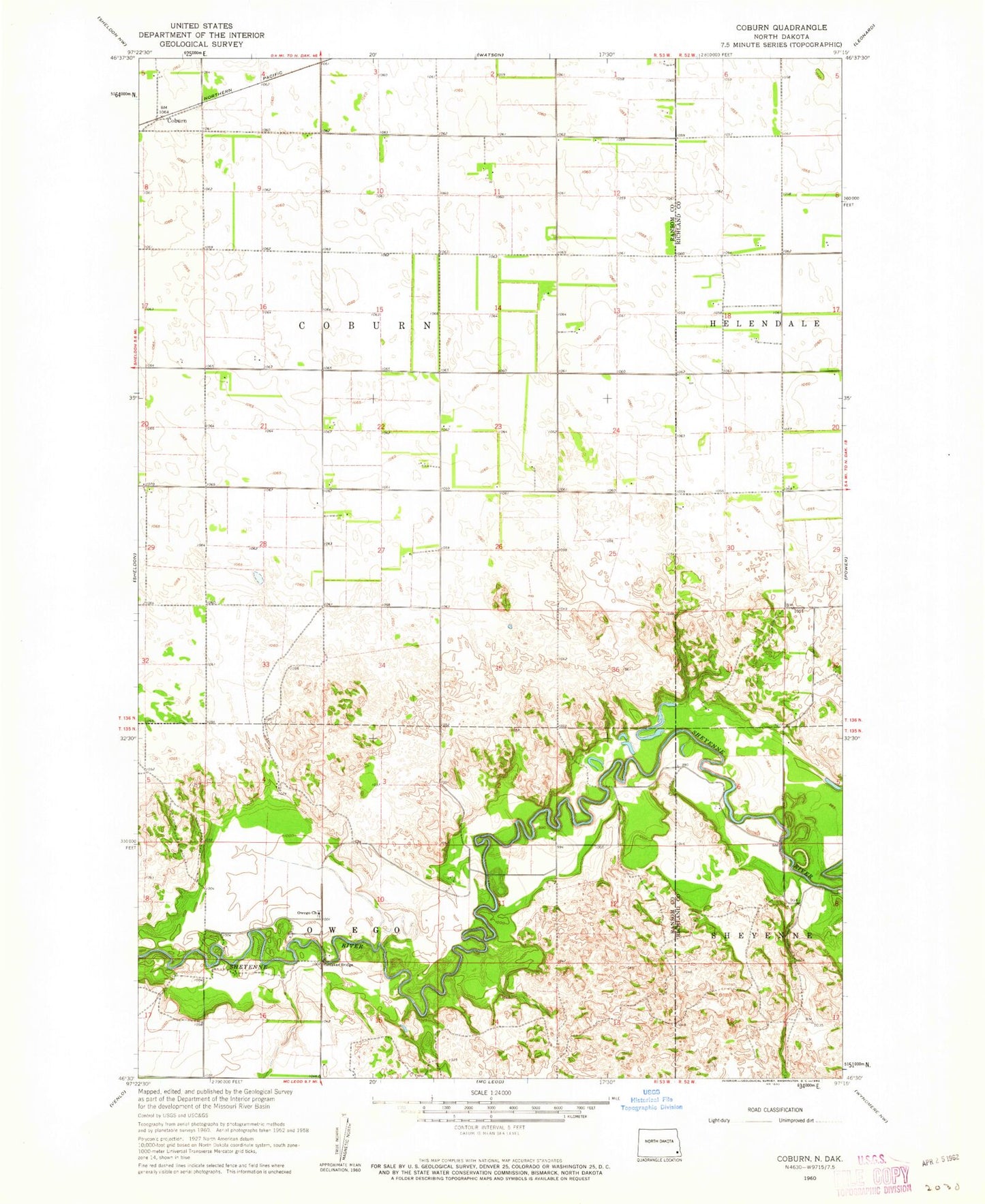
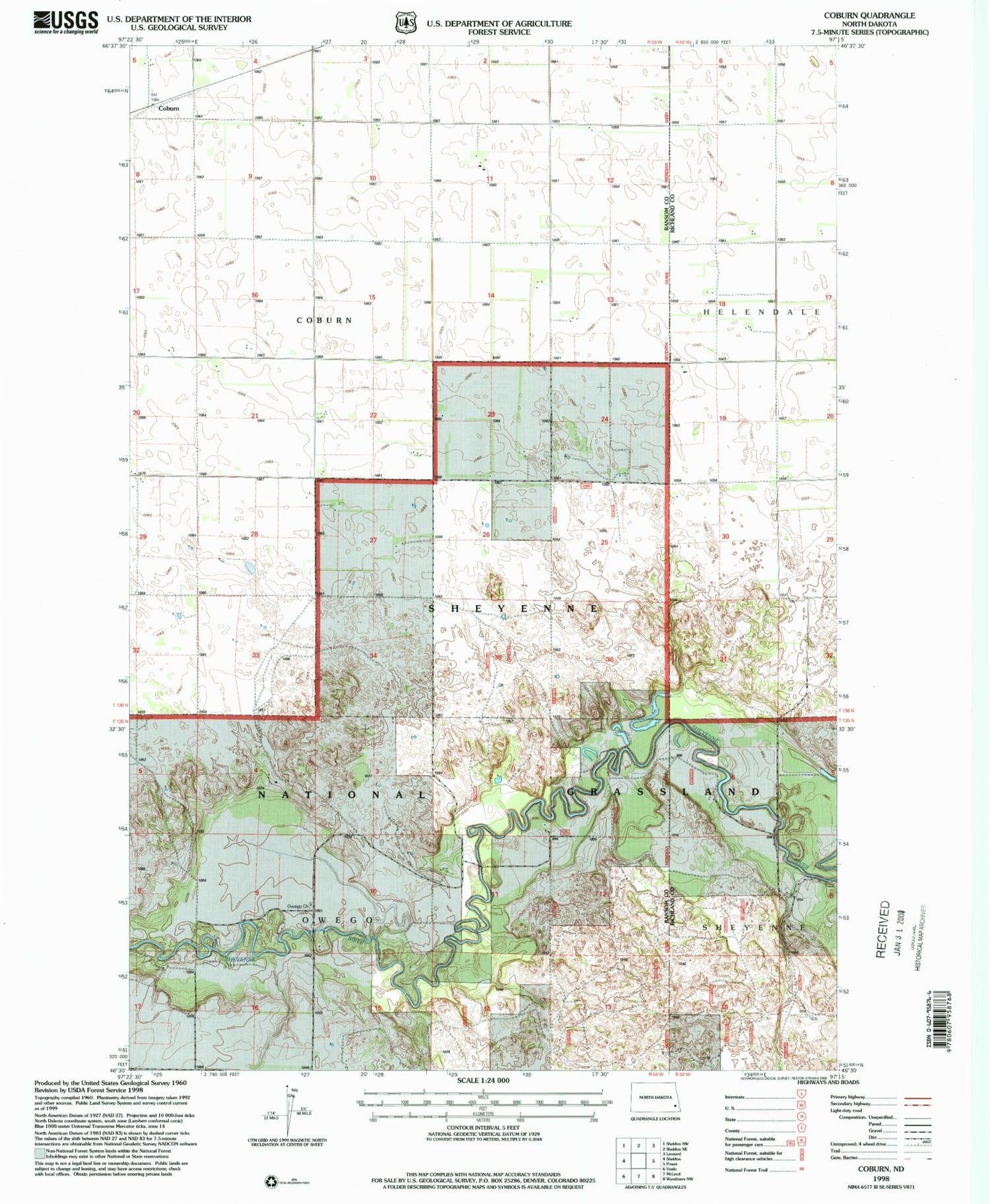
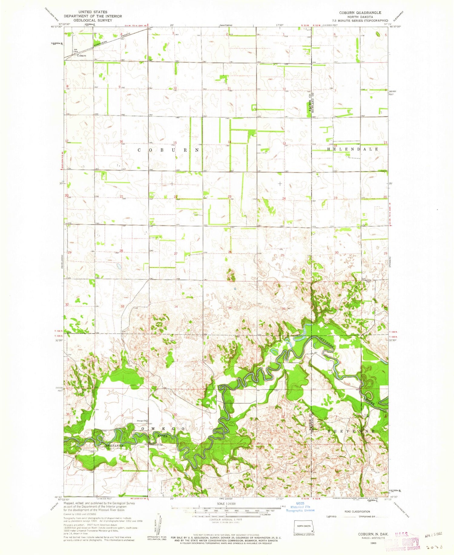
Historical USGS topographic quad map of Coburn in the state of North Dakota. Map scale may vary for some years, but is generally around 1:24,000. Print size is approximately 24" x 27"
This quadrangle is in the following counties: Ransom, Richland.
The map contains contour lines, roads, rivers, towns, and lakes. Printed on high-quality waterproof paper with UV fade-resistant inks, and shipped rolled.
Contains the following named places: Coburn, Coburn Town Hall, Johnson - Vangsnes Pioneer Cemetery, Owego, Owego Church, Owego Lutheran Church Cemetery, Township of Coburn, Ylvisaker Bridge