MyTopo
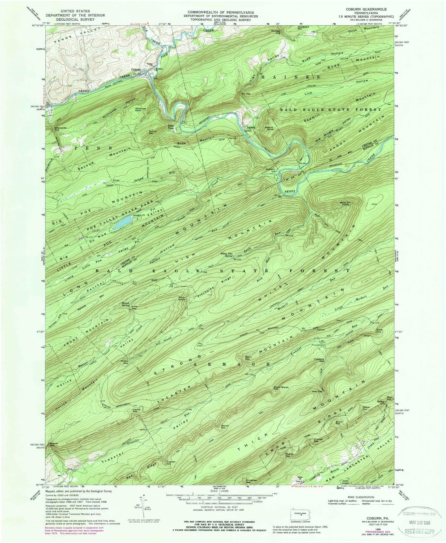
Classic USGS Coburn Pennsylvania 7.5'x7.5' Topo Map
Couldn't load pickup availability
Historical USGS topographic quad map of Coburn in the state of Pennsylvania. Typical map scale is 1:24,000, but may vary for certain years, if available. Print size: 24" x 27"
This quadrangle is in the following counties: Centre, Mifflin.
The map contains contour lines, roads, rivers, towns, and lakes. Printed on high-quality waterproof paper with UV fade-resistant inks, and shipped rolled.
Contains the following named places: Bear Gap, Bear Gap Trail, Big Poe Creek, Big Poe Valley, Black Gap, Board Shanty Gap, Brock Gap, Chestnut Gap, Coburn, Dean Gap, Dry Hollow Trail, Elk Creek, Elk Gap, Green Gap, Greenbrier Gap, Havice Gap, Havice Spring, High Mountain, High Valley, Hutt Trail, Ingleby, Kerstetter Path, Knob Ridge, Korman Gap, Lick Hollow, Little Poe Mountain, Little Poe Trail, Little Poe Valley, Loggers Path, McNitt Gap, McNitt Trail, Mitchell Gap, Old Mingle Valley, Panther Hollow, Panther Hollow Trail, Panther Run, Penn View, Peters Trail, Pine Swamp Run, Pitchpine Ridge, Poe Valley State Park, Price Gap, Price Kettle, Rock Run, Rupp Hollow, Saint Johns Church, Sawmill Knob, Sawmill Mountain, Skinall Gap, Slide Mountain, Spruce Mountain, Stillhouse Hollow, Stillhouse Knob, Strong Mountain, Swift Run, Tower Trail, Treaster Gap, Treaster Mountain, Trinity Church, Tunnel Mountain, Wagner Gap, Wagner Gap, Weaver Gap, White Mountain, White Mountain Kettle, White Mountain Ridge Trail, White Pine Spring, Dean Trail, Havice Mountain, Little Poe Creek, Pine Creek, Second Mountain, Showalter Gap, Poe Lake, Poe Dam, Poe Paddy State Park, CCC Camp, Wert School (historical), Penns View, Ingleby, Ravens Knob, Bear Gap Picnic Area, Township of Penn, Township of Armagh, Red Ridge Trail, Poe Mills (historical), Coburn Census Designated Place, Coburn Post Office, Salem United Methodist Cemetery, Bear Gap, Bear Gap Trail, Big Poe Creek, Big Poe Valley, Black Gap, Board Shanty Gap, Brock Gap, Chestnut Gap, Coburn, Dean Gap, Dry Hollow Trail, Elk Creek, Elk Gap, Green Gap, Greenbrier Gap, Havice Gap, Havice Spring, High Mountain, High Valley, Hutt Trail, Ingleby, Kerstetter Path, Knob Ridge, Korman Gap, Lick Hollow, Little Poe Mountain, Little Poe Trail, Little Poe Valley, Loggers Path, McNitt Gap, McNitt Trail, Mitchell Gap, Old Mingle Valley, Panther Hollow, Panther Hollow Trail, Panther Run, Penn View, Peters Trail, Pine Swamp Run, Pitchpine Ridge, Poe Valley State Park, Price Gap, Price Kettle, Rock Run, Rupp Hollow, Saint Johns Church, Sawmill Knob, Sawmill Mountain, Skinall Gap, Slide Mountain, Spruce Mountain, Stillhouse Hollow, Stillhouse Knob, Strong Mountain, Swift Run, Tower Trail, Treaster Gap, Treaster Mountain, Trinity Church, Tunnel Mountain, Wagner Gap, Wagner Gap, Weaver Gap, White Mountain, White Mountain Kettle, White Mountain Ridge Trail, White Pine Spring, Dean Trail, Havice Mountain, Little Poe Creek, Pine Creek, Second Mountain, Showalter Gap, Poe Lake, Poe Dam, Poe Paddy State Park, CCC Camp, Wert School (historical), Penns View, Ingleby, Ravens Knob, Bear Gap Picnic Area, Township of Penn, Township of Armagh, Red Ridge Trail, Poe Mills (historical), Coburn Census Designated Place, Coburn Post Office, Salem United Methodist Cemetery


