MyTopo
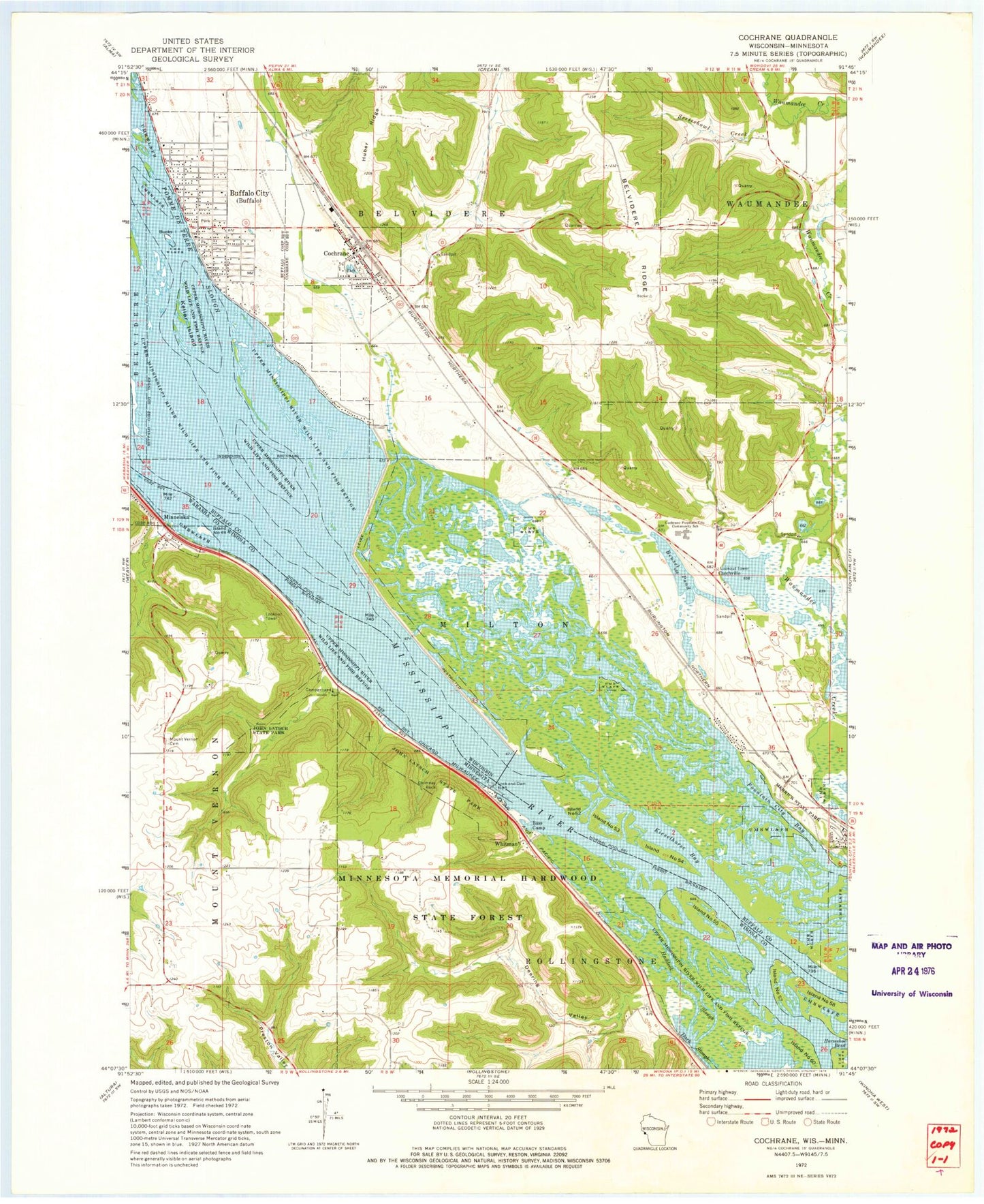
Classic USGS Cochrane Wisconsin 7.5'x7.5' Topo Map
Couldn't load pickup availability
Historical USGS topographic quad map of Cochrane in the states of Wisconsin, Minnesota. Typical map scale is 1:24,000, but may vary for certain years, if available. Print size: 24" x 27"
This quadrangle is in the following counties: Buffalo, Wabasha, Winona.
The map contains contour lines, roads, rivers, towns, and lakes. Printed on high-quality waterproof paper with UV fade-resistant inks, and shipped rolled.
Contains the following named places: Bensel Pond, Buffalo City, Cochrane, Cochrane - Fountain City School, Eagle Creek, Huber Ridge, Island Number Fifty-two, Island Number Fifty-three, Island Number Fifty-four, Keller Island, Kieselhorse Bay, Lock and Dam Number 5, Pomme de Terre Slough, Screech Owl Creek, Waumandee Valley, Czechville, City of Buffalo City, Village of Cochrane, Town of Milton, Garden Valley School (historical), Middle Island (historical), Oak Valley School (historical), Spring Lake (historical), Stirn Island (historical), Whitman Bottoms Floodplain Forest State Natural Area, Tri - Community Fire Department, Scenic Valley Emergency Medical Services, Buffalo Lutheran School, Cochrane - Fountain City Elementary School, Whitman Dike, Snipe Island, Deep Hole Island, Bullrush Island, Deer Toe Island, Water Snake Island, Pelican Island, Bucks Island, Cochrane Post Office, Bass Camp, Chimney Rock, Deering Valley, Haddock Slough, Island Number Fortynine, Island Number Fiftyfive, Island Number Fiftyseven, Island Number Fiftyeight, Island Number Sixty, John Latsch State Park, Lock and Dam 5, Minneiska, Mount Vernon Cemetery, Whitman, Lock and Dam Number 5, Pool 5, Mississippi River Historical Marker, Thorpe Wildlife Management Area, Snyder Lake


