MyTopo
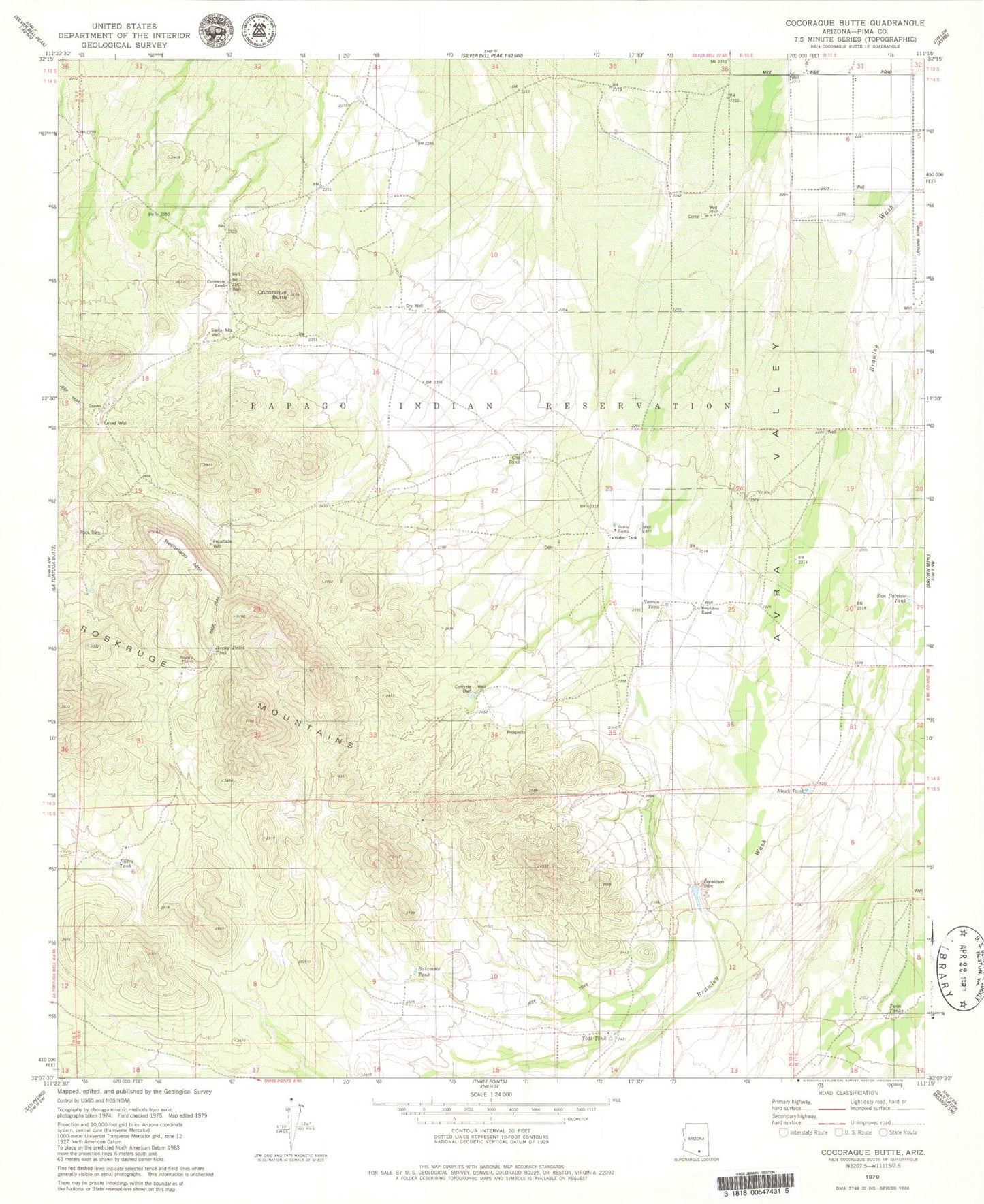
Classic USGS Cocoraque Butte Arizona 7.5'x7.5' Topo Map
Couldn't load pickup availability
Historical USGS topographic quad map of Cocoraque Butte in the state of Arizona. Typical map scale is 1:24,000, but may vary for certain years, if available. Print size: 24" x 27"
This quadrangle is in the following counties: Pima.
The map contains contour lines, roads, rivers, towns, and lakes. Printed on high-quality waterproof paper with UV fade-resistant inks, and shipped rolled.
Contains the following named places: Batamote Tank, Black Tank, Cat Tank, Cocoraque Butte, Cocoraque Ranch, Concrete Dam, Donaldson Dam, Donaldson Ranch, Filtro Tank, Garcia Ranch, Ramon Tank, Recortado Mountain, Recortado Well, Rock Dam, Rocky Point, Rocky Point Tank, Santa Rita Well, Tunnel Well, Twin Tanks, Yodi Tank, Altar Valley