MyTopo
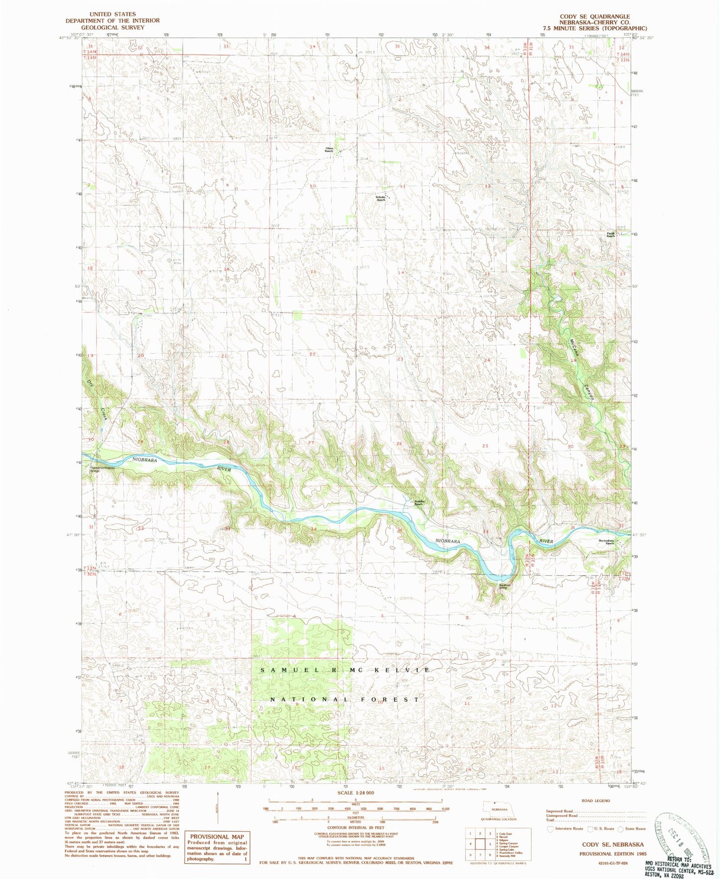
Classic USGS Cody SE Nebraska 7.5'x7.5' Topo Map
Regular price
$16.95
Regular price
Sale price
$16.95
Unit price
per
Couldn't load pickup availability
Historical USGS topographic quad map of Cody SE in the state of Nebraska. Map scale may vary for some years, but is generally around 1:24,000. Print size is approximately 24" x 27"
This quadrangle is in the following counties: Cherry.
The map contains contour lines, roads, rivers, towns, and lakes. Printed on high-quality waterproof paper with UV fade-resistant inks, and shipped rolled.
Contains the following named places: Blahaveck Ranch, Buckhorn Spring, C Schultz Ranch, Dry Creek, G Horner Ranch, Hockenbary Ranch, J Schultz Ranch, Kudelka Ranch, Liebermann Ranch, Nollette Ranch, Olsen Ranch, Pavlik Ranch, Riemenschneider Bridge, School Number 60