MyTopo
Classic USGS Coffee Mill Butte Nebraska 7.5'x7.5' Topo Map
Couldn't load pickup availability
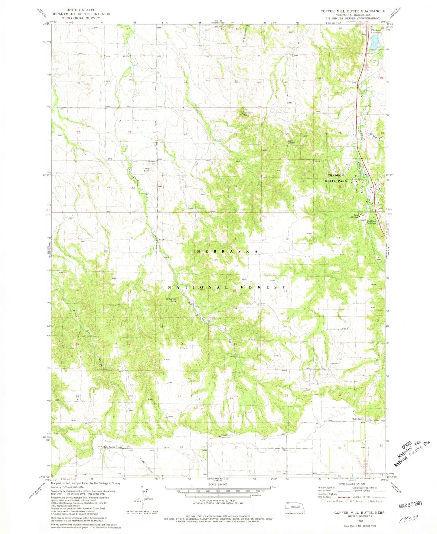
Historical USGS topographic quad map of Coffee Mill Butte in the state of Nebraska. Typical map scale is 1:24,000, but may vary for certain years, if available. Print size: 24" x 27"
This quadrangle is in the following counties: Dawes.
The map contains contour lines, roads, rivers, towns, and lakes. Printed on high-quality waterproof paper with UV fade-resistant inks, and shipped rolled.
Contains the following named places: Camp Norwesca, Chadron Reservoir, Chadron State Park, Coffee Mill Butte, Flag Butte, Flag Butte School, Flannigan Butte, Lookout Point, Open Door Church, Rattlesnake Butte, Coffee Mill Trailhead, Chadron State Park Trailhead, Red Cloud Picnic Area, Strong Canyon, Pine Ridge Trail, KQSK-FM (Chadron), Chadron Dam Number 2, Chadron Reservoir Number 2, Chadron State Park Historical Marker, Chadron Camping Area, Red Cloud Campground, Chadron Trails, Pine Ridge National Recreation Area