MyTopo
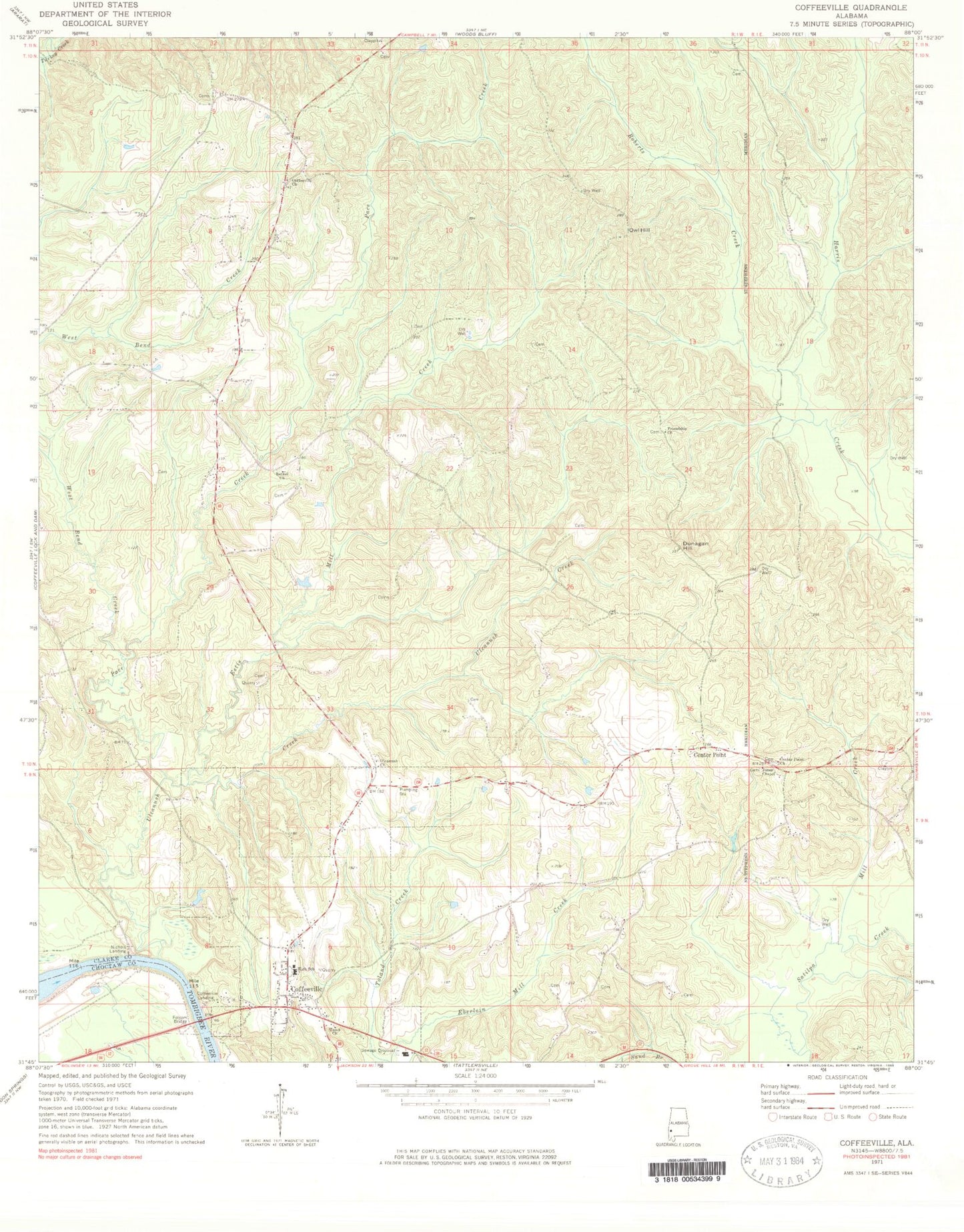
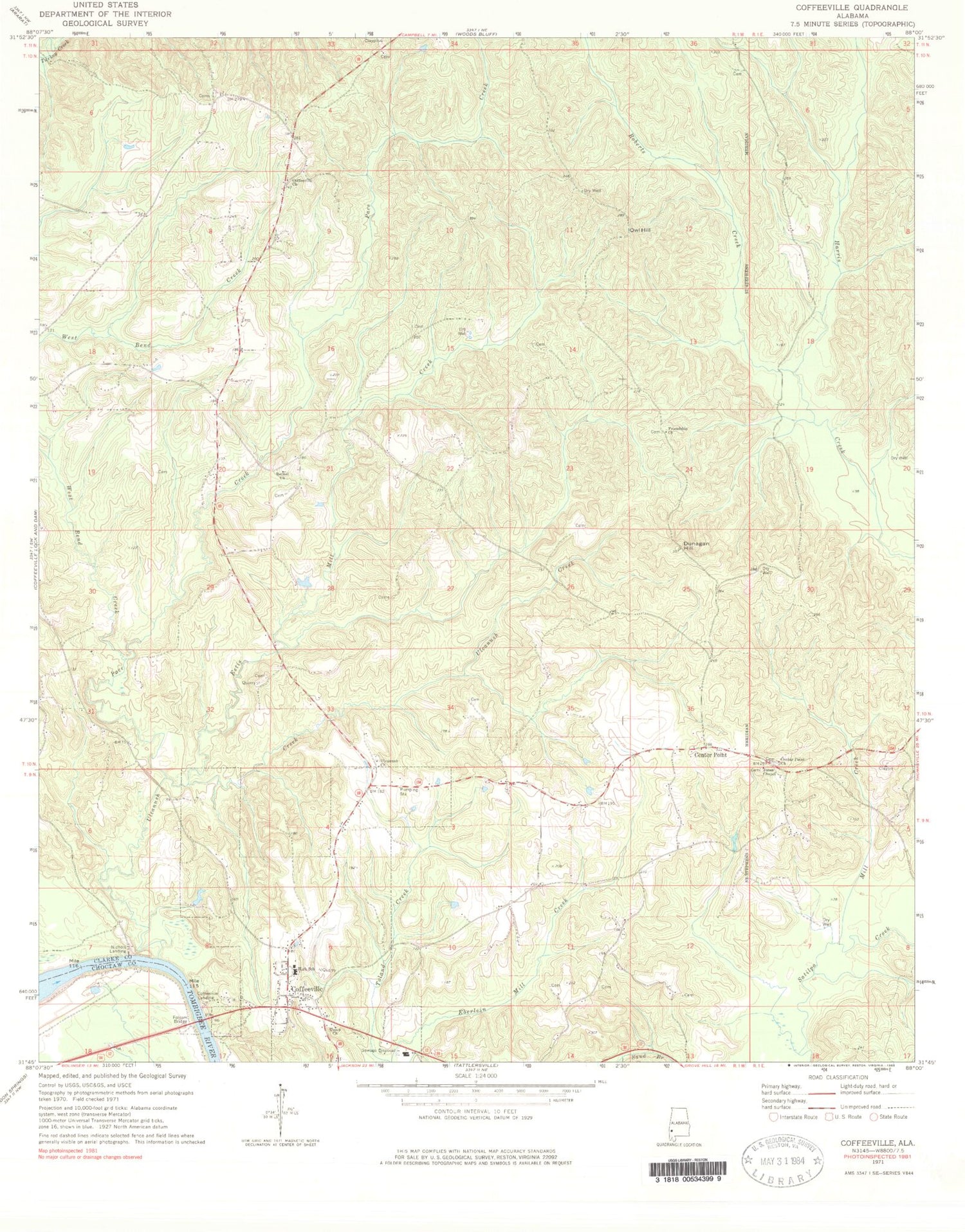
Classic USGS Coffeeville Alabama 7.5'x7.5' Topo Map
Couldn't load pickup availability
Historical USGS topographic quad map of Coffeeville in the state of Alabama. Map scale may vary for some years, but is generally around 1:24,000. Print size is approximately 24" x 27"
This quadrangle is in the following counties: Choctaw, Clarke.
The map contains contour lines, roads, rivers, towns, and lakes. Printed on high-quality waterproof paper with UV fade-resistant inks, and shipped rolled.
Contains the following named places: Anderson Cemetery, Ball Bluff, Bethel, Bethel Baptist Church, Center Point, Center Point Church, Coffeeville, Coffeeville Cemetery, Coffeeville Church, Coffeeville Division, Coffeeville Elementary School, Coffeeville Ferry, Coffeeville Fire and Rescue, Coffeeville High School, Coffeeville Landing, Coffeeville Post Office, Dunagan Hill, Estis Mill Creek, Folsom Bridge, Friendship, Friendship Baptist Church, James Cemetery, Jones Chapel Church of Christ, Kiels Cemetery, Mill Creek, Nichols Landing, Owl Hill, Pace Creek, Pace Creek Oil Field, Panther Stadium, Roberts Creek, Rockbar Church, Toland Creek, Town of Coffeeville, Trotter Cemetery, Ulcanush Baptist Church, Ulcanush Cemetery, Ulcanush Creek, Union Baptist Church, Webb Cemetery, West Bend Creek, ZIP Code: 36524