MyTopo
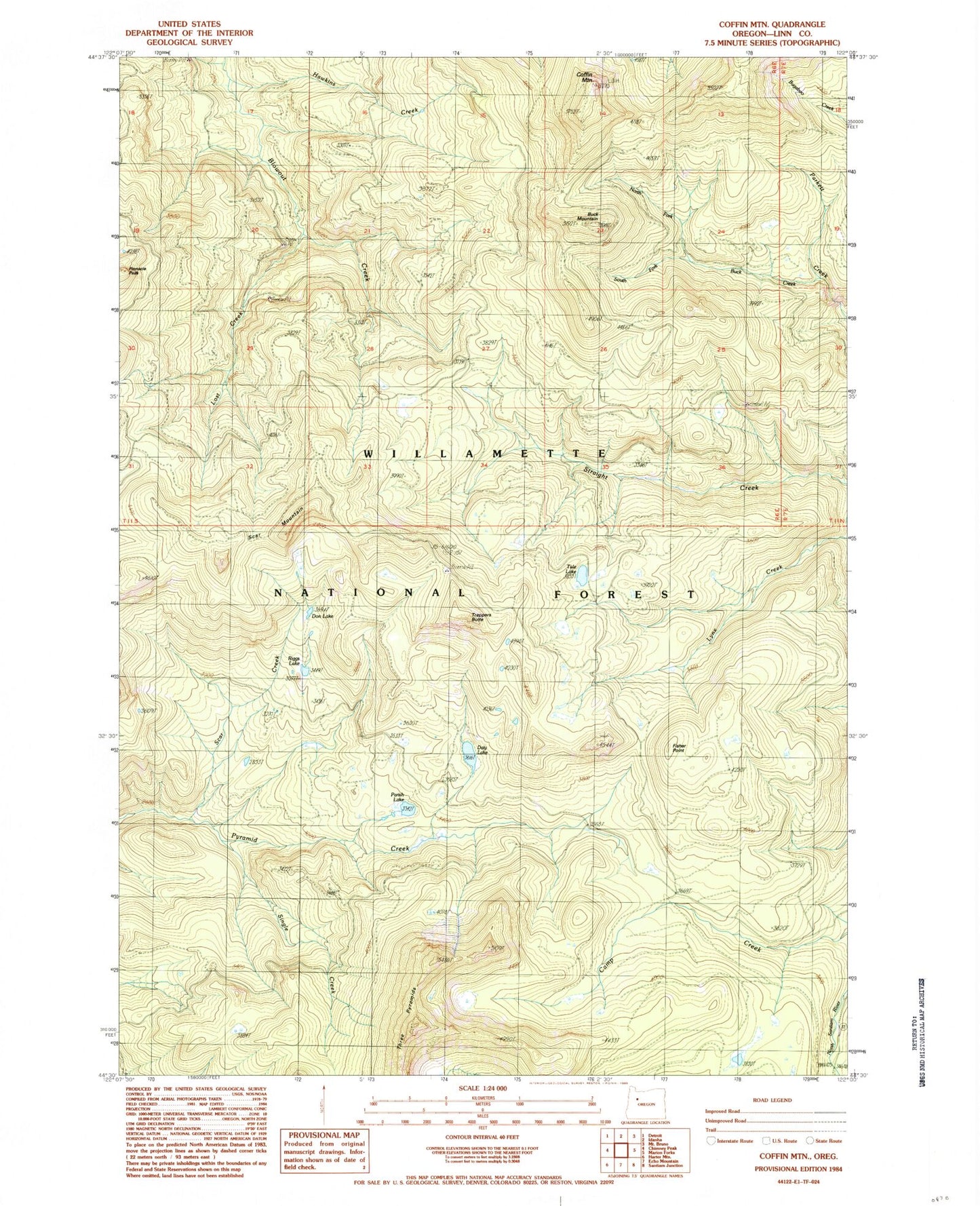
Classic USGS Coffin Mountain Oregon 7.5'x7.5' Topo Map
Couldn't load pickup availability
Historical USGS topographic quad map of Coffin Mountain in the state of Oregon. Map scale may vary for some years, but is generally around 1:24,000. Print size is approximately 24" x 27"
This quadrangle is in the following counties: Linn.
The map contains contour lines, roads, rivers, towns, and lakes. Printed on high-quality waterproof paper with UV fade-resistant inks, and shipped rolled.
Contains the following named places: Buck Creek, Buck Mountain, Coffin Mountain, Coffin Mountain Lookout, Coffin Mountain Trail, Daly Lake, Don Lake, Fawn Creek, Fisher Point, Hawkins Creek, Lost Creek, Lunch Creek, Lynx Creek, North Fork Buck Creek, Parish Lake, Riggs Lake, Scar Creek, Scar Mountain, Single Creek, South Fork Buck Creek, Straight Creek Cat Trail, Trappers Butte, Tule Lake