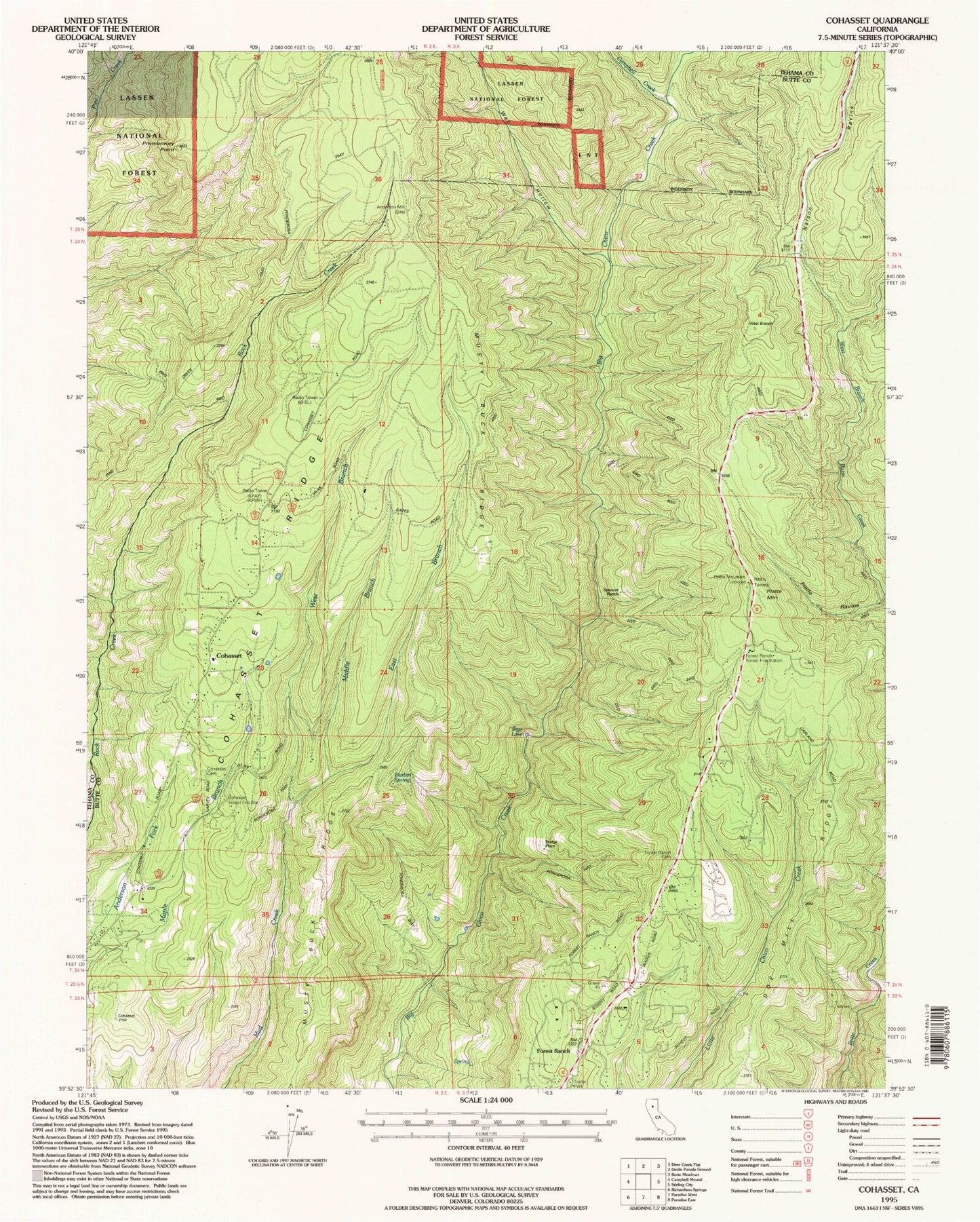
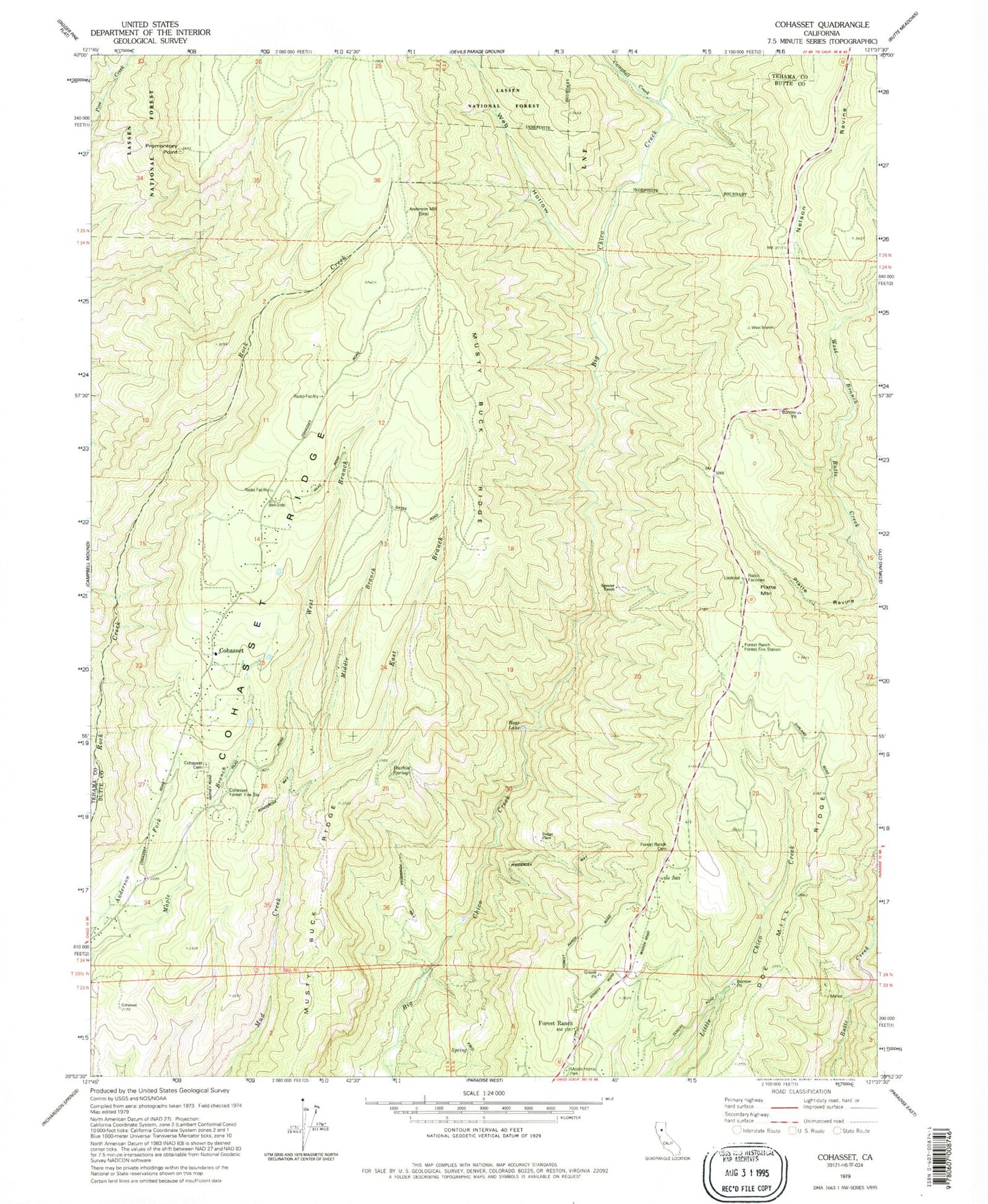
MyTopo
Classic USGS Cohasset California 7.5'x7.5' Topo Map
Couldn't load pickup availability
Historical USGS topographic quad map of Cohasset in the state of California. Typical map scale is 1:24,000, but may vary for certain years, if available. Print size: 24" x 27"
This quadrangle is in the following counties: Butte, Tehama.
The map contains contour lines, roads, rivers, towns, and lakes. Printed on high-quality waterproof paper with UV fade-resistant inks, and shipped rolled.
Contains the following named places: Campbell Creek, Keefer Ridge, Nelson Ravine, Bear Lake, Forest Ranch, Forest Ranch Forest Fire Station, Promontory Point, Doe Mill Ridge, East Branch Mud Creek, Musty Buck Ridge, Web Hollow, Middle Branch Mud Creek, West Branch Mud Creek, Cohasset, KPAY-FM (Chico), KFMF-FM (Chico), KCHO-FM (Chico), KCHH-FM (Paradise), KHSL-TV (Chico), KBCP-TV (Paradise), Anderson Mill (historical), Cohasset Cemetery, Cohasset Forest Fire Station, Dodge Place, Durbin Spring, Forest Ranch Cemetery, Platte Mountain, Platte Ravine, Spencer Ranch, Cohasset Elementary School, Forest Ranch Elementary School, Webb Creek, Cohasset Census Designated Place, Forest Ranch Census Designated Place, Butte County Fire Department Station 21, Butte County Fire Department Station 24, California Department of Forestry and Fire Protection Station 23 Forest Ranch, California Department of Forestry and Fire Protection Station 22 Cohasset