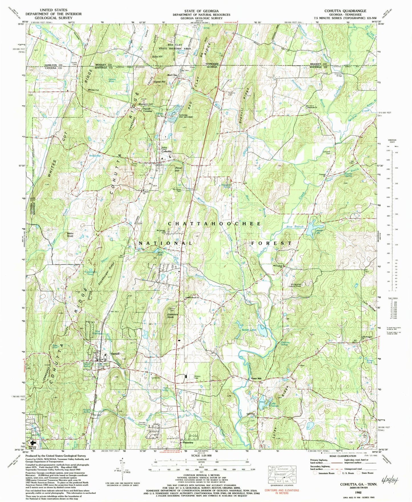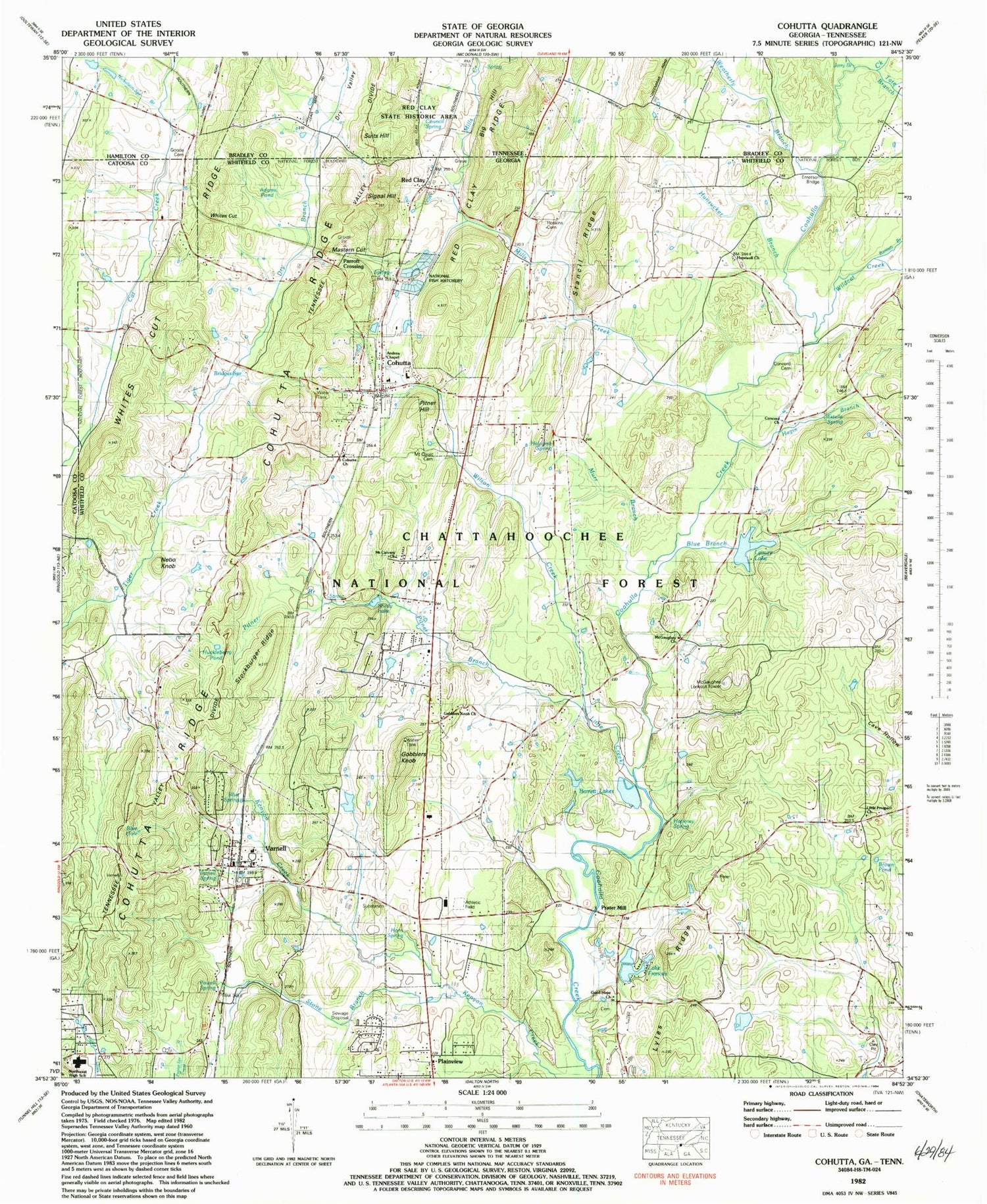
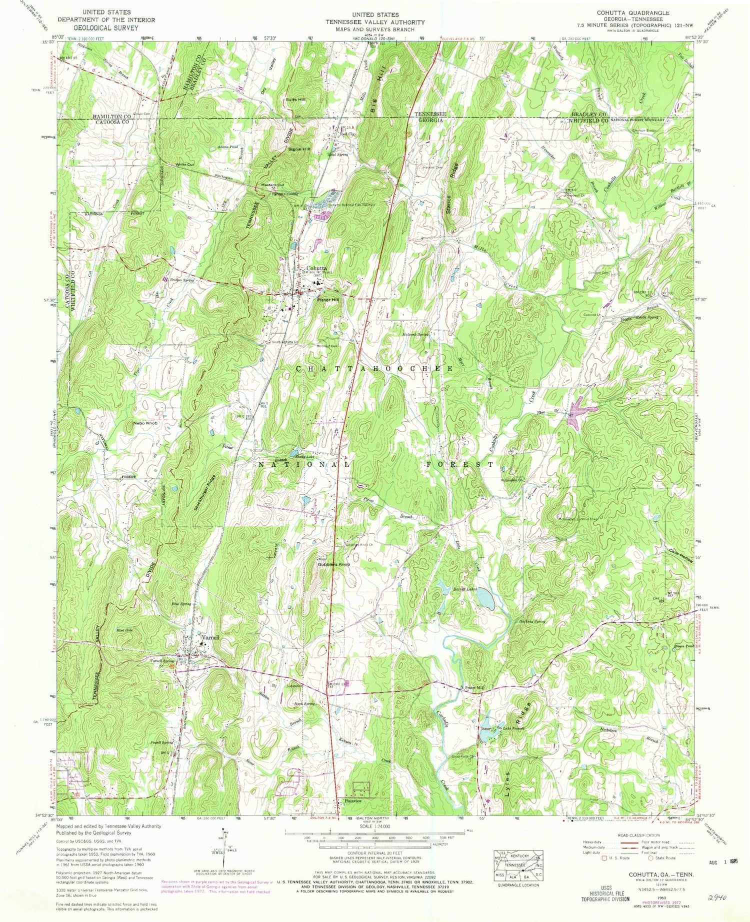
MyTopo
Classic USGS Cohutta Georgia 7.5'x7.5' Topo Map
Couldn't load pickup availability
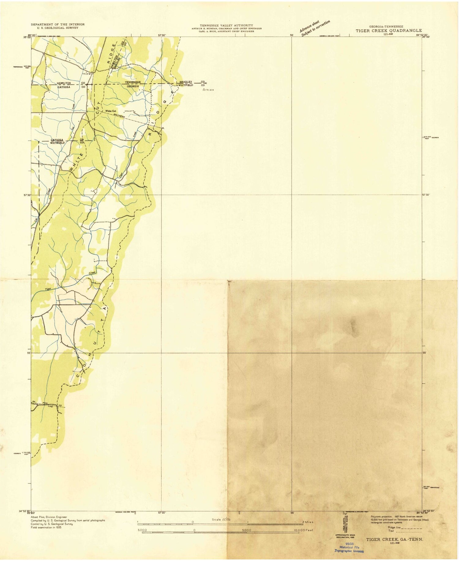
Historical USGS topographic quad map of Cohutta in the states of Georgia, Tennessee. Map scale may vary for some years, but is generally around 1:24,000. Print size is approximately 24" x 27"
This quadrangle is in the following counties: Bradley, Catoosa, Hamilton, Whitfield.
The map contains contour lines, roads, rivers, towns, and lakes. Printed on high-quality waterproof paper with UV fade-resistant inks, and shipped rolled.
Contains the following named places: Adams Pond, Anderson Bridge, Andrew Chapel, Barrett Lake, Barrett Lake Dam, Barrett Lakes, Bartlett Branch, Big Hill, Blue Branch, Blue Hole, Blue Spring, Bridges Spring, Brown Pond, City of Cohutta, City of Varnell, Cohutta, Cohutta Baptist Church, Cohutta Church, Cohutta Elementary School, Cohutta National Fish Hatchery, Cohutta Police Department, Cohutta Post Office, Cohutta Ridge, Cohutta Volunteer Fire Department, Concord Cemetery, Concord Church, Copeland Springs, Council Spring, Dry Branch, Dry Valley, Edgar, Emerson Bridge, Estelle Spring, Gobblers Knob, Gobblers Knob Church, Good Hope Church, Goode Cemetery, Hackney Spring, Hagin Branch, Halcomb Spring, Hopewell Baptist Church, Horn Spring, Hoskins Cemetery, Huckleberry Pond, Hunsucker Branch, Jerry Branch, Lake Frances, Lake Frances Dam, Leisure Lake, Leisure Lake Dam, Little Creek, Little Prospect Church, Lyles Ridge, Mastern Cut, McGaughey Church, McGaughey Lookout Tower, Mills, Mills Creek, Mount Calvary Church, Mount Olivet Church, Mount Olivet Methodist Church, Murr Branch, Nebo Knob, New Hope Middle School, Nickolson Spring Branch, North Whitfield Division, Northwest Whitfield High School, Parrett Crossing, Pitner Branch, Pitner Hill, Plainview, Powell Spring, Prater Mill, Pratermill Flight Park, Red Clay, Red Clay Council Grounds, Red Clay Ridge, Red Clay State Historic Area, Sand Spring, Shady Lake, Signal Hill, South Cohutta Church, Stancil Ridge, Station Branch, Stockburger Ridge, Stone Branch, Suits Hill, Tate Branch, Tuckers School, Varnell, Varnell Church, Varnell Consolidated School, Varnell Elementary School, Varnell Police Department, Varnell Post Office, Varnell Spring, Weatherly Branch, Whites Cut, Whitfield County Fire Department Station 2, Wildcat Creek, Wilson Creek, ZIP Codes: 30710, 30756