MyTopo
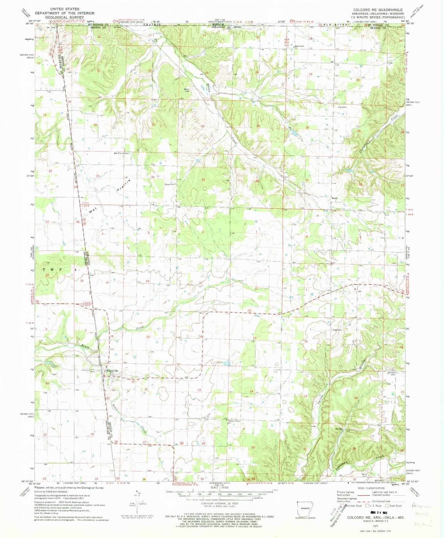
Classic USGS Colcord NE Arkansas 7.5'x7.5' Topo Map
Couldn't load pickup availability
Historical USGS topographic quad map of Colcord NE in the states of Arkansas, Oklahoma. Map scale may vary for some years, but is generally around 1:24,000. Print size is approximately 24" x 27"
This quadrangle is in the following counties: Benton, Delaware, McDonald.
The map contains contour lines, roads, rivers, towns, and lakes. Printed on high-quality waterproof paper with UV fade-resistant inks, and shipped rolled.
Contains the following named places: Appleglen Dairy, Batson Prairie, Beatie Prairie, Beatie Prairie School, Beaty, Camden Farm, Cave, Chalybeate Creek, Checks Corner, Crump, Dow Cemetery, Everlasting Farms, Georgia Cemetery, Jaybird, Jaybird Church, Jaybird School, Lee, Lee Cemetery, Lee Church, Lee School, Maysville, Maysville Cemetery, Maysville Census Designated Place, Maysville Fire Station, Maysville Post Office, Maysville School, Miller Springs, Moses Fields Cemetery, Mount Zion Baptist Church, Mount Zion School, Pleasant Center Church, Rome City, Shady Grove School, T K Farms, Town Creek, Township of Apple Glenn, Township of Beatie, Wann, Wann Baptist Church, Wann Cemetery, Wann School, Ward Cemetery, Wet Prairie Cemetery, Wet Prairie Church, Wet Prairie School