MyTopo
Classic USGS Cold Spring Arizona 7.5'x7.5' Topo Map
Couldn't load pickup availability
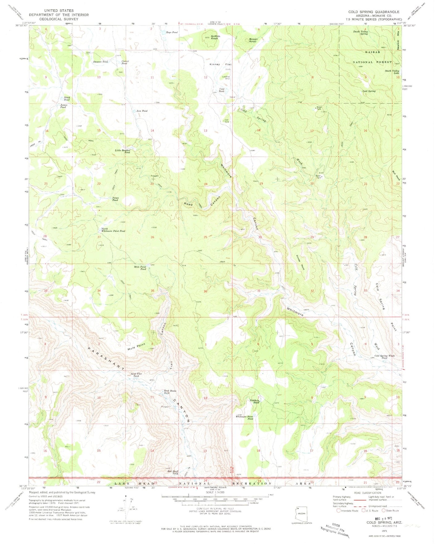
Historical USGS topographic quad map of Cold Spring in the state of Arizona. Map scale may vary for some years, but is generally around 1:24,000. Print size is approximately 24" x 27"
This quadrangle is in the following counties: Mohave.
The map contains contour lines, roads, rivers, towns, and lakes. Printed on high-quality waterproof paper with UV fade-resistant inks, and shipped rolled.
Contains the following named places: Ann Pond, Brown Knoll, Cold Spring, Cold Spring Point, Cold Spring Wash, Cold Spring Wash Pond, Cold Tank, Cole Spring, Corral Pond, Death Valley Lake, Death Valley Spring, Ditch Pond, Duncan Tank, Fence Pond, Griffith Knoll, James Pond, Kinney Flat, Kinney Point, Little Boulder Pond, Mule Point, Mule Point Pond, North Whitmore Point Pond, Red Bluff Tank, Road Canyon, Rock Basin Tank, Roys Pond, Sand Flat Tank, Sinkhole Pond, Trail Canyon, Whitmore Point Pond