
MyTopo
Classic USGS Colemans Lake Georgia 7.5'x7.5' Topo Map
Couldn't load pickup availability
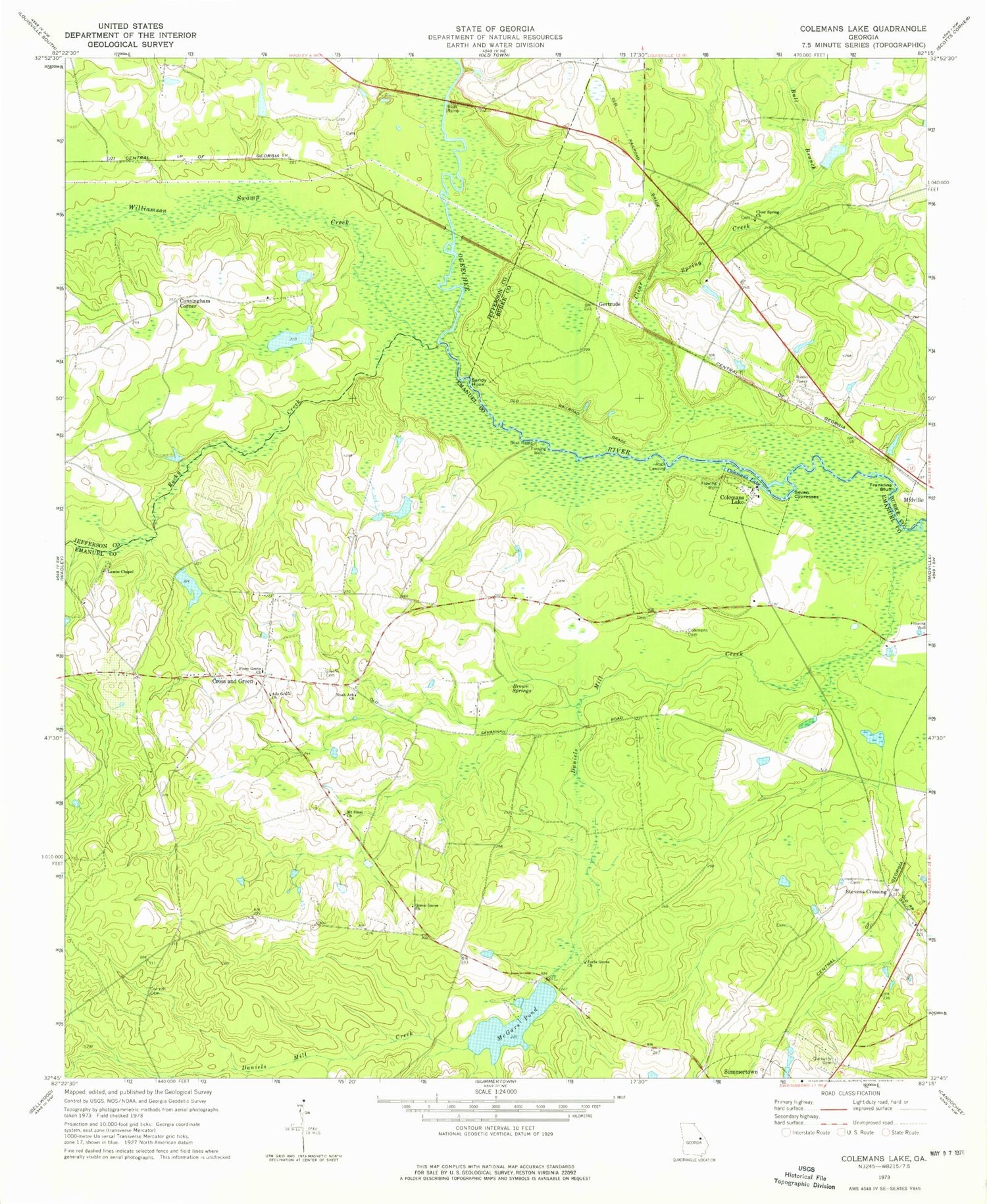
Historical USGS topographic quad map of Colemans Lake in the state of Georgia. Map scale may vary for some years, but is generally around 1:24,000. Print size is approximately 24" x 27"
This quadrangle is in the following counties: Burke, Emanuel, Jefferson.
The map contains contour lines, roads, rivers, towns, and lakes. Printed on high-quality waterproof paper with UV fade-resistant inks, and shipped rolled.
Contains the following named places: Ada Grove Church, Beegles Pond, Beegles Pond Dam, Brown Springs, Bull Branch, Clear Spring Creek, Clear Spring School, Colemans Cemetery, Colemans Lake, Corinth Cemetery, Cross and Green, Cunningham Corner, Emanuel County Volunteer Fire Department Station 2, Farmer Lake, Farmer Lake Dam, Forts Grove Church, Franklins Bluff, Gambrell Lake, Gambrell Lake Dam, Garbutts Cemetery, Gertrude, Green Grove Church, Greens Cemetery, Lambs Chapel, Lambs Chapel Cemetery, McGars Pond, Mcgars Pond Dam, McGars Pond Dam Two, McKinzie Cemetery, Midville International Airport, Mount Sinai Church, Noah Ark Church, Number Ten, Piney Grove Church, Rayfords Bridge, Rock Landing, Rocky Creek, Sandy Hook, Seven Cypresses, Stevens Crossing, Williamson Swamp Creek


