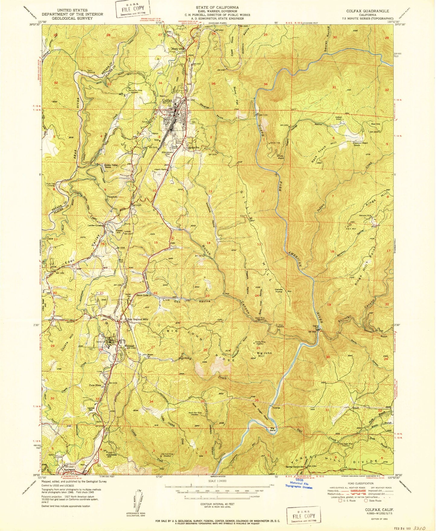
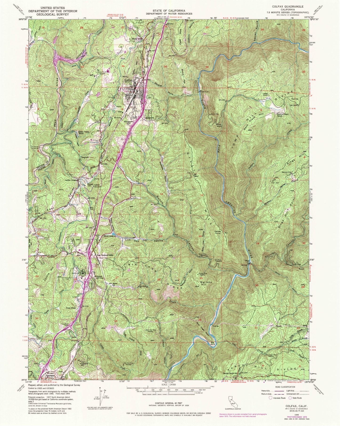
MyTopo
Classic USGS Colfax California 7.5'x7.5' Topo Map
Couldn't load pickup availability
Historical USGS topographic quad map of Colfax in the state of California. Typical map scale is 1:24,000, but may vary for certain years, if available. Print size: 24" x 27"
This quadrangle is in the following counties: Nevada, Placer.
The map contains contour lines, roads, rivers, towns, and lakes. Printed on high-quality waterproof paper with UV fade-resistant inks, and shipped rolled.
Contains the following named places: Bauer Mine, Big Bend, Big John Hill, Big John Ridge, Black Oak Mine, Blue Cut, Brushy Creek, Bunch Canyon, Burnt Flat, Camels Hump, Campbell Creek, Diamond Heart Ranch, Dinner Tree, Gillis Hill, Grey Eagle Mine, Hidden Valley, Hidden Valley Ranch, Hinchy Mine, Hotchkiss Hill, Howell Hill, Illinoistown (historical), Indian Flat, Jefferson Canyon, John Brown Flat, Little Codfish Creek, Live Oak Ravine, New England Mills, Old Vore Mine, Owl Creek, Quail Trap Ravine, Rising Sun Mine, Salvation Ravine, Slaughter Ravine, Sleepy Hollow, Probable Donner Trail, Smuthers Ravine, Sore Finger Point, Specimen Gulch, Spring Garden School, Swan Lake Junior, Weimar, Welcome Mine, Windy Point, H and H Mine, Cape Horn, Devils Canyon, Haymes Mine, Indian Creek, Mexican Gulch, Middle Branch Owl Creek, North Branch Owl Creek, Robbers Ravine, Secret Ravine, Shirttail Canyon, Bear River Canal, South Branch Owl Creek, Applegate, Colfax, Colfax Hill, Coyote Hill, Heather Glen, Indian Knoll, Kings Hill Point, Lander Crossing, Pinecroft, Plumtree Crossing, Race Track Hill, Red Hill, Shady Glen, Taylor Crossing, Twin Pines, Spring Valley Ranch 1321 Dam, Waste Water Storage 2022 Dam, Colfax Branch Auburn-Placer County Library, Colfax Cemetery, Colfax Elementary School, Colfax High School, Colfax Post Office, Weimar Hills Middls School, Weimar Medical Center (historical), Weimar Post Office, Eden Valley, City of Colfax, Colfax Fire Department, Placer County Fire Department 30 Colfax Station, Placer County Fire Department Station 86 / Placer Hills Fire Department Station 3, Placer County Fire Department Station 85 / Placer Hills Fire Department Station 2, Placer County Fire Department Station 88 / Forest Hill Fire Department Station 1, Bear's Elbow Quarry, Hope Village (historical), Weimar Institute of Health & Education, Weimar College, Weimar Academy, Placer County Sheriff's Office Colfax Substation, Weimar Sanitorium Cemetery