MyTopo
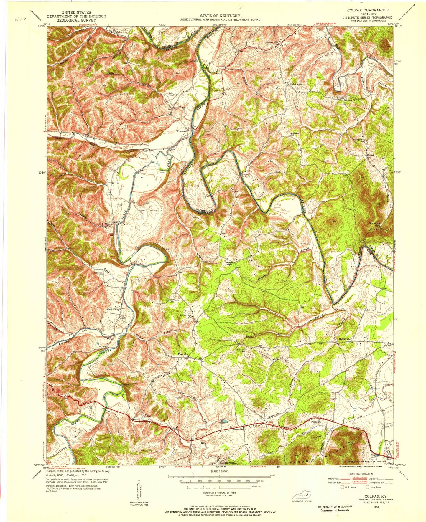
Classic USGS Colfax Kentucky 7.5'x7.5' Topo Map
Couldn't load pickup availability
Historical USGS topographic quad map of Colfax in the state of Kentucky. Map scale may vary for some years, but is generally around 1:24,000. Print size is approximately 24" x 27"
This quadrangle is in the following counties: Bath, Fleming, Rowan.
The map contains contour lines, roads, rivers, towns, and lakes. Printed on high-quality waterproof paper with UV fade-resistant inks, and shipped rolled.
Contains the following named places: Allen Cemetery, Atchison Cemetery, Baileys Chapel, Barbers Graveyard, Bath County, Bracken Branch, Claver Branch, Colfax, Colfax Oil Pool, Colfax Post Office, Craig's Post Office, Devils Nose, Dry Branch, Fairview Church, Forge Hill Post Office, Forge Hill School, Goodpaster Cemetery, Grace Tabernacle, Grange City, Grange City Post Office, Happy Hollow, Haven Branch, Hedrick Church, Hendrick School, Hog Branch, Indian Creek, Johnson Church, Johnson Ford, Johnson School, Knob Lick, Knox Hill Branch, Knox Hill Cemetery, Lees Chapel, Little Indian Creek, Little Rose Run, Lower White Oak School, Marshall Post Office, Mc Carthy Cemetery, Naylor Creek, Naylor School, Oakla, Oakla Church of God, Old Virginia Cemetery, Old Virginia Church, Old Virginia School, Ore Mines, Ore Mines Church of God, Ore Mines Railroad Station, Peasticks, Peasticks School, Polksville, Polksville Cemetery, Polksville Christian Church, Polksville Church of God, Polksville School, Prickley Ash Bridge, Prickly Ash Creek, Red Bush, Reeves Cemetery, Rose Run, School Number Thirty-two, Shrout, Shrouts School, Skillet Branch, Slate Creek, Slate Valley, Slate Valley Christian Church, Slaty Point Cemetery, Smoky Hollow, Snedigar Branch, Sportsman Lake, Spring Hill School, Spurlock Gap, Storey Branch, Stringtown, Vance's Store, Washington Branch, Whickliffe Forge, Whickliffe Forge Post Office, White Oak Creek, Wyoming, Wyoming Post Office, Wyoming School


