
MyTopo
Classic USGS Colfax Louisiana 7.5'x7.5' Topo Map
Couldn't load pickup availability
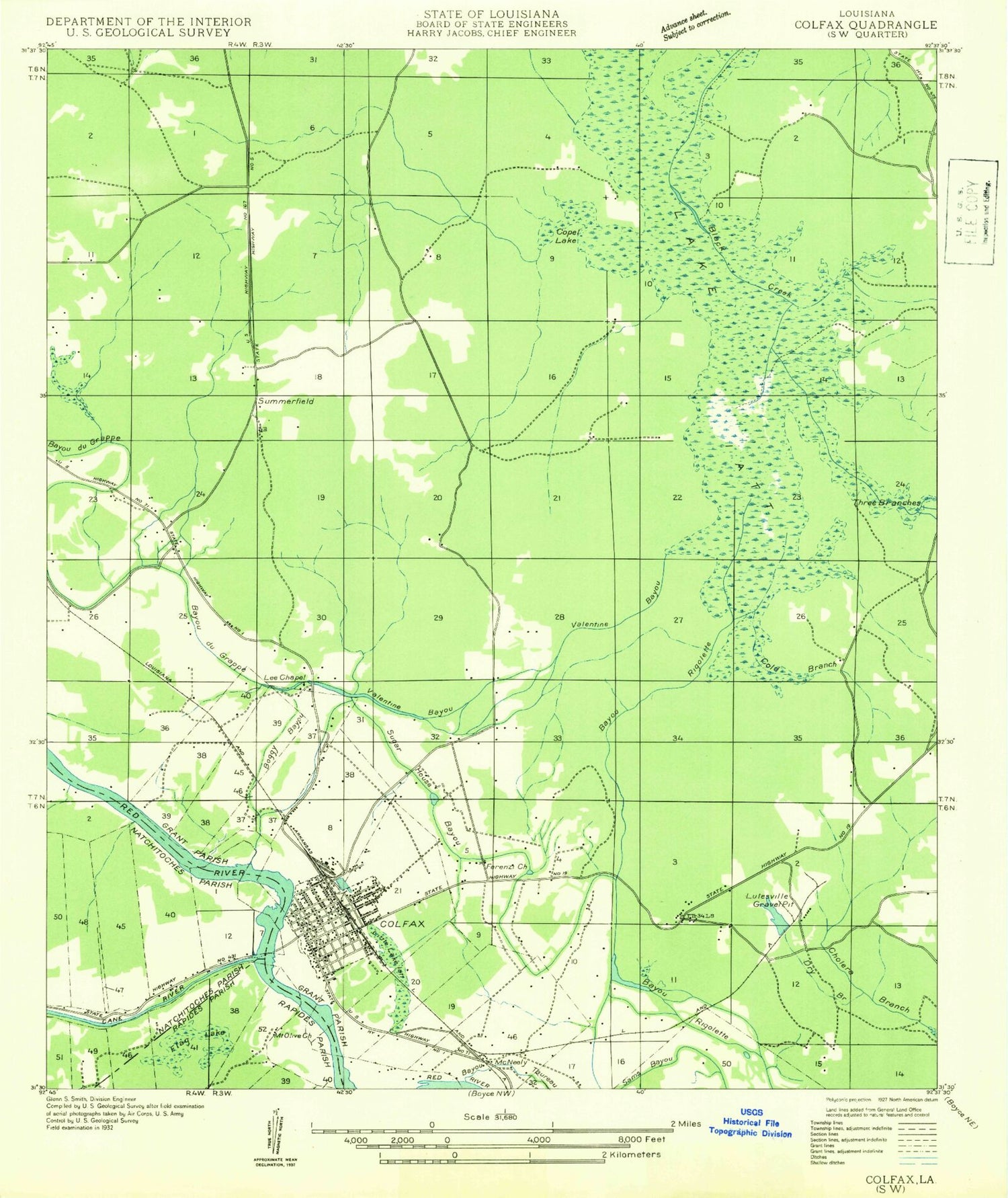
Historical USGS topographic quad map of Colfax in the state of Louisiana. Map scale may vary for some years, but is generally around 1:24,000. Print size is approximately 24" x 27"
This quadrangle is in the following counties: Grant, Natchitoches, Rapides.
The map contains contour lines, roads, rivers, towns, and lakes. Printed on high-quality waterproof paper with UV fade-resistant inks, and shipped rolled.
Contains the following named places: Apalachie Island, Boggy Bayou, Bonaparte Creek, Camp Creek, Cane River, Cold Branch, Colfax, Colfax Elementary School, Colfax Ferry, Colfax Oil Field, Colfax Police Department, Colfax Post Office, Copol Creek, Corbett Cemetery, Dry Branch, Faranzie Baptist Church, Flag Lake, Givens, Grant Parish Fire District 1, Grant Parish Sheriffs Office, Hutnance School, Iatt Lake Dam, Jarrett School, Lake Iatt, Lee Chapel, Lutesville Gravel Pit, Magnolia Lake, McNeely, Mount Pilgrim Rest Baptist Church, Parish Governing Authority District 2, Phillips, Pin Oak Island, Red Bayou, Rock Hill Oil Field, Shady Grove Cemetery, Shady Grove School, Sugarhouse Bayou, Summerfield, Summerfield Branch, The Rock, Three Branches Creek, Town of Colfax, Valentine Bayou, Ward One, Ward Six, Zion Hill Church, ZIP Code: 71417


