MyTopo
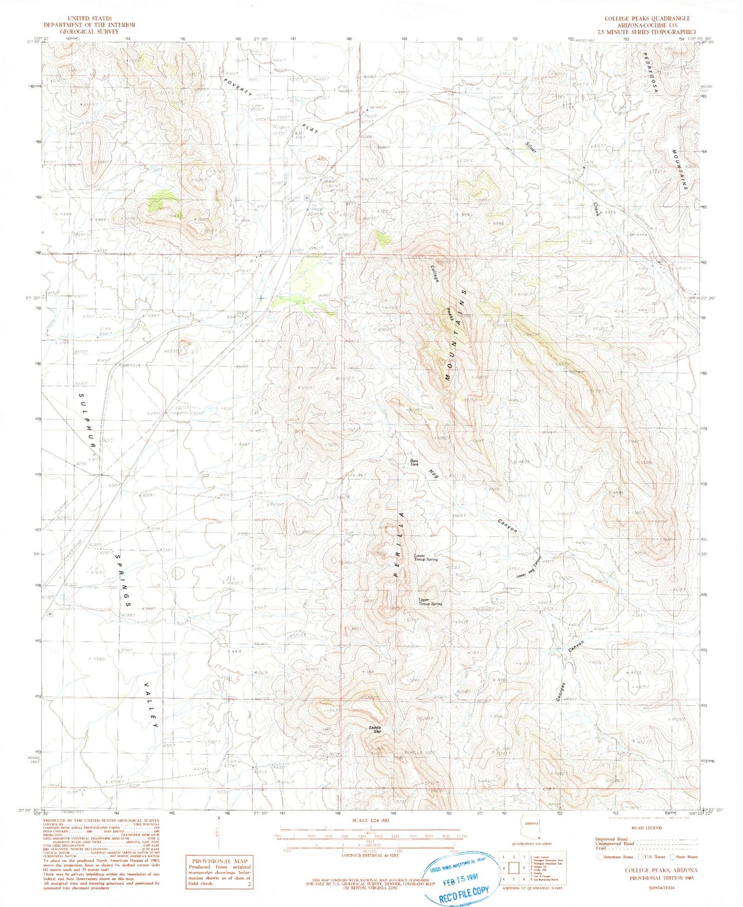
Classic USGS College Peaks Arizona 7.5'x7.5' Topo Map
Couldn't load pickup availability
Historical USGS topographic quad map of College Peaks in the state of Arizona. Map scale may vary for some years, but is generally around 1:24,000. Print size is approximately 24" x 27"
This quadrangle is in the following counties: Cochise.
The map contains contour lines, roads, rivers, towns, and lakes. Printed on high-quality waterproof paper with UV fade-resistant inks, and shipped rolled.
Contains the following named places: Bass Tank, Cazador, Circle H Ranch Airport, College Peaks, Douglas Division, Gardner Windmill, Georges Canyon, Hog Canyon, Johnson Windmill, Lease Windmill, Lower Hog Canyon Windmill, Lower Tincup Spring, New Windmill, North College Peak, Perilla Mountains, Poverty Flat, Saddle Gap, South College Peak, South Collge Peak, Turner Windmill, Upper Tincup Spring, Watson Windmill, Watt Windmill